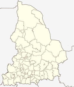
Makhnyovo
| Urban-type settlement
Machnjowo
Махнёво
|
||||||||||||||||||||||||||||||||
|
||||||||||||||||||||||||||||||||
|
||||||||||||||||||||||||||||||||
Machnjowo ( Russian Махнёво ) is an urban-type settlement in Sverdlovsk Oblast in Russia with 3,399 inhabitants (as of October 14, 2010).
geography
The place is about 200 km as the crow flies north-northeast of the Yekaterinburg Oblast Administrative Center and about 70 km north of the city of Alapayevsk east of the Urals , on both sides of the Tagil River .
Machnjowo is the administrative center of the "municipal entity" Machnjowskoje munizipalnoje obrasowanije with the status of an urban district , to which a total of 39 villages and rural settlements belong. The settlement is free of parishes, as there is no corresponding administrative level (here city parish / gorodskoje posselenije ), as is common in urban districts in Russia.
history
The place goes back to a horse and post office (jam) , which was established in 1624 on Babinov Street (Babinowskaja doroga) via Verkhoturye , the most important connection between the European part of Russia and Siberia from its opening in 1597 to the establishment of the Siberian tract from 1730 .
In 1923 Machnjowo became the administrative seat of a rajon named after him, which was dissolved in 1963 and joined to the Alapajewski rajon . Since 1968 Makhnyovo had the status of an urban-type settlement. In July 2004 the place was converted into a village, but raised again to an urban-type settlement in October 2007, in connection with the planned spin-off of an urban district based in Machnjowo, which was carried out on January 1, 2009.
Population development
| year | Residents |
|---|---|
| 1869 | 352 |
| 1939 | 819 |
| 1959 | 1712 |
| 1970 | 3067 |
| 1979 | 3813 |
| 1989 | 4233 |
| 2002 | 3750 |
| 2010 | 3399 |
Note: from 1939 census data
traffic
The regional road 65K-0111 leads to Machnjowo from Verkhnyaya Sinjatschicha near Alapayevsk, where there is a connection to Nizhny Tagil and Irbit . From Machnjowo, the road continues down the right bank of the Tagil to the village of Bolotovskoye, about 50 km away .
On the eastern edge of the settlement is the Jersowka station at kilometer 172 of the Serow - Soswa - Alapayevsk railway line opened on this section in 1947 .
Web links
Individual evidence
- ↑ a b Itogi Vserossijskoj perepisi naselenija 2010 goda. Tom 1. Čislennostʹ i razmeščenie naselenija (Results of the All-Russian Census 2010. Volume 1. Number and distribution of the population). Tables 5 , pp. 12-209; 11 , pp. 312–979 (download from the website of the Federal Service for State Statistics of the Russian Federation)


