Severouralsk
| city
Severouralsk
Severeouralsk
|
||||||||||||||||||||||||||||||||||||||||||||
|
||||||||||||||||||||||||||||||||||||||||||||
|
||||||||||||||||||||||||||||||||||||||||||||
| List of cities in Russia | ||||||||||||||||||||||||||||||||||||||||||||
Severouralsk ( Russian Североура́льск ) is a city in the Sverdlovsk Oblast in Russia with 29,263 inhabitants (as of October 14, 2010).
geography
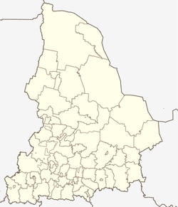
The city is located on the eastern edge of the Urals about 45 kilometers south of the Ural mountain range and 450 km north of the regional capital Yekaterinburg on the Wagran River , a right tributary of the Soswa . Neighboring cities are Ivdel in the north (80 kilometers) and Volchansk in the south (32 kilometers).
To the west of the city is the Pokrovsk-Uralsky settlement (9 kilometers), and even further west is the village of Bajanowka , which is the starting point for the ascent to the Kumba and Solotoi Kamen mountains, 20 kilometers from Severouralsk . Both mountains are clearly visible from the area; they are the city's calling cards and popular excursion destinations.
The main ridge of the Urals with the highest mountain in this section, Deneschkin Kamen ( 1492 m ) runs eight kilometers northwest of the ghost settlement Solwa (32 kilometers west of Vsevolodo-Blagodatskoje).
The climate is continental.
Administratively, the city has a further eight settlements with a total of 19,065 inhabitants (including several that had the status of urban-type settlements until 2009 ): Treti Severny, Kalja, Cheryomukhovo, Sosva and Vsevolodo-Blagodatskoye in the north, Pokrovsk-Uralsky and Bayanovka in the west and Boksity , today a ghost town, in the south; the total number of inhabitants in the urban district is therefore 50,536 (2009 calculation).
history
Until the 17th century, the area around today's city was only sparsely populated by Mansen . The first mentioned settlement in the area of today's Severouralsk arose in 1758, when Maxim Pochodjashin had an ironworks called Petropawlowski Sawod ( Петропавловский Завод , Peter and Paul Works ) built here. Production began in 1760, and from 1764 copper was mainly smelted. In 1791 Pochodjaschin's heirs sold the plant, whose importance began to decline with the boom of the Bogoslowsk plant (in today's Karpinsk ), to the state. In 1827 production was completely stopped due to unprofitability.
In the 19th century, in addition to hunting and fishing, the population was mainly occupied with prospecting for gold in the surrounding rivers. With the start of production of the Nadeschdinski plant (Nadeschdinski Sawod, in today's Serow ) the area experienced a new economic boom.

In 1931 the geologist Nikolai Karschawin discovered a large bauxite deposit; in their place the railway station Krasnaya Schapotschka (Russian for Little Red Riding Hood , here based on the color of the bauxite) was built. On April 2, 1934, the city-building company, the North Urals bauxite mine ( Северо-Уральский бокситовый рудник (СУБР) / Severo-Uralski boksitowy rudnik (SUBR)), was founded and construction began in the same year. As a result, further bauxite deposits were discovered north of the first site.
The new settlement was only eight kilometers north of the existing and inhabited settlement of Petropavlovskoye . The settlements gradually merged and were given the current name Severouralsk and town charter on November 27, 1944 by a resolution of the Supreme Soviet of the USSR.
Population development
| year | Residents |
|---|---|
| 1789 | 269 |
| 1897 | 667 |
| 1926 | 822 |
| 1959 | 25,942 |
| 1970 | 29,880 |
| 1979 | 32,536 |
| 1989 | 36,131 |
| 2002 | 34,673 |
| 2010 | 29,263 |
Note : census data
traffic
Severouralsk is connected to the southern part of the Oblast with the capital Yekaterinburg via a railway line and a road. The railway was put into operation in 1935 and connects the city to Serov via Karpinsk and Krasnoturjinsk . The Boksity – Severouralsk line is not electrified, which is why passenger trains only run to the Boksity station south of the city. There is a train every day; the travel time to Yekaterinburg is about 12 hours. The Boksity - Pokrovsk-Uralsky railway line was shut down several years ago.
There is a poorly navigable road to Iwdel in the north (only by off-road vehicle or in winter when there is snow).
To the north of the city near Kalja is the Severouralsk airport, which was only in constant operation during the Soviet era and today only serves as a landing pad for occasional flights by airplanes and helicopters.
Culture and sights
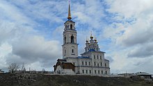
One of the sights is the Peter and Paul Church, built in 1782–98 ( Петропавловская церковь / Petropawlowskaja zerkow). There has been a local history museum in Severouralsk since 1970, and a history museum in the Kalja settlement since 1972.
The Deneschkin Kamen nature reserve was originally founded in 1946, has since been closed and rebuilt in 1991. It extends over the main Ural ridge and comprises 782 square kilometers of little-touched nature. The border to the reserve runs 40 kilometers northwest of the city at Vsevolodo-Blagodatskoje.
economy
The economy is mainly shaped by the urban building company SUBR , headquartered in Moscow . The company deals exclusively with the mining of bauxite. The production of building materials and the timber industry are secondary and have lost their former importance in recent years.
Individual evidence
- ↑ a b Itogi Vserossijskoj perepisi naselenija 2010 goda. Tom 1. Čislennostʹ i razmeščenie naselenija (Results of the All-Russian Census 2010. Volume 1. Number and distribution of the population). Tables 5 , pp. 12-209; 11 , pp. 312–979 (download from the website of the Federal Service for State Statistics of the Russian Federation)
Web links
- City information page (Russian)
- City Portal (Russian)
- Severouralsk on mojgorod.ru (Russian)


