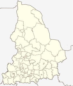
Druzhinino (Sverdlovsk)
| Urban-type settlement
Druschinino
Дружинино
|
||||||||||||||||||||||||||||||||||||
|
||||||||||||||||||||||||||||||||||||
|
||||||||||||||||||||||||||||||||||||
Druschinino ( Russian Дружинино ) is an urban-type settlement in the Sverdlovsk Oblast in Russia with 3793 inhabitants (as of October 14, 2010).
geography
The place is about 70 km as the crow flies west of the Yekaterinburg Oblast Administrative Center on the western, European side of the central Urals . It is located on the left bank of the Utka, a left tributary of the Chusovaya .
Druzhinino belongs to the Nizhneserginsky Rajon and is located about 20 km northeast of its administrative center Nizhny Sergi . The settlement is the seat of the municipality Druschininskoje gorodskoje posselenije, which also includes the village Pervomaiskoje (4 km north) and the settlements Lasorewy (2 km south) and Soldatka (8 km west-northwest).
history
The site was developed in connection with the railway in the 1910s: in 1913 began construction of the route Kazan - Yekaterinburg, and 1914 was there the station Druschinino the crossing there, along its entire length in 1916 as West-Ural Railway opened stretch of Kalino ( near Tschussowoi ) opened in Berdjausch . The station settlement was initially administered by the nearby village of Grobowo (today's Perwomaiskoje ) founded in 1723 .
With the mining of a nearby limestone deposit beginning in 1933, the importance of the place continued to grow, and in 1938 it received the status of an urban-type settlement.
Population development
| year | Residents |
|---|---|
| 1939 | 3116 |
| 1959 | 4709 |
| 1970 | 4703 |
| 1979 | 3361 |
| 1989 | 3954 |
| 2002 | 2945 |
| 2010 | 3493 |
Note: census data
traffic
The railway line Moscow - Kazan - Yekaterinburg (km 1574), an alternative route of the Trans-Siberian Railway, runs through Druzhinino . Since the electrification of the line, Druzhinino has been a system transfer station between 3 kV direct current in the direction of Yekaterinburg and 25 kV / 50 Hz alternating current in the direction of Kazan. The Kalino - Berdjausch branch line crosses in Druzhinino (in a southerly direction from Nizhny Sergi since 2011, it has been out of service, but not closed).
The federal highway R242 Perm - Yekaterinburg passes a few kilometers north of Druzhinino , from which a regional road branches off via Mikhailovsk , Arti and Krasnoufimsk back to the R242 near Achit .
Web links
Individual evidence
- ↑ a b Itogi Vserossijskoj perepisi naselenija 2010 goda. Tom 1. Čislennostʹ i razmeščenie naselenija (Results of the All-Russian Census 2010. Volume 1. Number and distribution of the population). Tables 5 , pp. 12-209; 11 , pp. 312–979 (download from the website of the Federal Service for State Statistics of the Russian Federation)


