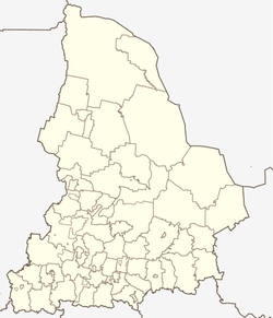
Nataljinsk
| Urban-type settlement
Nataljinsk
Natalyinsky
|
||||||||||||||||||||||||||||||||
|
||||||||||||||||||||||||||||||||
|
||||||||||||||||||||||||||||||||
Nataljinsk ( Russian Ната́льинск ) is an urban-type settlement in the Sverdlovsk Oblast in Russia with 1914 inhabitants (as of October 14, 2010).
geography
The place is about 170 km as the crow flies west-southwest of the Yekaterinburg Oblast Administrative Center in the western part of the central Urals . It is about 3 km from the left bank of the Ufa River.
Nataljinsk is formally the administrative center of the "municipal entity" (munizipalnoje obrasowanije) Krasnoufimski okrug with the status of an urban district , to which a total of 67 villages and rural settlements belong. In fact, the administrative bodies of the urban district are located in the 15 km northwest of the city of Krasnoufimsk , which is eponymous for the Krasnoufimski okrug, but does not belong to it, but forms an independent urban district of the same name (Gorodskoi okrug Kransnoufimsk) .
history
The place was created in 1872 in connection with the construction of a glassworks by the Krasnoufimsk merchant Ivan Shevelin. He named the work after his wife Natalja as Nataljinski sawod; the associated settlement was given its current name accordingly. From February 27, 1924 Nataljinsk belonged to the newly created Krasnoufimski rajon . After the temporary closure of the plant in 1926, after the outbreak of the German-Soviet War, parts of a measuring device factory from Moscow and a glassworks from Schodnja near Moscow (now a district of Chimki ) were evacuated to Nataljinsk. As a result of this development, the place received the status of an urban-type settlement in 1943.
When, as part of the administrative reform in Russia, the city of Krasnoufimsk was spun off as an independent urban district from the former Rajon and this was itself converted into an urban district, Nataljinsk was appointed as its administrative seat on January 1, 2006.
Population development
| year | Residents |
|---|---|
| 1959 | 1389 |
| 1970 | 1723 |
| 1979 | 2118 |
| 1989 | 2377 |
| 2002 | 2094 |
| 2010 | 1914 |
Note: census data
traffic
The settlement is on the regional road 65K-0409 (formerly R350), which branches off 35 km north of Achit from the federal highway R242 Perm - Yekaterinburg, via Krasnoufimsk to Nataljinsk and further south to Messjagutowo in the neighboring republic of Bashkortostan . 7 km north of Nataljinsk the 65K-1402 branches off via Arti to Kasli in the Chelyabinsk Oblast .
The nearest train station is in Krasnoufimsk at kilometer 1434 on the Moscow - Kazan - Yekaterinburg line, which was opened on this section in 1924 and has been electrified since 1980 (from the direction of Yekaterinburg) / 1982 (from the direction of Kazan) .
Web links
Individual evidence
- ↑ a b Itogi Vserossijskoj perepisi naselenija 2010 goda. Tom 1. Čislennostʹ i razmeščenie naselenija (Results of the All-Russian Census 2010. Volume 1. Number and distribution of the population). Tables 5 , pp. 12-209; 11 , pp. 312–979 (download from the website of the Federal Service for State Statistics of the Russian Federation)
- ↑ All-Russian Classifier of Territories of Municipal Formations (OKTMO). Volume 6. Urals Federal District (confirmed by Instruction No. 159-st Rosstandart of June 14, 2013).


