Artyomovsky
| city
Artyomovsky
Артёмовский
|
||||||||||||||||||||||||||||||||||||||||||
|
||||||||||||||||||||||||||||||||||||||||||
|
||||||||||||||||||||||||||||||||||||||||||
| List of cities in Russia | ||||||||||||||||||||||||||||||||||||||||||
Artjomowski ( Russian Артёмовский ) is a city in Sverdlovsk Oblast ( Russia ) with 33,160 inhabitants (as of October 14, 2010).
geography
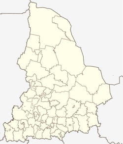
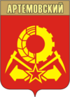
The city is located in the west of the West Siberian lowlands , about 120 km northeast of the Oblast capital Yekaterinburg not far from the mouth of the Bobrowka river (from Russian bobr for beaver , see city arms) into the Irbit in the Ob river system .
Artjomowski is the center of an urban district of the same name .
The Yekaterinburg - Tawda (opened 1916) and Bogdanovich - Alapayevsk (opened 1918, later on to Serow ) railway lines intersect at the Yegorschino station in Artjomovsky .
history
The village of Jegorschino was built in 1665 on the site of today's town . A coal deposit was discovered in its vicinity in 1871 , and mining began towards the end of the century. The associated miners' settlement was later named imeni Artjoma after the revolutionary Fyodor Sergejew (known as "Artjom") as early as the Soviet period .
In 1938 the village and settlement were united and received city rights under the current name.
Population development
| year | Residents |
|---|---|
| 1939 | 17,884 |
| 1959 | 34,775 |
| 1970 | 37,740 |
| 1979 | 39.192 |
| 1989 | 41,247 |
| 2002 | 34,980 |
| 2010 | 33,160 |
Note: census data
Culture and sights
The city has a history museum .
In the former Jegorschino thermal power station (Russian Егоршинская ГРЭС / Jegorschinskaja GRES) a museum of energy has been established. According to the GOELRO plan, the power plant was the first in the Ural region to start operating in 1923 and was shut down in 2003.
15 kilometers from Artjowowski, on the left bank of the Irbit, is the 10-meter-high Pissany Kamen ( Inscribed Stone ) with prehistoric rock carvings .
economy
In addition to hard coal mining, there is a machine factory, a factory for radio electronics, construction and timber industry as well as the food industry, based on the products of the agricultural area surrounding the city.
sons and daughters of the town
- Jelena Melnikowa-Tschepikowa (* 1971), biathlete
Web links
- City administration website (Russian)
- Artjomowski on mojgorod.ru (Russian)
Individual evidence
- ↑ a b Itogi Vserossijskoj perepisi naselenija 2010 goda. Tom 1. Čislennostʹ i razmeščenie naselenija (Results of the All-Russian Census 2010. Volume 1. Number and distribution of the population). Tables 5 , pp. 12-209; 11 , pp. 312–979 (download from the website of the Federal Service for State Statistics of the Russian Federation)
- ↑ Jegorschino power plant ( Memento of the original from July 11, 2007 in the Internet Archive ) Info: The archive link was inserted automatically and has not yet been checked. Please check the original and archive link according to the instructions and then remove this notice. on the website "85 Years of the GOELRO Plan" of the Unified Energy System (Russian)


