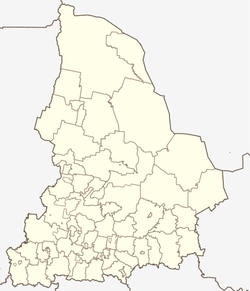
Gornouralski
| Urban-type settlement
Gornouralski
Горноуральский
|
||||||||||||||||||||||||||||||||
|
||||||||||||||||||||||||||||||||
|
||||||||||||||||||||||||||||||||
Gornouralski ( Russian Горноура́льский ) is an urban-type settlement in the Sverdlovsk Oblast in Russia with 3972 inhabitants (as of October 14, 2010).
geography
The place is about 140 km as the crow flies north-north-west of the Yekaterinburg Oblast Administrative Center and about 20 km north of the city of Nizhny Tagil on the eastern edge of the Urals . It is located on the right bank of the Laja river, which flows into the Tagil a good 5 km south of the left .
Gornouralski is formally the administrative center of the urban district of Gornouralski , to which a total of 59 villages and rural settlements belong. In fact, the administrative bodies of the urban district are located in Nizhny Tagil, which does not belong to the Gornouralski district, but forms an independent urban district.
history
The place was created from 1961 in connection with the establishment of large agricultural operations to supply the industrial cities of the region. The name stands in Russian for "mountain" or "mining Ural (settlement)". Gornouralski has had urban-type settlement status since 1977. As part of the administrative reform in Russia, the settlement was designated as the administrative seat of the urban district created on January 1, 2006 on most of the former Prigorodny rajon (before 1963 Nizhne-Tagilski rajon ) (a good quarter of the villages became part of the Nizhny Tagil district).
Population development
| year | Residents |
|---|---|
| 1979 | 2740 |
| 1989 | 6164 |
| 2002 | 4268 |
| 2010 | 3972 |
Note: census data
traffic
The regional road 65K-4103 (formerly R352) Yekaterinburg - Nizhny Tagil - Serow runs immediately west of Gornouralski . 3 km southwest of the settlement is the Laja station at kilometer 342 of the Perm - Nizhny Tagil - Yekaterinburg railway line, which opened in 1878 and has been electrified on this section since 1935 .
Web links
Individual evidence
- ↑ a b Itogi Vserossijskoj perepisi naselenija 2010 goda. Tom 1. Čislennostʹ i razmeščenie naselenija (Results of the All-Russian Census 2010. Volume 1. Number and distribution of the population). Tables 5 , pp. 12-209; 11 , pp. 312–979 (download from the website of the Federal Service for State Statistics of the Russian Federation)
- ↑ All-Russian Classifier of Territories of Municipal Formations (OKTMO). Volume 6. Urals Federal District (confirmed by Instruction No. 159-st Rosstandart of June 14, 2013)

