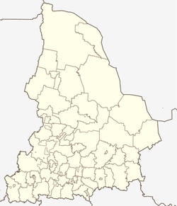
Shaly
| Urban-type settlement
Shalya
Шаля
|
||||||||||||||||||||||||||||||||||||
|
||||||||||||||||||||||||||||||||||||
|
||||||||||||||||||||||||||||||||||||
Schalja ( Russian Ша́ля ) is an urban-type settlement in the Sverdlovsk Oblast in Russia with 6,433 inhabitants (as of October 14, 2010).
geography
The place is about 120 km as the crow flies west-north-west of the Yekaterinburg Oblast Administrative Center on the western flank of the central Urals . It is located on the same river Shalya, the km north in about 8 Chusovaya creek Sylva flows.
Schalja is the administrative center of the city district Schalja (Schalinski gorodskoi okrug), to which a total of 38 villages and rural settlements belong. The settlement is free of communes, as there is no corresponding administrative level (here township / gorodskoje posselenije ), as is common in urban districts in Russia.
history
The place was founded in 1903 in connection with the preparations for the construction of the direct railway connection Perm - Yekaterinburg (a line running further northeast via Nizhny Tagil had already existed since 1878).
On January 1, 1932, Shalya came to a newly founded Rajon named after the Shalya river. Its administrative headquarters were initially in the village of Sylwa , but in 1937 it was relocated to the more conveniently located and now more important Schalja. Since 1943 the place has had the status of an urban-type settlement. On January 1, 2006, the Rajon was converted into an urban district.
Population development
| year | Residents |
|---|---|
| 1939 | 3297 |
| 1959 | 9518 |
| 1970 | 7196 |
| 1979 | 7388 |
| 1989 | 7123 |
| 2002 | 6801 |
| 2010 | 6433 |
Note: census data
traffic
Schalja is on the Trans-Siberian Railway (1669 km from Moscow ), which was opened on this section in 1911 and has been electrified since 1962 (from the direction of Yekaterinburg) / 1963 (further towards Perm) . The settlement is the end point of the 100 km long regional road 65K-5803, which begins in Pervouralsk , in the vicinity of which there is a connection to the federal highway R242 Perm - Yekaterinburg. From Shalja the road as 65K-3108 continues along the railway line to Shamary , the second largest town in the Rajon.
Web links
Individual evidence
- ↑ a b Itogi Vserossijskoj perepisi naselenija 2010 goda. Tom 1. Čislennostʹ i razmeščenie naselenija (Results of the All-Russian Census 2010. Volume 1. Number and distribution of the population). Tables 5 , pp. 12-209; 11 , pp. 312–979 (download from the website of the Federal Service for State Statistics of the Russian Federation)


