Achit
| Urban-type settlement
Achit
Achit
|
||||||||||||||||||||||||||||||||||
|
||||||||||||||||||||||||||||||||||
|
||||||||||||||||||||||||||||||||||
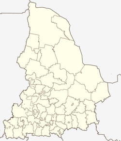
Achit ( Russian Ачи́т ) is an urban-type settlement in the Sverdlovsk Oblast in Russia with 4948 inhabitants (as of October 14, 2010).
geography
The place is a good 160 km as the crow flies west of the Yekaterinburg Oblast Administrative Center on the western flank of the Urals . It is located on the upper reaches of the river of the same name (also Atschitka ), which flows 12 km south into the Bissert , and this in turn a little later from the right into the Ufa .
Atschit is the administrative center of the city district of Achit , which includes a total of 52 villages and rural settlements. The settlement is free of communes, as there is no corresponding administrative level (here township / gorodskoje posselenije ), as is common in urban districts in Russia.
history
The place goes back to a fortress built in 1735, which was supposed to protect the mines and metallurgical works of the central Urals from attacks by people living in the south , such as the Bashkirs , who were semi-nomadic at that time . With the consolidation of Russian rule in the region, the place lost its military importance after the suppression of the Pugachev uprising in 1775 at the latest .
On February 27, 1924, Atschit became the administrative seat of a Rajon named after him, which has since been dissolved twice and attached to the Krasnoufimski rajon (January 1, 1932 to January 25, 1935 and February 1, 1963 to December 30, 1966). On January 1, 2006, the Rajon was converted into an urban district. Atschit has had the status of an urban-type settlement since 1968.
Population development
| year | Residents |
|---|---|
| 1939 | 3585 |
| 1959 | 4320 |
| 1970 | 4334 |
| 1979 | 4607 |
| 1989 | 5565 |
| 2002 | 5120 |
| 2010 | 4948 |
Note: census data
traffic
The federal trunk road R242 from Perm to Yekaterinburg passes south of Achit . There the regional road 65K-0409 (formerly R350) branches off in a southerly direction to the city of Krasnoufimsk , 20 km away , and on to Messjagutowo in the neighboring republic of Bashkortostan .
Almost 15 km southeast of the Ufimski settlement is the nearest railway station Ufimka at kilometer 1458 on the Moscow - Kazan - Yekaterinburg route, which was opened on this section in 1924 and has been electrified since 1980 .
Web links
Individual evidence
- ↑ a b Itogi Vserossijskoj perepisi naselenija 2010 goda. Tom 1. Čislennostʹ i razmeščenie naselenija (Results of the All-Russian Census 2010. Volume 1. Number and distribution of the population). Tables 5 , pp. 12-209; 11 , pp. 312–979 (download from the website of the Federal Service for State Statistics of the Russian Federation)


