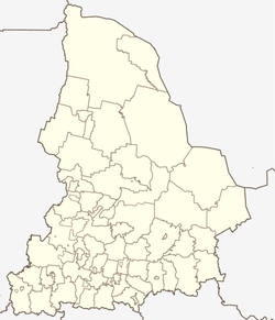
Pelym (Sverdlovsk, Pelym)
| Urban-type settlement
Pelym
Пелым
|
||||||||||||||||||||||||||||||||||
|
||||||||||||||||||||||||||||||||||
|
||||||||||||||||||||||||||||||||||
Pelym ( Russian Пелы́м ) is an urban-type settlement in the Sverdlovsk Oblast in Russia with 3376 inhabitants (as of October 14, 2010).
geography
The place is located about 470 km as the crow flies north of the Yekaterinburg Oblast Administrative Center in the western part of the West Siberian lowlands on the left bank of the eponymous Tawda tributary Pelym .
Pelym is the administrative center of the Pelym district , which also includes the settlements of Atymja, Kerschal, Nerpja and Vershina; the latter three, however, have in fact been abandoned. The settlement is free of parishes, as there is no corresponding administrative level (here city parish / gorodskoje posselenije ), as is common in urban districts in Russia.
history
The place was created in 1962 in connection with the construction of the Iwdel - Priobje railway and as a forestry site and base for the construction of natural gas pipelines from Western Siberia to the European part of the Soviet Union . It should not be confused with the present-day village of Pelym , which was built at the end of the 16th century and is located 170 km south-southeast in the Gari district of the Sverdlovsk Oblast at the mouth of the Pelym River.
Since 1989 Pelym has had the status of an urban-type settlement. On November 10, 1996 it became an independent administration, after it had previously been subordinate to the 90 km southwest of the town of Iwdel since its creation. On January 1, 2006, Pelym became the administrative seat of an urban district of the same name that was separated from the Iwdel district.
Population development
| year | Residents |
|---|---|
| 2002 | 3708 |
| 2010 | 3376 |
Note: census data
traffic
Pelym is located at kilometer 95 of the railway line Ivdel - Priobje opened on this section in 1966, which connects to the line Kushwa (Goroblagodatskaya) - Serow - Polunochnoye . A few kilometers north of the settlement follows the railway line, the subsection ivdel - Yugorsk of under construction over 2500 km long highway Northern latitudinal magistrale (Severnaya schirotnaja magistral) of Perm on Khanty-Mansiysk to Tomsk . The section from Ivdel to the border with the Khanty and Mansi Autonomous Okrug / Ugra 40 km east of Pelym, which was completed after 2000, is currently (2014) the regional road of Sverdlovsk Oblast with the number 65K-431. Previously, Pelym was not connected to the fixed, year-round traffic network.
Web links
- Pelym City District on the Sverdlovsk Oblast Official Website (Russian)
Individual evidence
- ↑ a b Itogi Vserossijskoj perepisi naselenija 2010 goda. Tom 1. Čislennostʹ i razmeščenie naselenija (Results of the All-Russian Census 2010. Volume 1. Number and distribution of the population). Tables 5 , pp. 12-209; 11 , pp. 312–979 (download from the website of the Federal Service for State Statistics of the Russian Federation)


