Meshduretschensky
| Urban-type settlement
Mezhdurechensky
Mezhdurechensky
|
||||||||||||||||||||||||||||||
|
||||||||||||||||||||||||||||||
|
||||||||||||||||||||||||||||||
| List of large settlements in Russia | ||||||||||||||||||||||||||||||
Meschduretschenski ( Russian Междуреченский ) is an urban-type settlement in the Khanty and Mansi Autonomous Okrug / Ugra ( Russia ) with 11,058 inhabitants (as of October 14, 2010).
geography
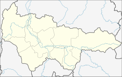
The settlement is located between the Urals and Ob in the western part of the West Siberian lowlands a good 200 kilometers southwest of the district administrative center of Khanty-Mansiysk on the right bank of the Konda , a tributary of the Irtysh .
The settlement is Meschduretschenski since January 26, 1995 the administrative center of the Rajons Kondinskoye .
history
The old settlement Ustje-Acha (stands for the confluence of the [brook] Ach [into the Konda] ) was granted at the beginning of the 1960s as a supply base and end point of a located on the navigable Konda as part of the beginning of the development of the oil and gas deposits in this part of Western Siberia building railway line was chosen. Urban-type settlement status was granted on May 29, 1964. On September 29 of the same year it was given its current name (from Russian meschdu rekami for between the rivers ).
Population development
| year | Residents |
|---|---|
| 1970 | 5,609 |
| 1979 | 7,220 |
| 1989 | 8,657 |
| 2002 | 10,907 |
| 2010 | 11,058 |
Note: census data
Economy and Infrastructure
There are several logging companies in the settlement. In addition, Meshduretschensky is one of the logistic centers of the oil and gas industry in the west of the Khanty and Mansi Autonomous Okrug. Several pipelines with pumping stations run near the village.
Meshduretschensky is the end of the 1969 extension of the Yekaterinburg - Irbit - Tawda railway (station name Ustye-Acha ; route km 538; to Tawda, km 353, as early as 1916). There is a road connection to the city of Urai , but no year-round (even in summer) access to the all-Russian road network. A road to Tyumen is under construction. Meschduretschenski has an airport and a river port on the Konda (including passenger traffic to Khanty-Mansiysk).
Sons and daughters of the settlement
- Sergei Ustjugow (* 1992), Russian cross-country skier
Individual evidence
- ↑ a b Itogi Vserossijskoj perepisi naselenija 2010 goda. Tom 1. Čislennostʹ i razmeščenie naselenija (Results of the All-Russian Census 2010. Volume 1. Number and distribution of the population). Tables 5 , pp. 12-209; 11 , pp. 312–979 (download from the website of the Federal Service for State Statistics of the Russian Federation)


