Isluchinsk
| Urban-type settlement
Isluchinsk
Излучинск
|
||||||||||||||||||||||||||||||||||||
|
||||||||||||||||||||||||||||||||||||
|
||||||||||||||||||||||||||||||||||||
| List of large settlements in Russia | ||||||||||||||||||||||||||||||||||||
Isluchinsk ( Russian Излу́чинск ) is an urban-type settlement in the West Siberian Autonomous Okrug of the Khanty and Mansi / Ugra ( Russia ) with 17,399 inhabitants (as of October 14, 2010).
geography
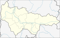
The settlement is located in the West Siberian lowlands about 420 kilometers (as the crow flies) east of the administrative center of the Khanty-Mansiysk Autonomous Okrug on the right bank of the Wach, not far from its confluence with the Ob .
Isluchinsk belongs to the Nizhnevartovsk district ; its administrative center, the city of Nizhnevartovsk , is just under 20 kilometers to the west. The municipality of Isluchinsk City Settlement also includes the village of Bolschetarchowo, which is located upstream on the left bank of the Wach.
history
The settlement was established in the 1980s in connection with the construction of the Nizhnevartovsk thermal power station to the northeast (Nizhnevartovskaya GRES) .
In 1988 the status of an urban-type settlement was given, the name of which is derived from the Russian word isluchina for river loop . In 1993 the power plant went into operation. the second block in 2003.
In recent years, due to its modern facilities, the place has developed into a popular residential area for the population of the Nizhnevartovsk area, who are mainly active in the oil industry .
Population development
| year | Residents |
|---|---|
| 1989 | 9,646 |
| 2002 | 15,505 |
| 2010 | 17,399 |
Note: census data
Culture and sights
At the end of the 1990s, the five-domed Russian Orthodox Nikolai Church ( церковь Николая Угодника / zerkow Nikolaja Ugodnika ) with a bell tower was built on the bank of the Wach .
Economy and Infrastructure
The largest operation is the Nizhnevartovsk thermal power plant with an output of 1,600 megawatts , which is operated as a joint stock company that has been controlled by the energy supplier OGK-1 since 2006 (the remaining 25% plus one share belong to TNK-BP ). There are also companies in the construction industry.
There is a road connection to Nizhnevartovsk, where the nearest railway station (the end of a line from Surgut ) and an airport are also located. Immediately south of Isluchinsk, the road from Nizhnevartovsk to the Streschewoi oil production center in the neighboring Tomsk Oblast passes. The Wach is crossed by a pontoon bridge in the course of the road during the ice-free period ; a permanent bridge is under construction.
Individual evidence
- ↑ a b Itogi Vserossijskoj perepisi naselenija 2010 goda. Tom 1. Čislennostʹ i razmeščenie naselenija (Results of the All-Russian Census 2010. Volume 1. Number and distribution of the population). Tables 5 , pp. 12-209; 11 , pp. 312–979 (download from the website of the Federal Service for State Statistics of the Russian Federation)
- ↑ a b Nizhnevartovskaya GRES ( Memento of the original from December 21, 2007 in the Internet Archive ) Info: The archive link was inserted automatically and has not yet been checked. Please check the original and archive link according to the instructions and then remove this notice. on the website of the operator OGK-1 (English)
Web links
- Isluchinsk on the Autonomous Okrug Administration website (in Russian)


