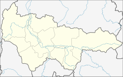
Urai
| city
Urai
Uray
|
||||||||||||||||||||||||||||||||||||||||||||
|
||||||||||||||||||||||||||||||||||||||||||||
|
||||||||||||||||||||||||||||||||||||||||||||
| List of cities in Russia | ||||||||||||||||||||||||||||||||||||||||||||
Urai ( Russian Ура́й ) is a city in the Khanty and Mansi Autonomous Okrug / Ugra in Western Siberia ( Russia ). It has 39,457 inhabitants (as of October 14, 2010).
geography
The city is located in the middle of the forests and swamps of the Konda lowlands , part of the West Siberian lowlands , about 350 kilometers southwest of the administrative center of Khanty-Mansiysk . Urai is located on the right bank of the Konda River .
The city of Urai is administratively directly subordinate to the region. Several smaller settlements, mainly in a north-westerly direction, such as Nasarowo, Chantyrja and Shaim, belong to the urban area.
history
In 1922, resettlers from central Russia founded the Kolossja settlement near today's city .
At the end of the 1950s, a base for oil exploration was established here , and in 1960, about 40 kilometers to the north-west, near the village of Shaim , the first oil deposit in Western Siberia, Shaimskoye, was discovered. As a result, the place grew rapidly and in 1965 received city rights under the name Urai ( Mansi for oxbow river , arched lake ).
Population development
| year | Residents |
|---|---|
| 1959 | 900 |
| 1970 | 17,385 |
| 1979 | 21,519 |
| 1989 | 37.198 |
| 2002 | 38,872 |
| 2010 | 39,457 |
Note: census data (1959 rounded)
Culture, education and sights
Urai has a city history museum.
In the city there are branches of the Tyumen State University (since 1995) and the Tyumen State Oil and Gas University .
Economy and Infrastructure
The city is an important base for oil production in the western part of the West Siberian lowlands. It is one of the three original locations of the oil company Lukoil (the U in the company name stands for Urai ). An oil pipeline to Tyumen begins here .
There are also companies in the construction and food industries.
Urai has an airport and is a local traffic center with its bus station. The nearest railway station is 160 kilometers down the Konda at the Mezhduretschenski settlement ( Ustye-Acha station ), where a line from Yekaterinburg that was built in the 1960s ends.
sons and daughters of the town
- Wiktorija Schilinskaite (* 1989), Russian handball player
Web links
- City administration website (Russian)
- Urai on mojgorod.ru (Russian)
Individual evidence
- ↑ a b Itogi Vserossijskoj perepisi naselenija 2010 goda. Tom 1. Čislennostʹ i razmeščenie naselenija (Results of the All-Russian Census 2010. Volume 1. Number and distribution of the population). Tables 5 , pp. 12-209; 11 , pp. 312–979 (download from the website of the Federal Service for State Statistics of the Russian Federation)


