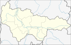
Bely Jar (Chanting and Mansi)
| Urban-type settlement
Bely Jar
Белый Яр
|
||||||||||||||||||||||||||||||||||
|
||||||||||||||||||||||||||||||||||
|
||||||||||||||||||||||||||||||||||
| List of large settlements in Russia | ||||||||||||||||||||||||||||||||||
Bely Jar ( Russian Белый Яр ) is an urban-type settlement in the West Siberian Autonomous Okrug of Khanty and Mansi / Ugra ( Russia ) with 14,580 inhabitants (as of October 14, 2010).
geography
The place is located in the West Siberian lowlands about 250 km east of the capital of the Khanty-Mansiysk Autonomous Okrug on the right bank of the Ob . The city of Surgut , whose suburb Bely Jar is in fact, is located almost ten kilometers east of the settlement .
Bely Jar belongs to the Surgut district . The place is not to be confused with the town of Belojarski located in the northwestern part of the Autonomous Okrug (also the administrative center of the raion of the same name).
history
An insignificant village Bely Jar in the place of today's settlement existed before the 20th century.
When, on August 28, 1958, the neighboring Surgut, which had been a town since the 17th century and has since been demoted to a village, regained the status of an urban-type settlement , the village soviet for the surrounding towns was moved from there to Bely Yar.
In connection with the development of the West Siberian oil - and natural gas deposits from the 1960s, the city grew, especially after completion of the railway bridge over the Ob with the route to Surgut 1975. On November 5, 1984, also Bely Yar the status of an urban-type settlement awarded .
Population development
| year | Residents |
|---|---|
| 1989 | 13.004 |
| 2002 | 14,392 |
| 2010 | 14,580 |
Note: census data
Economy and Infrastructure
Most of the population is employed in the oil and gas industry in neighboring Surgut and the surrounding area.
Railway line (since 1975) and trunk road (since 2000) Tyumen –Surgut, which cross about five kilometers downstream (southwest) of Bely Yar the Ob, bypass the settlement to the north. The city of Surgut train station is about five kilometers northeast of Bely Jar.
Individual evidence
- ↑ a b Itogi Vserossijskoj perepisi naselenija 2010 goda. Tom 1. Čislennostʹ i razmeščenie naselenija (Results of the All-Russian Census 2010. Volume 1. Number and distribution of the population). Tables 5 , pp. 12-209; 11 , pp. 312–979 (download from the website of the Federal Service for State Statistics of the Russian Federation)
Web links
- Website of the Surgut district administration (Russian) ( page no longer available , search in web archives )

