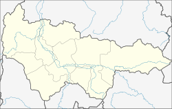
Oktyabrskoje (Khanty and Mansi)
| Urban-type settlement
Oktyabrskoye
Октябрьское
|
||||||||||||||||||||||||||||||||||||
|
||||||||||||||||||||||||||||||||||||
|
||||||||||||||||||||||||||||||||||||
Oktjabrskoje ( Russian Октя́брьское ) is an urban-type settlement in the Khanty and Mansi Autonomous Okrug in Russia with 3640 inhabitants (as of October 14, 2010).
geography
The place is located about 225 km as the crow flies northwest of the district administrative center Khanty-Mansiysk in the West Siberian lowlands on the right bank of the Ob, which is 1.5 km wide .
Oktjabrskoje is the administrative center Rajons Oktyabrsky and seat of the municipality Oktjabrskoje gorodskoje posselenije, which also includes the village of Bolshoy Kamen and the settlement Kormuschichanka include (both some 10 km to the east / upstream).
history
The place was founded in 1590 as the Russian Ostrog Kodsk . The name goes back to the Chantic name Koda for the area, which first appeared in Russian chronicles in 1484. In the 17th century the place name Kondinskoje became common (not to be confused with today's settlement of the same name Kondinskoje ); later the place became the seat of a Volost of Ujezds Berjosow of the Tobolsk Governorate .
On July 4, 1937, the village became the administrative seat of the newly created Mikojanowski rajon (named after Anastas Mikojan ). On December 13, 1957, the Rajon was renamed Oktjabrski , and the village was accordingly renamed Oktjabrskoje, from Russian oktjabr for "October", here in reference to the October Revolution . Since July 23, 1959 Oktyabrskoye has had the status of an urban-type settlement.
Population development
| year | Residents |
|---|---|
| 1939 | 2,465 |
| 1959 | 3.834 |
| 1970 | 3,842 |
| 1979 | 3,650 |
| 1989 | 3,781 |
| 2002 | 3,857 |
| 2010 | 3,640 |
Note: census data
traffic
The nearest train station is 25 km northwest of Priobje , where a line from Serow via Iwdel has been going since 1967 . Priobje can be reached from Oktjabrskoje over the Ob by car ferry , in winter over the ice. Oktyabrskoye is also connected to the Russian road network via Priobje, the end point of the regional road 71-100N-2104 from Nyagan .
On the right bank of the Obufer, a road leads from Oktyabrskoje to the settlement of Andra 10 km downstream , from there the regional road 71-100N-1101 past Belojarski to Verkhnekasymski and on into the neighboring Yamal-Nenets Autonomous Okrug to Nadym .
Web links
Individual evidence
- ↑ a b Itogi Vserossijskoj perepisi naselenija 2010 goda. Tom 1. Čislennostʹ i razmeščenie naselenija (Results of the All-Russian Census 2010. Volume 1. Number and distribution of the population). Tables 5 , pp. 12-209; 11 , pp. 312–979 (download from the website of the Federal Service for State Statistics of the Russian Federation)

