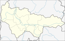
Kondinskoje (Khanty and Mansi)
| Urban-type settlement
Kondinskoye
Кондинское
|
||||||||||||||||||||||||||||||||||
|
||||||||||||||||||||||||||||||||||
|
||||||||||||||||||||||||||||||||||
Kondinskoje ( Russian Конди́нское ) is an urban-type settlement in the Khanty and Mansi Autonomous Okrug / Ugra in Russia with 3616 inhabitants (as of October 14, 2010).
geography
The place is about 175 km as the crow flies southwest of the district administrative center Khanty-Mansiysk in the West Siberian lowlands . It is located on the left bank of the Konda directly below the confluence of the tributary Jukonda , which forms a lake there on its left branch of the mouth.
Kondinskoje belongs to the Kondinsky Rajons , whose administrative seat Meshduretschensky is 85 km to the west. The settlement is the seat of the municipality Kondinskoje gorodskoje posselenije, which also includes the villages of Ilyichovka (14 km east-southeast), Nikulinka (20 km west) and Stary Katysh (35 km west-southwest).
history
A place called Nachratschi in the sparsely populated predominantly by Khanty and Mansi region on the middle Konda was mentioned for the first time in 1715. In 1847 it received the official status of a village and became the seat of a Volost ; this year is the founding year of the place. Since February 1, 1924, Nachratschi was the administrative seat of the Kondinski rajon named after the river.
On August 29, 1961, the place received its current name, adapted to that of the river and the Rajons. A previously called Kondinskoje , a good 300 km north on the right bank of the Ob , without reference to the Konda, was renamed Oktjabrskoje in 1959 .
Since August 5, 1963, Kondinskoje has had the status of an urban-type settlement. In 1995 the administrative seat of the Rajon was relocated to Meschduretschenski, which is more convenient in terms of transport and has been more important since the railway was built in 1969.
Population development
| year | Residents |
|---|---|
| 1939 | 2,478 |
| 1959 | 3,045 |
| 1970 | 3,683 |
| 1979 | 4,772 |
| 1989 | 5.125 |
| 2002 | 4,086 |
| 2010 | 3,616 |
Note: census data
traffic
A slope that is only passable in winter leads to Kondinskoje, which branches off the regional road 71-100K-16 between Meschduretschenski and Mortka . From Meschduretschenski there is a connection to the year-round road network, via the 71-100K-15 in the direction of Urai , further than 71-100K-14 to Sowetski . The closest train stations on a route from Yekaterinburg are also located in Mezhduretschensky ( Ustye-Acha terminus ) and Mortka .
Kondinskoje has had an airport ( ICAO code USHK ) on the eastern edge of the town, which today (as of 2014) regularly flies to Khanty-Mansiysk and Tyumen since 1968 .
Web links
- Kondinskoye Municipality on the official Raion government website (Russian)
Individual evidence
- ↑ a b Itogi Vserossijskoj perepisi naselenija 2010 goda. Tom 1. Čislennostʹ i razmeščenie naselenija (Results of the All-Russian Census 2010. Volume 1. Number and distribution of the population). Tables 5 , pp. 12-209; 11 , pp. 312–979 (download from the website of the Federal Service for State Statistics of the Russian Federation)
- ↑ Kondinskoje on the website of the Geographical Institute of the RAN (Russian)

