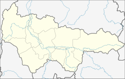
Lugovoi (Khanty and Mansi)
| Urban-type settlement
Lugovoi
Луговой
|
||||||||||||||||||||||||||||||||||||
|
||||||||||||||||||||||||||||||||||||
|
||||||||||||||||||||||||||||||||||||
Lugowoi ( Russian Лугово́й ) is an urban-type settlement in the West Siberian Autonomous Okrug of the Khanty and Mansi / Ugra ( Russia ) with 1756 inhabitants (as of October 14, 2010).
geography
The settlement is located on the left bank of the strongly meandering Konda River , in the West Siberian lowlands , about 226 kilometers as the crow flies southwest of the administrative center of the Khanty-Mansiysk Autonomous Okrug . The Rajonzentrum Meschduretschenski is located about 13 kilometers south of Lugovoi.
As to the administrative division, Lugowoi belongs to the Kondinski rajon . It is also the administrative seat and the only permanently inhabited place of the municipality of the same name Gorodskoje posselenije Lugowoi ( Городское поселение Луговой ).
history
Lugovoi was founded in 1922 as a settlement for farmers of Russian descent near the former village of Sujewka ( Зуевка ). The name of the place was derived from the rich meadow areas (Russian луг / lug ; meadow) on the banks of the Konda, which the farmers used as arable and pasture areas for growing grain and raising cattle. In addition to the fur trade, the settlers also went fishing in the surrounding fish-rich lakes.
In 1929, a commune was founded, but it quickly disintegrated and in 1932 it was transformed into the agricultural kolkhoz Red Banner ( Красное знамя ). Since 1937 there was also a wood harvesting company. In the 1950s and 1960s the settlement was greatly expanded. In addition to a library, a post office, a forestry, a brickworks, an ambulance, a music school as well as shops and commercial buildings were built. A village soviet was founded in 1957. The kolkhoz was dissolved in 1959.
In 1959 a small airfield with two runways was built on the western outskirts. Two years later, the Lugowoier Air Defense Department against forest fires ( Луговское отделение авиационной охраны лесов от пожаров ) was established from the airfield with helicopters ( Mi-1 , Mi-8, and later multi-purpose aircraft ( Mi-1 , Mi-2 ) and later ( Jak- 1 , Mi-2 ) Seaplanes ) operated.
The wood-producing and wood-processing industry became the most important branch of the economy. A sawmill was built in the late 1950s. The timber was transported from the felling bases by rafting across the Konda and winter roads. From 1956 to the 1970s, there was also a narrow-gauge railway up to 47 kilometers long to transport people and goods out of the forest . With the discovery and development of the West Siberian oil deposit Shaimskoye in the 1960s, the demand for housing for the growing settlements and cities in the area increased. The Lugovoi-based housing association benefited greatly from this and increased its sales of prefabricated wooden apartment buildings. On September 29, 1960 Lugovoi received urban-type settlement status.
In the 1970s, greenhouses, a chicken farm and a dairy were built in Lugowoi for local self-sufficiency. In 1980 the place, which until then had received energy from steam and diesel generators, was electrified using power lines.
Production at the Lugowoier forestry enterprise has been falling since the 1990s , as the logging bases are now more than 150 kilometers from the settlement. As a result, the population of the place is steadily decreasing.
Population development
| year | Residents |
|---|---|
| 1970 | 3,001 |
| 1979 | 2,672 |
| 1989 | 2,575 |
| 2002 | 1.956 |
| 2010 | 1,756 |
Note: census data
Culture and sights
The place has a cultural center, a library and a nearby health, sports and training camp for young people.
Economy and Infrastructure
The most important branch of the economy in the place is the wood industry.
Starting from Lukowoi, a road runs to the nearby Mezhduretschenski. From there there is a connection to the Russian railway network ( Yekaterinburg - Irbit - Tawda railway line ) via the Ustye-Acha station . Lugovoi also has a river port on the Konda.
Individual evidence
- ↑ a b Itogi Vserossijskoj perepisi naselenija 2010 goda. Tom 1. Čislennostʹ i razmeščenie naselenija (Results of the All-Russian Census 2010. Volume 1. Number and distribution of the population). Tables 5 , pp. 12-209; 11 , pp. 312–979 (download from the website of the Federal Service for State Statistics of the Russian Federation)
- ↑ Закон Ханты-Мансийского автономного округа - Югры от 25 ноября 2004 года № 63-оз "О статусе и границах муниципальных образований Ханты-Мансийского автономного округа - Югры» (Russian); accessed on November 6, 2016
- ↑ a b c d e f История поселения (Russian); accessed on November 6, 2016
- ↑ Узкоколейные железные дороги Ханты-Мансийского автономного округа (Russian); accessed on November 6, 2016
- ↑ Article Календарь памятных и знаменательных дат on the archived official website of Kondinsky Rajon (Russian); accessed on November 6, 2016
- ↑ оздоровительно-образовательный центр «Юбилейный» (Russian); accessed on November 6, 2016
Web links
- Official website of the local government (Russian)


