Serra de Caldas Novas
| Serra de Caldas Novas | ||
|---|---|---|
|
Waterfall in the Serra de Caldas Nova State Park |
||
| height | 1043 m | |
| location | South Goiás | |
| Mountains | Brazilian mountain country | |
| Coordinates | 17 ° 48 ′ 30 ″ S , 48 ° 42 ′ 0 ″ W | |
|
|
||
| Type | extinct volcano | |
| rock | Quartzite | |
| Age of the rock | +600 mya | |
| Last eruption | unknown | |
|
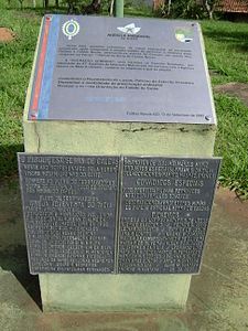
Inscription at the park entrance |
||
Serra de Caldas Novas is a mountain range in the southeast of the Brazilian state of Goiás .
The mountains emerged from a former volcano that has long been extinct. Its crater was filled by weathering and today forms a plateau with an average height of almost 1000 m and a maximum height in the northeast of 1043 m, which means that the plateau towers over the surrounding area with the towns of Caldas Novas and Rio Quente by approx. 250 m. The elliptically shaped crater with a longitudinal extension of 12 km and a width of 7 km acts today as a collecting basin for the precipitation, which seeps into the earth's interior at depths of up to 1000 m. When the water seeps away, its temperature increases by 3 ° C / 100 m due to the geothermal energy and the resulting increased pressure and the geological stratification , the water is directed upwards again, where it acts as a thermal spring on the mountain flanks and in their immediate vicinity returns to the surface of the earth at a temperature of around 60 ° C.
For several decades, the thermal water in the towns of Rio Quente and Caldas Novas has been used intensively through the construction of thermal baths. This makes the two places one of the most popular tourist destinations in the Brazilian Midwest .
State park
The Serra de Caldas was under the name Parque Estadual Serra de Caldas Novas ((Pescan) on 25 September 1970. State Schutzgebiet¨ port .: Parque Estadual ) Goiás explained. It extends over an area of 123 km 2 and thus includes the plateau as well as the mountain flanks. Access to the park is only permitted with a guide and only via the signposted paths during opening hours. This serves to protect the flora , fauna and especially the thermal springs.
See also
Web links
- Secretariat for Environment and Water Resources of Goiás: Serra de Caldas Novas State Park ( port. )
- Caldas Novas hot springs, State of Goiás; Remarkable occurrence of thermal waters not related to magmatism (PDF file; 408 kB); José Eloi Guimarães Campos, Uwe Tröger, Fábio Floriano Haesbaert. ( eng .)
Individual evidence
- ↑ Hydrographic cycle in the Serra de Caldas Novas of the Universidade Federal de Uberlândia ( PDF file, Portuguese; 655 kB)
- ↑ Hydraulic observations in the aquifers of Caldas Novas ( page no longer available , search in web archives ) Info: The link was automatically marked as defective. Please check the link according to the instructions and then remove this notice. (PDF). Kristina Gazić, Institute for Applied Geosciences, Department of Hydrogeology, Technical University of Berlin


