Shade River
| Shade River | ||
|
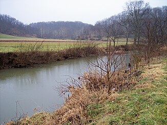
The East Branch Shade River in Chester Township in southeast Ohio. |
||
| Data | ||
| Water code | US : 1066950 | |
| location | southeastern state of Ohio , USA | |
| River system | Mississippi River | |
| Drain over | Ohio River → Mississippi River → Gulf of Mexico | |
| origin | The confluence of the West Branch and Middle Branch Shade Rivers 2 km north of Chester in Meigs County, OH 39 ° 5 ′ 58 ″ N , 81 ° 55 ′ 21 ″ W |
|
| Source height | 182 m | |
| muzzle | Ohio River 2 km south of Longbottom in Olive Township, OH Coordinates: 39 ° 4 '3 " N , 81 ° 48' 49" W 39 ° 4 '3 " N , 81 ° 48' 49" W |
|
| Mouth height | 171 m | |
| Height difference | 11 m | |
| Bottom slope | 0.39 ‰ | |
| length | 28 km | |
| Catchment area | 572 km² | |
| Left tributaries | Middle Branch Shade River, East Branch Shade River | |
| Right tributaries | West Branch Shade River | |
The Shade River is a 28 km long right tributary of the Ohio River in the southeastern US state of Ohio . He drained an area of 570 square kilometers and is part of the river system of the Mississippi River . It drains into the Gulf of Mexico via the Ohio River and Mississippi River .
The Shade River arises from the confluence of the West Branch Shade River and Middle Branch Shade River about 2 kilometers north of the town of Chester in Meigs County . The Shade River flows generally in an easterly direction meandering through Meigs County, takes up the East Branch Shade River coming from the north and reaches the confluence with the Ohio River 3 kilometers south of the parish Long Bottom in Meigs County.
The Shade River has had several names throughout its history, according to the Geographic Names Information System , including Devils Hole Creek and Shade Creek .
Individual evidence
- ↑ a b Google Earth altitude for GNIS coordinates, accessed on August 16, 2010.
- ↑ a b c Gazetteer of Ohio Streams ( Memento from October 20, 2013 in the Internet Archive ) (PDF; 1.8 MB), accessed on August 16, 2010
- ↑ Shade River in the Geographic Names Information System of the United States Geological Survey West Branch Shade River
- ↑ Shade River in the Geographic Names Information System of the United States Geological Survey Middle Branch Shade River
- ↑ Shade River in the Geographic Names Information System of the United States Geological Survey East Branch Shade River
- ^ A b Shade River in the United States Geological Survey's Geographic Names Information System , accessed August 16, 2010
Web links
- Shade River in the United States Geological Survey's Geographic Names Information System
- Gazetteer of Ohio Streams ( Memento from October 20, 2013 in the Internet Archive ) (PDF; 1.8 MB)
