Shrewsbury, Massachusetts
| Shrewsbury | ||
|---|---|---|
 |
||
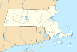
| Location in Massachusetts | ||
|
|
||
| Basic data | ||
| Foundation : | 1727 | |
| State : | United States | |
| State : | Massachusetts | |
| County : | Worcester County | |
| Coordinates : | 42 ° 18 ′ N , 71 ° 43 ′ W | |
| Time zone : | Eastern ( UTC − 5 / −4 ) | |
| Residents : | 35,608 (as of 2010) | |
| Population density : | 663.1 inhabitants per km 2 | |
| Area : | 56.1 km 2 (approx. 22 mi 2 ) of which 53.7 km 2 (approx. 21 mi 2 ) is land |
|
| Height : | 204 m | |
| Postal code : | 01545 | |
| Area code : | +1 508, 774 | |
| FIPS : | 25-61800 | |
| GNIS ID : | 0619489 | |
| Website : | www.shrewsbury-ma.gov | |
| Mayor : | Daniel J. Morgado | |
 |
||
Shrewsbury is a small town ( Town ) in Worcester County in the US state of Massachusetts with 35,000 inhabitants.
The place is on the Boston Post Road a few miles east of Worcester .
Personalities
- Lillian Asplund (1906-2006), Titanic passenger
- Min Chueh Chang (1908-1991), biologist
- Ralph Earl (1751-1801), painter
- Joseph D. Early (1933–2012), politician
- Calvin Goddard (1768–1842), politician
- Gregory Mcdonald (1937-2008), writer
- Tim Murray (* 1968), politician
- Jaak Panksepp (1943–2017), psychology professor
- Nahum Parker (1760–1839), politician
- Karyn Polito (* 1966), politician
- Artemas Ward (1727-1800), major general
- Artemas Ward junior (1762–1847), politician
Web links
Commons : Shrewsbury, Massachusetts - collection of pictures, videos, and audio files
