Siegburger Mühlengraben
| Siegburger Mühlengraben | ||
|
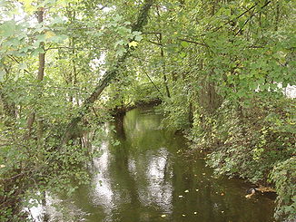
Siegburger Mühlengraben near the Siegwerk in Siegburg |
||
| Data | ||
| Water code | DE : 272792 | |
| location | North Rhine-Westphalia , Germany | |
| River system | Rhine | |
| Drain over | Victory → Rhine → North Sea | |
| origin | East of Siegburg by teeing off from the Sieg (km 15.1) 50 ° 47 ′ 20 ″ N , 7 ° 13 ′ 34 ″ E |
|
| Source height | 59 m above sea level NN | |
| muzzle | Southwest of Troisdorf in die Sieg (km 10.1) Coordinates: 50 ° 47 '57 " N , 7 ° 10' 45" E 50 ° 47 '57 " N , 7 ° 10' 45" E |
|
| Mouth height | 51 m above sea level NN | |
| Height difference | 8 m | |
| Bottom slope | 1.7 ‰ | |
| length | 4.7 km | |
| Catchment area | 5.746 km² | |
The Siegburger Mühlengraben is an approximately 4.7 km long canal in the system of the Sieg River in Siegburg ( Rhein-Sieg-Kreis , North Rhine-Westphalia , Germany ).
course
The junction of the Siegburger Mühlengraben from the Sieg is about 60 m above sea level. NN directly above or west of the barrier structure of the "Siegburger Siegwehr". From there the artificially created water, which is about 4 m wide, winds in west-northwest directions through Siegburg, including through the grounds of the Siegwerk , within which it is divided into two arms, and then past the foot of the Michaelsberg (location the abbey Michael Berg ) in the direction of downtown and "Bertrams mill".
It then crosses under the district court and the municipal "Gymnasium Alleestraße" for a few meters each , continues past the foot of the Brückberg district in the direction of the Zange district , after which it runs about 160 m below the Cologne-Frankfurt ICE route and then around 400 m east of the Agger confluence at about 50 m above sea level. NN comes across the victory again. Due to changes in the estuary area, the trench used to flow into the Agger for a time.
history
Most of the mill moat was created artificially. The exact age is unknown, it was first mentioned in a document in the 12th century. The Abbey Michael Berg were among the five mills on the trench (grinding mill, fulling mill, Lohmühle, paper mill and oil mill). Only the grinding mill was within the city wall in the Middle Ages . All other mills were in front of this one.
In addition to the mills, the mill moat was also important for the population. You could draw the Siegwasser and wash your clothes here. From the 15th century it also served as a transport route for the nearby quarries on the Wolsbergen , until the beginning of the 19th century these stones and other loads were transported on the mill ditch.
In 1839/40 a factory (calico factory) was established on the upper part of the mill ditch, which required a lot of water for its production. To avoid the dispute over the water, the owners bought all of the mills by 1865. In 1914 the factory was closed and the Siegwerk became the legal successor. The mills were then sold to a cooperative in 1924. From 1906 to 1928 there was a bathing establishment on Mühlengraben.
In 1993 the only building from the history of the mill in Siegburg (the grinding mill) was renovated. The mill wheel from 1877 was also restored and should now be used to generate electricity. Because of its loud running noise, the waterwheel was taken out of service again.
Individual evidence
- ↑ a b German basic map 1: 5000
- ↑ a b Topographical Information Management, Cologne District Government, Department GEObasis NRW ( Notes )
- ^ Entry by Franz-Josef Knöchel on Mühlengraben Siegburg in the " KuLaDig " database of the Rhineland Regional Council
Web links
- Markus Bauer: A corpse and nude bathing in the Siegburger Mühlengraben. In: General-Anzeiger . November 29, 2007, accessed August 29, 2015 .
