
Skytok
| Skytok | |||
| Скиток | |||

|
|
||
| Basic data | |||
|---|---|---|---|
| Oblast : | Chernihiv Oblast | ||
| Rajon : | Ripky District | ||
| Height : | 122 m | ||
| Area : | 0.33 km² | ||
| Residents : | 31 (2001) | ||
| Population density : | 94 inhabitants per km² | ||
| Postcodes : | 15013 | ||
| Area code : | +380 4641 | ||
| Geographic location : | 52 ° 4 ' N , 30 ° 58' E | ||
| KOATUU : | 7424486409 | ||
| Administrative structure : | 1 village | ||
| Address: | вул.30 років Перемоги 40 15013 с. Нові Яриловичі |
||
| Statistical information | |||
|
|||


Skytok ( Ukrainian Скиток ; Russian Скиток Skitok ) is a village in the northwest of the Ukrainian Oblast Chernihiv with about 30 inhabitants (2001).
The village, known since 1749, belongs administratively to the district council of Nowi Jarylowytschi in the north of the Ripky district .
Skytok has an area of 0.33 km² and is located on the border with Belarus at an altitude of 122 m on the left bank of the Sosch , a 648 km long left tributary of the Dnepr , which forms the border river with Belarus.
In the east of the village is the "Nowi Jarylowytschi border crossing" to Belarus , located on the M 01 / E 95 road . To the northeast of the village is the 3.2 hectare Sucha Hrjad nature reserve ( Суха Грядь ). It was established in 1978 and is home to a 120 year old pine forest.
The village is located 6 km north of the Novi Yarylowytschi community center, 31 km north of the Ripky district center and 68 km north of the Chernihiv oblast center .

The Skytok village street

Residential house in Skytok
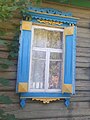
Window in Ukrainian colors


Web links
Individual evidence
- ↑ a b local website on the official website of the Verkhovna Rada ; accessed on August 23, 2019 (Ukrainian)
- ↑ Chernihiv Oblast Natural Monuments ; accessed on August 23, 2019 (Ukrainian)
- ^ Reserve map on the website of the Ministry of Ecology and Natural Resources of the Regional State Administration; accessed on August 23, 2019 (Ukrainian)