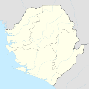
Sonfon lake
| Sonfon lake | ||
|---|---|---|

|
||
| Geographical location | in the north of Sierra Leone | |
| Tributaries | various | |
| Drain | Pampana → Sherbro → Atlantic Ocean | |
| Places on the shore | no | |
| Location close to the shore | Kabala | |
| Data | ||
| Coordinates | 9 ° 14 ′ 54 ″ N , 11 ° 31 ′ 17 ″ W | |
|
|
||
| Altitude above sea level | 549 m | |
| surface | 2.6 | |
| Maximum depth | 6 m | |
|
Lake Sonfon National Park
|
|
| location | Northern Province , Sierra Leone |
| surface | 51.8 km² |
| WDPA ID | 19255 |
| administration | National Protected Area Authority |
The Sonfon Lake ( English Lake Sonfon ) is a lake in the Koinadugu district in Sierra Leone , West Africa . It is located in the hills of the Sula Mountains at an altitude of 549 m , around 60 kilometers south of the city of Kabala . The lake is a nature reserve .
description
The lake has a maximum depth of six meters and is one of the largest lakes in the country with an area of 2.6 square kilometers. It is fed by seven small tributaries. The annual rainfall in the region is between 2286 mm and 2540 mm. During the rainy season, the water level in the lake rises significantly and floods a much larger area.
The outflow is via the Pampana at the southern end , which flows into the Atlantic Ocean via the Sherbro . In the dry season the lake is completely covered with vegetation. The hilly environment consists of grassland and forests. Around 115 species of birds were recorded in the lake area and the surrounding vegetation during the IBA survey in 1994, including the rare Schillerglanzstar ( Coccycolius iris , English Emerald Starling = "Smaragdstar"). Herons and egrets are widely used in the marine environment.
Gold mining
Gold deposits have been known in the sea area since 1926. At times up to 15,000 miners are said to have been active around the lake and the tributary areas. In 1994, the gold content of the alluvial material in six tributary areas was given as 14.27 grams per ton of excavation. The nature conservation authorities made this degradation responsible for the lowering of the water level.
See also
Web links
Individual evidence
- ↑ Lake Sonfon and Environs . Visit Sierra Leone. 2011. Archived from the original on January 9, 2011. Info: The archive link was automatically inserted and has not yet been checked. Please check the original and archive link according to the instructions and then remove this notice. Retrieved January 23, 2013.
- ^ The Statistical Digest 2007-2013 Edition. Statistics Sierra Leone, October 2014, p. 1. ( Memento of the original dated February 2, 2017 in the Internet Archive ) Info: The archive link was inserted automatically and has not yet been checked. Please check the original and archive link according to the instructions and then remove this notice.
- ↑ Photo Schillerglanzstar
- ^ Biodiversity Resource Endowment and Conservation . World Wildlife Fund. Retrieved January 23, 2013.
- ^ Gold Exploration project
- ^ About Company & PropertyMine 1994
