Oregon Coast Range
| Oregon Coast Range | ||
|---|---|---|
|
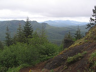
Saddle Mountain at Astoria in the Northern Oregon Coast Range |
||
| Highest peak | Marys Peak ( 1249 m ) | |
| location | Oregon (USA) | |
|
|
||
| Coordinates | 44 ° 30 ′ N , 123 ° 33 ′ W | |
The Oregon Coast Range is an almost 500 km long mountain range in the US state of Oregon , which belongs to the series of mountain ranges along the North American Pacific coast .
geography
The mountains consist of an irregular, up to 1249 meter high mountain range, which has some foothills, especially to the west. The Coast Range is in the Columbia River to the Salmon River reaching Northern , the Salmonella to the Umpqua River reaching Central and in the Umpqua until the Coquille River reaching Southern Coast Range divided. The border to the northern Willapa Hills in Washington forms the Columbia River, in the east about two-thirds of the Willamette Valley are bounded, while the southern part merges into the Klamath Mountains and the Cascade Range . Numerous rivers such as the Nehalem , Alsea , Siletz , Siuslaw , Umpqua and Coquille Rivers have their source in the Coast Range and flow into the Pacific Ocean.
geology
The mountain range was created by plate tectonic forces. A number of volcanic islands were formed 50 million years ago, which collided with the North American plate and unfolded the mountains . The now heavily eroded volcanoes form many of the projections and capes along the coast such as Cape Lookout .
climate
Due to the proximity to the Pacific, the Coast Range has a maritime climate . Average temperatures are moderate, ranging from 5 ° C in January to 14 ° C in July, with temperatures dropping at higher elevations. The westerly winds bring humid air masses from the sea, which rains down as incline rain on the west side of the Coast Range. The higher the location, the higher the rainfall. Annual rainfall ranges from up to 3000mm on the western side to 1500mm in the rain shadow in the east, with summers being relatively dry. The precipitation mostly falls as rain, a closed snow cover is rare.
flora
The original vegetation includes primeval forests of Sikta spruce , West American hemlocks and Douglas firs . Today, however, the forests consist almost entirely of secondary forest, as the original primeval forest was cut down. Remnants of the jungle can be found u. a. in the Northern Coast Range in Ecola , Oswald West and Cape Lookout State Park as well as in the three 90 km² wilderness areas of the Siuslaw National Forest , to which large parts of the densely forested Coast Range belong.
The highest peaks
- Marys Peak (1249 m)
- Rogers Peak (1130 m)
- Grass Mountain (1098 m)
- Laurel Mountain (1094 m)
- Bone Mountain (1079 m)
- South Saddle Mountain (1056 m)
- Larch Mountain (1052 m)
See also
Web links
- Oregon Department of Geology and Mineral Industries: Coast Range
- The Oregon Coast Visitors Guide: Oregon Coast Range
Individual evidence
- ^ Central Oregon Coast Range. Retrieved June 10, 2011 .
- ^ Climate of Oregon. Retrieved July 4, 2011 .
- ^ Eugene N. Kozloff: Plants of Western Oregon, Washington & British Columbia. Portland, 2005: Timber Press. ISBN 978-0881927245 , p. 27


