
Spelsberg
|
Spelsberg
City of Remscheid
Coordinates: 51 ° 12 ′ 6 ″ N , 7 ° 11 ′ 20 ″ E
|
||
|---|---|---|
| Height : | 239 m above sea level NN | |
| Postal code : | 42855 | |
| Area code : | 02191 | |
Location of Spelsberg in Remscheid |
||
.svg)
Spelsberg is a district of the Lüttringhausen district in the north of the North Rhine-Westphalian city of Remscheid .
location
The Hofschaft is located about 250 meters in a straight line to the north and some 50 meters above the Morsbachtals and the metalworking industry dominated local situation Spelsberg hammer . Spelsberg is located at about 239 meters above sea level on a ridge rising in a northerly direction between Clarenbach and Gründerhammer. On one of the farms, a couple of lovers breeds the old domestic animal varieties “Bergisches Wollschwein ”, the chicken variety “Bergische Schlotterkämme” and the “Ostfriesische Milchschafe” as part of the “Bergische Arche” in order to save these animals from extinction.
history
It is not known when Spelsberg was founded. Since a hammer near Spelsberg is mentioned as early as the 14th century , the village could be about as old. The court was mentioned in a document in 1547 as "Spedelsbergh", which means something like "remote forest settlement".

Another mention comes from the year 1607, where "two grinding cottons under Spilsberg" are mentioned. In 1727 Spelsberg belonged to the Heydt school district , later to the Grund district and church to Lüttringhausen . Most of the older houses were once farmhouses. Until the 1950s there was a restaurant in the first house at the beginning of the farm.
traffic
The Ronsdorf-Müngstener Railway ran through Spelsberger Hammer, which is located below the Hofschaft am Morsbach. It was opened on this section on November 16, 1891 and was also closed for freight traffic on August 30, 1959. There were train stations in Clarenbach and Ehligshammer. Today the citizens' bus runs here several times a day .
Buildings and nature
Spelsberg consists of 17 residential buildings, both of which are slated half-timbered houses of older construction dates as well as some new buildings. In 2015, the houses in Spelsberg No. 2, 3, 4, 5, 6, 12 are under monument protection. The location on a ridge that continues to rise towards the north is partially surrounded by (poor) meadows and pastures as well as forest and bush areas. It conveys a rural appearance without industrial operations.

Spelsberg court

Former Spelsberg farmhouse with stable
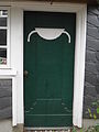
Old front door on Spelsberg

Slate houses on Spelsberg


The route to Ronsdorf , which leads in a northerly direction via Grüner, was formerly the old coal route , which runs as a hollow path both in the Neuland area and above Spelsberg and is now designated as a natural monument . Over a distance of around 100 m, the ravine looks like a natural tunnel made of hornbeams and ivy. The trees grow into one another in the crowns.
The landscape around Spelsberg and the surrounding villages is, according to the expert opinion of the Rhineland Regional Association, a "regionally important cultural area" to be protected. Through Spelsberg u. a. the hiking trail “Naturerlebnis Grund” (marked here as hiking trail A4).
literature
- Heinrich Rauscher: Historical hike through the Morsbachtal and its side valleys , Born-Verlag, Wuppertal 1986, ISBN 3-87093-037-3
- Hans Kadereit: Where there is still celebrations, reels and delights , a historical illustrated book Lüttringhausen, RGA-Buchverlag, 2009, ISBN 978-3-940491-07-7
- Gustav Hermann Halbach: Bergischer Sprachschatz .
Individual evidence
- ↑ Mention of the Spelsberger Hammer, In: Günther Schmidt: Gustav Platte stood at the hammer for more than 50 years , article from February 28, 2009 on waterboelles.de
- ↑ Belonging to the Heydt school district ( Memento from February 3, 2010 in the Internet Archive ) on ronsdorf-wektiven.de
- ↑ Classification as "regionally significant cultural area", see Chapter 7.2; KBL 20.04 "Tal der Wupper", p. 65, In: Cultural landscape specialist contribution to state planning in North Rhine-Westphalia , Part 4 , Website of the Rhineland Regional Association (PDF file; 9.72 MB)
- ↑ Information boards for the "Naturerlebnis Grund" hiking trail (PDF file; 2.66 MB)