Spouthead Gill
| Spouthead Gill | ||
|
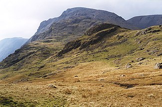
View over Spout Head with the source of Spouthead Gill in the center right and Great Gable in the background |
||
| Data | ||
| location | Cumbria , England | |
| River system | River Esk (Cumbria) | |
| Drain over | Wast Water → River Esk (Cumbria) → Irish Sea | |
| River basin district | North West | |
| Source height | 830 m ASL | |
| muzzle | Confluence with Piers Gill Coordinates: 54 ° 28 ′ 18 ″ N , 3 ° 13 ′ 3 ″ W 54 ° 28 ′ 18 ″ N , 3 ° 13 ′ 3 ″ W. |
|
| Mouth height | 250 m ASL | |
| Height difference | 580 m | |
The Spouthead Gill is a river in the Lake District , Cumbria , England . The Spouthead Gill is emerging north of Scafell Pike and west of Sprinkling Tarn . The Spouthead Gill flows to the west and forms the Lingmell Beck at its confluence with Piers Gill .
swell
- West Cumbria, Cockermouth & Wast Water (= Landranger Map . Band 89 ). Ordnance Survey , Southampton 2011, ISBN 978-0-319-23205-7 .
