Standerton
| Standerton | ||
|---|---|---|
|
|
||
| Coordinates | 26 ° 57 ′ S , 29 ° 14 ′ E | |
| Basic data | ||
| Country | South Africa | |
| Mpumalanga | ||
| District | Gert Sibande | |
| ISO 3166-2 | ZA-MP | |
| local community | Lekwa | |
| height | 1526 m | |
| Residents | 43,966 (2011) | |
| founding | 1878 | |
|
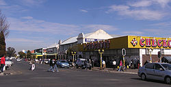
Standerton town center
|
||
Standerton is a city in the South African province of Mpumalanga . It is located in the municipality of Lekwa in the Gert Sibande district . Standerton is the seat of the municipality of Lekwa.
geography
In 2011 Standerton had 43,966 residents. The township of Sakhile is southwest of the city center , the township of Azalea to the west and the township of Meyerville to the north.
Standerton lies on the upper reaches of the Vaal . To the west of the city is the Standerskop hill. The Grootdraai Dam is a reservoir of the Vaal, which is about ten kilometers upstream east of the city and has a capacity of 364 million cubic meters.
history
Standerton was founded in 1878 on the site of the Grootverlangen farm , owned by Adriaan Hendrik Stander. The city and the hill in the west are named after him.
During the Second Boer War, the Boers besieged a British garrison in Standerton for three months . The South African Prime Minister Jan Smuts had his parliamentary seat here. The loss of the seat in 1948 sealed the takeover of power by the National Party and the introduction of the apartheid system in South Africa. In 1982 the Grootdraai Dam was completed.
In 2007, the mayor of Lekwa, a member of the African National Congress (ANC), had a memorial in the center of Standerton demolished that commemorated the Great Trek of the Boers . There were nationwide protests, in which Desmond Tutu intervened in the interests of reconciliation. The mayor had to bear the cost of the restoration after a court ruling. In 2009 there were serious riots in Sakhile, as a result of which the mayor resigned.
Economy and Transport
Standerton is an agricultural center. The main areas around the city are cattle farming and maize cultivation.
The city is on the R23, R39 and R50 highways and on the Johannesburg - Durban railway line . A branch line leads south to Vrede .
Nearby is located airfield Standerton Airport, which is not served in regular service. He has the ICAO code FASR.
Personalities
- Stoffel Botha (1929–1998), South African politician
- Marthinus Theunissen (* 1911, year of death unknown), athlete, born in Standerton
Web links
- Website for Standerton (English)
Individual evidence
- ↑ 2011 census , accessed November 16, 2013
- ↑ Excerpt from the book on Smuts' last years , accessed on September 3, 2011
- ↑ Article in Mail & Guardian , accessed on September 3, 2011

