Vaal
| Vaal | ||
|
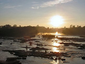
Sunrise over the Vaal near Parys |
||
| Data | ||
| location |
Free State , Mpumalanga |
|
| River system | Orange | |
| Drain over | Orange → Atlantic | |
| muzzle | in the Oranje coordinates: 29 ° 4 ′ 16 ″ S , 23 ° 38 ′ 10 ″ E 29 ° 4 ′ 16 ″ S , 23 ° 38 ′ 10 ″ E |
|
| Mouth height |
976 m
|
|
| length | 1251 km | |
| Discharge at the level de Hoop 65 (1159500) A Eo : 121,052 km² Location: 200 km above the mouth |
NNQ MNQ 1968–1986 MQ 1968–1986 Mq 1968–1986 MHQ 1968–1986 HHQ (max. Month Ø) |
0 l / s 2.8 m³ / s 33 m³ / s 0.3 l / (s km²) 125 m³ / s 608 m³ / s |
| Left tributaries | Wilge River | |
| Reservoirs flowed through | Vaal Reservoir , Bloemhof Reservoir , Vaalhartz Reservoir | |
|
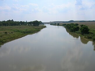
The Vaal at Villiers |
||
The Vaal is a river in South Africa . It got its name from the Boers in memory of the Waal , the most water-rich arm of the Rhine in the delta in the distant home of the Netherlands . The name is derived from the old high. falo , "pale, pale" and is related to the Latin word pallidus , "pale" or English. pale , "pale".
course
The Vaal rises in the northeast part of the country in the Mpumalanga province , near Swaziland . It flows 1,251 km in a south-westerly direction until it flows into the Orange River near Douglas in the center of the country . It flows through fertile land, in places it marks the border between the provinces of Mpumalanga and the Free State .
It is used agriculturally intensively for drinking water and irrigation . To the southeast of Vereeniging (about 60 km south of Johannesburg ) there is the Vaal reservoir , one of the largest in the country, which is used as a water reservoir by the state utility Rand Water .
Further downstream, the Vaal is dammed again. At Bloemhof is the Bloemhof Dam . This also forms the core of the Bloemhof Dam Nature Reserve .
Not far from the town of Warrenton, there is also the Vaalharts Weir , a weir used to extract water for agricultural land. In 1938 the Vaalharts irrigation system , which was politically supported by Cecil Rhodes in 1881, was put into operation and later expanded. It is the largest irrigation system in South Africa.
Hydrometry
The flow rate of the river was measured for 18 years (1968–1986) at the gauge de Hoop 65, about 200 km above the mouth in m³ / s. It should be noted that the river can dry up almost at any time of the year.

Historical meaning
Although the area of the Transvaal was already in 1848 for the first time occupied by the British, managed the Boer settlers during the great trek beyond the Vaal independent Boer republics to start. In 1852 the British recognized the Boer suzerainty beyond the Vaals in the so-called Sand River Convention of January 17, 1852. As a result, the independent Republic of the Transvaal came into being under the leadership of Voortrekker Andries Pretorius . A second independent republic ( Orange Free State ) was also established between Vaal and Oranje in 1854 . Both republics lasted until the Boer War , and in 1910 they were incorporated into the South African Union .
Others
The Vaal Triangle is a densely populated area with large industrial plants on both sides of the Vaal. It includes the cities of Vereeniging , Vanderbijlpark and Sasolburg as well as numerous townships .
See also
Web links
Individual evidence
- ↑ a b Homepage UNH / GRDC - The Great Fish River in Outspan. Retrieved July 2, 2020


