Stonehouse (Devon)
Stonehouse is a district of the south-west English city of Plymouth . From the end of the 18th century until after the Second World War , the town, which was independent until 1914, housed important facilities of Plymouth Dock , the later Naval Base Devonport .
Stonehouse in the Middle Ages and in the early modern period
Already in the Domesday Book of 1084 the place is referred to as Stanehvs . The name Stonehouse may have come from a villa from Roman times that was still preserved in the early Middle Ages, which is why the place got its name from the Anglo-Saxon settlers.
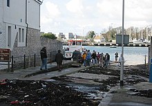
The village was on a peninsula on the east bank at the mouth of the Hamoaze , the confluence of the Tamar in the Plymouth Sound . To the north, the place was bounded by Stonehouse Creek , a tidal bay of the Hamoaze that cut deeply inland, and to the east of the place was Mill Bay , another bay of Plymouth Sound that reached far inland.
In the Middle Ages the place was called the East Stonehouse in contrast to the West Stonehouse on the western bank of the Hamoaze . The two villages were owned by the Valletort family , but Buckland Abbey also had rights in the villages. In 1204 a ferry service between East and West Stonehouse was first mentioned. Before 1275, Roger de Valletort gave the villages to his son-in-law Ralph de Stonehouse , an illegitimate son of Richard of Cornwall . West Stonehouse was completely destroyed in a French raid during the Hundred Years War in 1350, after which the settlement was called Cremyll . In 1368 Stephen Durnford inherited Stonehouse. In East Stonehouse at that time there was a fortified mansion called Stonehouse Manor with an adjoining chapel dedicated to St George. Another chapel, consecrated to St Lawrence, was first mentioned in 1472 at Devil's Point right at the mouth of the Hamoaze. In 1493 Stonehouse fell to Piers Edgcumbe when he married the widowed Joan Dynham , the heir to the Durnford estate. In 1525 the Edgcumbes acquired further lands north of Stonehouse Creek from the Wise family , after the dissolution of Buckland Abbey in 1535 they acquired their rights in Stonehouse. They built a bridge over the top of Stonehouse Creek and a tide mill . After Richard Edgcumbe had built Mount Edgcumbe House as a new mansion on the Rame Peninsula in place of the medieval Stonehouse Manor by 1553 , St George's Chapel of the old mansion became the village chapel of Stonehouse.
Growth in the 18th century
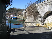
Stonehouse remained a small fishing village with about 700 inhabitants until the naval shipyard called Plymouth Dock was created north of the village from 1689 . To protect the access to the naval shipyard, a first gun battery was built near Stonehouse in 1701. The naval shipyard played an important role in the naval wars of the 18th century and became one of the most important bases of the Royal Navy from the end of the 18th century. From 1767 to 1769 a stone bridge designed by John Smeaton was built over Stonehouse Creek, allowing a direct land connection to Plymouth Dock. Stonehouse developed into a housing estate for workers in the shipyard and for members of the navy, and numerous facilities of the naval base such as the Royal Navy Hospital, founded in 1762, were built in the town itself . The naval hospital was on Stonehouse Creek, so the wounded and sick sailors could be brought directly to the hospital by boat. The hospital was not closed until March 31, 1995. On the opposite bank of Stonehouse Creek, the Stoke Military Hospital was built in the late 18th century . The Army Hospital started operating in 1797 and was closed after the end of World War II. The Devonport High School for Boys is located on the site today .
1,779 additional fasteners such as were Mount Wise Redoubt and Western King's Redoubt built in 1781 was the construction of the Royal Marines Barracks , the barracks of Marines started on the Mount Wise were Government House and other buildings built as residences and command posts for the military commander. The two old chapels of St George and St Lawrence were demolished in the 18th century, and in 1789 Stonehouse was given its own parish church, St George's Church, which, however, was demolished after the Second World War.
The city in the 19th century
In 1801 Stonehouse had a population of 3407. In 1824 the settlement located directly at the naval shipyard became independent as Devonport , the naval shipyard itself was renamed Devonport Dockyard in 1843 . Because of the increasing influx of Catholic workers from Ireland, a small Catholic church was built on Saint Mary Street in 1807 . Because of the continued growth of the Catholic community, it was replaced by the Plymouth Roman Catholic Cathedral , built from 1858 to 1880 .
From 1826 to 1835, the Royal William Victualling Yard was built at Devil's Point as the central supply depot for the naval base. The coastal fortifications Eastern and Western King's Redoubt were expanded from 1860 to form part of the inner defense line of the fort belt around Plymouth .
At the beginning of the 19th century, the Millbay was expanded as a port and landing stage. The port facility was called Millbay Docks or Great Western Docks . Today there is a ferry terminal, a marina and a residential area. The northwestern end of Stonehouse Creek, known as Deadlake , was drained towards the end of the 19th century and designed as Victoria Park on the occasion of Queen Victoria's diamond jubilee . In the 1960s, other parts of the bay were backfilled.
In 1881 Stonehouse was a town with about 15,000 inhabitants, which grew closely together with the neighboring towns of Plymouth and Devonport, but was still politically and administratively independent. On November 1, 1914, the three cities were finally merged to form the County Borough of Plymouth.
Web links
- Plymouth City Council: Local History
- The Encyclopaedia of Plymouth History: East Stonehouse ( September 28, 2013 memento in the Internet Archive )
- GENUKI: East Stonehouse
Individual evidence
- ^ Crispin Gill: Plymouth, a new history, Volume 1 David & Charles, Newton Abbot 1979, ISBN 3-8289-0730-X
- ^ Plymouth City Council: Cremyll Ferry. Retrieved July 2, 2013 .
- ^ RNH Stonehouse reunion website. Archived from the original on March 7, 2013 ; Retrieved June 30, 2013 .
- ↑ Empire in your Backyard: Stoke Military Hospital. Retrieved June 30, 2013 .
- ^ The Encyclopaedia of Plymouth History: Royal Marines Barracks, Stonehouse. Archived from the original on June 7, 2011 ; Retrieved June 30, 2013 .
- ^ The Encyclopaedia of Plymouth History: Church of Saint George of Lydda. Archived from the original on May 5, 2012 ; Retrieved June 28, 2013 .
- ^ Plymouth City Council: Victoria Park. (No longer available online.) Archived from the original on May 9, 2013 ; Retrieved June 30, 2013 . Info: The archive link was inserted automatically and has not yet been checked. Please check the original and archive link according to the instructions and then remove this notice.
Coordinates: 50 ° 22 '15 " N , 4 ° 9' 45" W.


