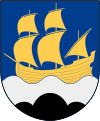
Strömstad
| Strömstad | ||||
|
||||
| State : | Sweden | |||
| Province (län): | Västra Götalands län | |||
| Historical Province (landskap): | Bohuslan | |||
| Municipality : | Strömstad | |||
| Coordinates : | 58 ° 56 ' N , 11 ° 10' E | |||
| SCB code : | 4584 | |||
| Status: | Crime scene | |||
| Residents : | 7176 (December 31, 2015) | |||
| Area : | 4.66 km² | |||
| Population density : | 1540 inhabitants / km² | |||
| Postal code : | 452 01 - 452 97 | |||
| List of perpetrators in Västra Götaland County | ||||
Strömstad is a place ( Tatort ) in the Swedish province of Västra Götalands län and the historical province of Bohuslän . It is the capital of the municipality of the same name .
history
Strömstad's emergence was linked to the efforts of the Swedish government to develop a counterweight to the Norwegian Halden , which concentrated trade in this area of the west coast. The place received the status of a minor city (köping) in 1667 and was designated as a city from 1672, which was achieved in 1676 by the transfer of city rights by Charles XI. has been confirmed. These rights became meaningless with the Swedish municipal reform of 1971. As a fortified border town, Strömstad was repeatedly involved in military disputes. For example, it functioned as the headquarters of Charles XII between 1716 and 1718 . in his campaigns against Norway . In 1717 Peter Tordenskiold attacked the place with a Danish fleet and was pushed back after two attempts at conquest.
Strömstad only had about 300 inhabitants around 1750, but several years followed with good herring fishing quotas , so that in 1805 the population was around 1,100. Shipping and fishing were the most important industries in the 19th century, but the population did not increase as significantly as in comparable places. In the following century, other economic sectors such as trading, canning and manufacturing developed more strongly. As early as the 1780s, Strömstad established itself as a resort and bathing resort, which grew stronger in the following period.
In the 1970s, Strömstad started a project to extract gas from the North Sea . The construction of the platform in the northern part of the village took five years and many of the recruited workers stayed in Strömstad afterwards. The platform was maneuvered into the sea through a specially dug deep water channel and today serves as a pumping station between the gas field and the mainland.
economy
Most of the income comes from tourism . Every summer more than 100,000 people visit the guest harbors and campsites in the town. About 85% of the visitors are Norwegians who use the short sea route, which is about 20 minutes to the border. The ordinary Norwegian tourist only stays for one day and uses the opportunity to buy food, alcohol and tobacco cheaper.
In the village, the local newspaper Strömstads Tidning is distributed three times a week as an offshoot of the regional newspaper Bohusläningen .
traffic
The public connections consist of a train line to Gothenburg , various bus lines to the region and the Norwegian border, and several ferries to Sandefjord in Norway and to offshore islands.
Strömstad is also the end of the Bohusleden hiking trail .
Attractions
- The large stone grave Massleberg is located on the roadside east of Strömstad
- The Massleberg burial ground is located directly to the right of the branch to the passage grave.
- The Massleberg 1 rock carving is about 80 m from the Massleberg burial ground at a farmstead before which you turn left.
- The rock carvings Massleberg 2 is about 850 m away from Massleberg 1 in the direction of Näsinge.
Sons and daughters of the place
- Emilie Flygare-Carlén (1807-1892), writer
- Bo Gustafsson (* 1954), walker
- Sven Andersson (* 1963), soccer player and goalkeeping coach
- Marius Dybwad Brandrud (* 1976), cameraman
Web links
swell
- ↑ a b Statistiska centralbyrån : Land area per Tatort, folkmängd and invånare per square kilometer. Vart femte år 1960 - 2015 (database query)


