Ray horn
| Ray horn | ||
|---|---|---|
|
Ray horn |
||
| height | 4190 m above sea level M. | |
| location | Canton of Valais , Switzerland | |
| Mountains | Valais Alps , Mischabel | |
| Dominance | 1.78 km → Rimpfischhorn | |
| Notch height | 401 m ↓ Adlerpass | |
| Coordinates | 635 863 / 95828 | |
|
|
||
| First ascent | August 15, 1854 by Christopher Smyth, Ulrich Lauener, Edmund J. Grenville and Franz-Josef Andenmatten | |
| Normal way | Northwest ridge from the Adlerpass | |
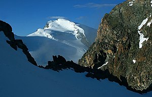
The Strahlhorn is a mountain near Saas Fee , only a few kilometers from the state border with Italy . Its peak height is 4190 m . It ranks 35th in the list of four-thousand-meter peaks in the Alps . The Strahlhorn is halfway between the Mischabel group and Monte Rosa . The ascent goes over the starting point Britanniahütte ( 3030 m ), accessible from Saas Fee ( 1803 m ).
The first ascent was made on August 15, 1854 by Christopher Smyth, Ulrich Lauener, Edmund J. Grenville and Franz-Josef Andenmatten.
There are also three lesser-known Valais peaks with the same name ( 3027 m , 3194 m , 3200 m ).
A little to the south, between the Findel Glacier and the Schwarzberg Glacier, is the Schwarzberg-Weisstor (3539 m above sea level).
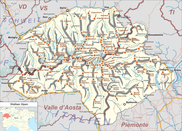
location
Location within the mountain range.
Location of the Strahlhorn in the Valais Alps. |
literature
- Helmut Dumler, Willi P. Burkhardt: Four-thousanders in the Alps. 12th, updated edition. Bergverlag Rother, Munich 2001, ISBN 3-7633-7427-2 .
Web links
- Strahlhorn at 4000m - the four-thousand-meter peaks of the Alps
- Strahlhorn on the ETHorama platform
Individual evidence
- ^ Summit of Switzerland | Summit | List. Retrieved February 17, 2018 .
- ↑ Schwarzberg-Weisstor on ETHorama


