Strenči
| Strenči sds | ||
|---|---|---|
 |
|
|
| Basic data | ||
| State : |
|
|
| Landscape: | Livonia ( Latvian : Vidzeme ) | |
| Administrative district : | Strenču novads | |
| Coordinates : | 57 ° 38 ′ N , 25 ° 44 ′ E | |
| Residents : | 1,228 | |
| Area : | 5.7 km² | |
| Population density : | 215 inhabitants per km² | |
| Height : | 45 m | |
| Website: | www.strenci.lv | |
| Post Code: | ||
| ISO code: | ||
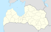
Strenči ( German Stackeln ) is a small town in northern Latvia and the center of the administrative unit of the same name (Lat. Strenču Novads). In 2016 it had 1228 inhabitants.
history
The place is shown for the first time on a map of the postal route from Riga to Dorpat (Estonian: Tartu ). In the 18th century, tree trunks from the surrounding estates were rafted down the Gauja . The opening of the Stackeln station on the Riga - Pleskau railway line in 1889 brought an economic boom. From 1903 on, the Livonian knighthood initiated the construction of the Livonian governorate psychiatric clinic , which was one of the most modern in Europe. The buildings and parks were designed by August Reinberg. After 1945 industrial companies were settled here, so that the population in 1979 was 2,666.
Events
- Every year a big rafting festival takes place in Strenči.
Twin cities
- There are city friendships with Lainate (Italy), Rosice u Brna (Czech Republic) and Sayda (Germany)
Strenču novads
Since 2009 there has been an administrative community with Seda and two rural communities. (See also: Administrative division of Latvia )
Individual evidence
literature
- Astrīda Iltnere (ed.): Latvijas Pagasti, Enciklopēdija. Preses Nams, Riga 2002, ISBN 9984-00-436-8 .

