Sõrve
| Sõrve | ||
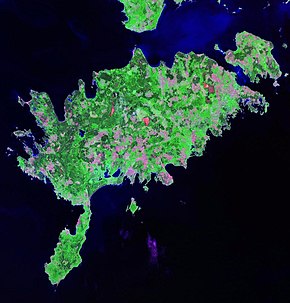
 Satellite image of Saaremaa (Sõrve in the south of the island) |
||
| Geographical location | ||
|
|
||
| Coordinates | 58 ° 11 ′ N , 22 ° 15 ′ E | |
| Waters 1 | Baltic Sea | |
| Waters 2 | Riga Bay | |
| length | 32 km | |
| width | 10 km | |
 Lighthouse at Sääre |
||
Sõrve ( German Sworbe ) is a peninsula on the southern tip of the Estonian island Saaremaa (German: Ösel ).
description
The Sõrve peninsula forms the elongated, narrow end of the Saaremaa island. It is 32 km long and 10 km wide. The peninsula was first mentioned in a document in 1234 under the name Sworve . Sõrve includes the two former rural communities Salme (in the north) and Torgu (in the south). The landscape is interesting for nature lovers, hiking tourists and bathers. The beaches offer ideal opportunities for windsurfers and paragliders . The 11 km long sand dunes of Järve are under nature protection.
Between the southern tip of the peninsula and the Latvian mainland is the Irben Strait , the most important shipping route from the Riga Bay to the Baltic Sea .
Military history
During the Second World War , the Sõrve peninsula was the scene of bitter battles between the German Wehrmacht and the Soviet Red Army . In 1940 numerous Soviet fortifications and bunkers were built, but in 1941 they were largely destroyed again during the German attack on the Soviet Union . The remains can be seen to this day. Both in 1941 with the German occupation of Estonia and in 1944/45 when the Wehrmacht withdrew from the Baltic States , thousands of soldiers were killed in several skirmishes on Sõrve.
The battle of Tehumardi in particular went down as one of the bloodiest in Baltic history. On the night of October 8, 1944, around 750 German and Soviet soldiers were killed, many in close combat in complete darkness. The German war dead are buried in the German military cemetery in Kudjape (German: Kudjapäh ). A 21 m high war memorial from 1966 on the beach near Tehumardi and a small German memorial stone from 2004 commemorate the battles.
Until the 1990s, Sõrve served as a site for missile launching bases for the Soviet air defense. To this day, the barracks buildings, solidly concreted hangars, air raid shelters and launch ramps for rockets can be seen on an area of around 7 hectares. The area is not considered a museum, but has been well preserved since the Red Army withdrew in 1992.
lighthouse
At the southern tip of the peninsula (Cape Zerel) near the village of Sääre there is a reinforced concrete lighthouse , the Sõrve tuletorn, built in 1960 . He is 52 meters high.
The Swedish governor general of Livonia , Gabriel Bengtsson Oxenstierna (1586–1656), had a beacon built there for the first time in 1646 . In 1770 a stone lighthouse was built on the same site, in 1945 a wooden structure.
Web links
- Full description (English)
- Sõrve lighthouse
Remarks
- ↑ other sources speak of up to 3000 deaths.
