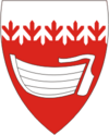
Salme (rural community)
| Salme | |||
|
|||
| State : |
|
||
| Circle : |
|
||
| Coordinates : | 58 ° 10 ′ N , 22 ° 16 ′ E | ||
| Area : | 115.07 km² | ||
| Residents : | 1,249 (2009) | ||
| Population density : | 11 inhabitants per km² | ||
| Time zone : | EET (UTC + 2) | ||
| Community type: | former rural community | ||

|
|||
Salme is a former rural community in the Estonian Saare district with an area of 115.07 km². It had 1249 inhabitants (as of January 1, 2009). In 2017 all municipalities on Saaremaa merged to form the new rural municipality Saaremaa .
Salme was in the southwest of the island of Saaremaa . In addition to the eponymous main town Salme ( Salme alevik ) the rural municipality included the villages Anseküla , Easte , Hindu , Imara , Jarve , Kaimri , Kaugatoma , Lahetaguse , Lassi , Lomala , Lou , Länga , Läätsa , Metsalõuka , Mõisaküla , Möldri , Rahuste , Suurna , Tehumardi , Tiirimetsa , Toomalõuka , Üüdibe , Ula and Vintri . The municipality comprised the northern part of the Sõrve peninsula (German Sworbe ).
The landscape on the Sõrve peninsula (total length 32 km, maximum width 10 km) is interesting for nature lovers and hiking tourists. In 1944 devastating battles between the German Wehrmacht and the Red Army took place on Sõrve . Some preserved military buildings as well as a Soviet memorial from 1967 on the beach near Tehumardi, which is dedicated to the night battle of Tehumardi on the late evening of October 8, 1944, remind of this today .
The Viking ship graves of Salme were found near Salme from 2008 .
swell
Web links
- Map of the municipality of Salme


