Spencer Dam
| Spencer Dam | ||
|---|---|---|
| The power plant 2010 | ||
| location | ||
|
|
||
| Coordinates | 42 ° 48 '17 " N , 98 ° 39' 35" W | |
| country |
|
|
| Waters | Niobrara River | |
| Height upstream | 461 m | |
| power plant | ||
| owner | Nebraska Public Power District | |
| Start of operation | 1927 | |
| technology | ||
| Bottleneck performance | 3 megawatts | |
| Turbines | 2 Kaplan turbines | |
| Others | ||
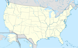
The dam Spencer (English Spencer Dam ) was a dam with running power plant in Nebraska , USA . It was destroyed in a storm in 2019.
The power plant went into operation on July 1, 1927 and is located on the Niobrara River , which is the border between Holt County and Boyd County .
The barrier structure consisted of four segment weirs , five dam beams , a gate , a flood relief and an earth embankment dam about 1127 meters long . In the power house were two Westinghouse - generators housed (2000 kW and 1300 kW). The area of the reservoir was around 4.85 km² when it was commissioned. To remove the deposited sediments from the reservoir, several weirs were opened every six months. These reservoir flushes , which lasted about a week , had a negative impact on the fish population in the river. In 2014, the weirs were only opened in autumn for a scientific study on sedimentation.
On the evening of March 13, 2019, an intense storm broke the dam and the engine house was damaged by drift ice . A bridge on Highway 281 over the Niobrara, 600 meters downstream, was destroyed by the flood, and some residents had to be evacuated from the flooded area.
supporting documents
- ^ David Budka: Spencer Dam Summer 2009. In: ipernity.com . 2009, accessed on March 16, 2019 .
- ↑ Michael P. Gutzmer, Justin W. King, David P. Overhue: Environmental Impacts in the Vicinity of Spencer Hydropower Dam During Sluicing Activities in the Niobrara River, Nebraska . In: Nebraska Academy of Sciences (Ed.): Transactions of the Nebraska Academy of Sciences and Affiliated Societies . No. 81 , 1996, pp. 1 (English, available online at unl.edu ).
- ↑ Nathaniel J. Schaepe, Anthony M. Coleman, Ronald B. Zelt: Documentation of particle-size analyzer time series, and discrete suspended-sediment and bed-sediment sample data collection, Niobrara River near Spencer, Nebraska, October 2014 (= USGS [Ed.]: US Geological Survey Data Series . No. 1079 ). 2018, p. 1 , doi : 10.3133 / ds1079 .
- ^ Elizabeth Ingram: Nebraska dam with 3-MW hydro powerhouse damaged during flooding. In: hydroworld.com. March 14, 2019, accessed on March 17, 2019 .
- ^ Nicole Rojas: Nebraska, Midwest Flooding Maps, Update: Nuclear Plant Braces for Rising Waters, Prepares for Shutdown. In: newsweek.com . March 15, 2019, accessed on March 17, 2019 .
- ↑ Pam Wright, Ron Brackett: Deadly, Historic Flooding Swamps Plains, Midwest; Nebraska City Cut Off, Bridges Washed Out, Levees Breached. In: weather.com . March 17, 2019, accessed on March 17, 2019 .

