Tama-ku (Kawasaki)
|
Tama-ku Municipality of Kawasaki |
|
|---|---|
| Coordinates | 35 ° 37 '10 " N , 139 ° 33' 44" E |
| surface | 20.49 km² |
| Residents | 219,868 (Oct 1, 2019) |
| Population density | 10,731 inhabitants / km² |
| Start-up | Apr 1, 1972 |
| Community key | 14135-6 |
Administration address |
1775-1, Noborito, Tama-ku, Kawasaki 214-8570 |
| Website | http://www.city.kawasaki.jp/tama/index.html |
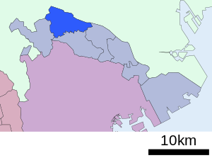
Tama-ku ( Japanese 多 摩 区 ) is one of seven boroughs ( ku ) in the Japanese city of Kawasaki .
geography
The district, established on April 1, 1972, is located in the west of Kawasaki and has three neighboring districts: Asao-ku - which was spun off from Tama-ku in 1982 - in the southwest, Takatsu-ku in the east and Miyamae-ku in the southeast. In the west, the Tama-ku borders the city of Inagi . To the north, across the Tama River, are the cities of Chofu , Komae and the Tokyo district of Setagaya . The Tama district has a total of 219,868 inhabitants and its area is 20.49 km². It is known as the growing area of the Japanese Nashi pear .
Education and culture
- Senshu University
- Meiji University (Faculty of Technology)
- Nihon Minka-en , open-air museum
- Taro Okamoto Museum of Art
- Fujiko F Fujio Museum
- Yomiuriland , amusement park
traffic
- JR Nambu Line : from Shukugawara, Noborito, Nakanoshima and Inadazutsumi to Kawasaki and Tachikawa
- Odakyū Odawara Line : from Noborito, Mukogaoka-Yuen, Ikuta and Yomiuriland-Mae to Shinjuku and Odawara
- Keiō Sagamihara Line: from Keio-Inadazutsumi to Shinjuku and Hashimoto
Web links
Commons : Tama-ku, Kawasaki - collection of images, videos and audio files

