Tannhorn
| Tannhorn | ||
|---|---|---|
| height | 2221 m above sea level M. | |
| location | Canton of Bern , Canton of Lucerne , Switzerland | |
| Mountains | Emmental Alps | |
| Dominance | 3.77 km → Schongütsch | |
| Notch height | 170 m ↓ Chruterepass | |
| Coordinates | 641 684 / 180548 | |
|
|
||
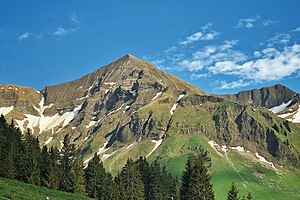
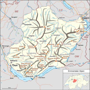
The Tannhorn ( 2221 m above sea level ) lies on the border of the municipalities of Brienz , Oberried am Brienzersee (both in the canton of Bern ) and Flühli ( canton of Lucerne ) in the Bernese Oberland and is the second highest mountain of the Brienzergrat .
Hiking routes
The mountain tour on the Tannhorn with its steeply sloping flanks is only recommended for experienced mountain hikers. The locals mostly choose the ascent from the Brienzer Rothorn over the ridge (only for those with a head for heights). Among alpine hikers this is called the Brienzergrat and offers a beautiful ridge crossing on exposed paths ( T5 ). The descent takes place over the steep southern slope to Rotschalp and from there on a little road back to the Planalp .
From Kemmeriboden there is also a path over the Ällgäulücke to the Tannhorn.

