Tarapaya
| Tarapaya | ||
|---|---|---|
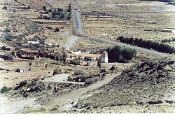
 View of Tarapaya and the Catechist Center |
||
| Basic data | ||
| Residents (state) | 96 pop. (2012 census) | |
| height | 3336 m | |
| Post Code | 05-0101-0200-4001 | |
| Telephone code | (+591) | |
| Coordinates | 19 ° 29 ′ S , 65 ° 48 ′ W | |
|
|
||
| politics | ||
| Department | Potosí | |
| province | Tomás Frías Province | |
| climate | ||
 Climate diagram Potosí |
||
Tarapaya is a town in the Potosí department in the South American Andean state of Bolivia .
Location in the vicinity
Tarapaya is a central place in the canton of Tarapaya in the district ( Bolivian : Municipio ) Potosí in the province of Tomás Frías . The village is located at an altitude of 3336 m on the banks of the Río Tarapaya , which belongs to the river system of the Río Pilcomayo . Tarapaya is the seat of the Diocesan Catechist Center of the Catholic Church in Potosí.
geography
Tarapaya is located on the eastern edge of the Bolivian Altiplano in front of the Andes mountain range of the Cordillera Central . The climate is the typical daytime climate of the cold tropics , in which the mean temperature differences between day and night are more pronounced than those between the seasons.
The annual average temperature of the region is around 11 ° C (see Potosí climate diagram), the monthly values fluctuate only slightly between 8 ° C in June / July and 13 ° C from November to March. The annual precipitation is around 350 mm, the monthly precipitation is between under 10 mm in the months May to September and almost 80 mm in January and February.
Transport network
Tarapaya is located at a distance of 25 kilometers by road northwest of Potosí , the capital of the department of the same name.
From Potosí, the Ruta 1 road leads north via Tarapaya to Poopó , Oruro and El Alto , the neighboring town of La Paz , and to Desaguadero on Lake Titicaca . In Tarapaya, a six-kilometer-long dirt road branches off to the northeast, which leads over the Tarapaya mine to the Hacienda Mondragón .
population
The population of the place has increased several times over in the past decade:
| year | Residents | source |
|---|---|---|
| 1992 | no data | census |
| 2001 | 11 | census |
| 2012 | 96 | census |
Due to the historically grown population distribution, the region has a significant proportion of Quechua population, in the Municipio Potosí 71.2 percent of the population speak the Quechua language.
El Ojo del Inca
Tarapaya is known for its hot springs, which - in addition to numerous bathing facilities - also feed a volcanic lagoon called "El Ojo del Inca" (the Inca eye). According to pre-Spanish sources, the Inca from distant Cusco are said to have undertaken the arduous journey to the deep south of the empire in order to benefit from the healing properties of the hot water in Tarapaya.
Bathing in the lagoon is not without danger, although it is unclear whether fatal accidents there were caused by carelessness of the swimmers or by sudden whirlpools reported by the locals.
Individual evidence
- ^ INE - Instituto Nacional de Estadística Bolivia 1992
- ^ INE - Instituto Nacional de Estadística Bolivia 2001
- ↑ INE - Instituto Nacional de Estadística Bolivia 2012 ( Memento of the original from July 22, 2011 in the Internet Archive ) Info: The archive link has been inserted automatically and has not yet been checked. Please check the original and archive link according to the instructions and then remove this notice.
- ↑ INE social data Potosí 2001 (PDF; 5.5 MB)
- ↑ Ojo del Inca: la misteriosa laguna de misteriosas desapariciones In: Guía del trotamundos. February 26, 2007 ( Spanish )
Web links
- Relief map of the Sucre region 1: 250,000 (PDF; 11.79 MB)
- Municipio Potosí - detailed map and population data (PDF; 722 kB) ( Spanish )
- Municipio Potosí - General Maps No. 50101
- Department Potosí - Social data of the provinces and municipalities (PDF; 5.23 MB) ( Spanish )

