Yablunitsky Pass
| Yablunitsky Pass | |||
|---|---|---|---|
|
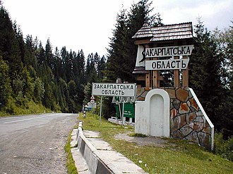
View of the top of the pass |
|||
| Compass direction | Northeast | southwest | |
| Pass height | 931 m | ||
| region | Transcarpathia , Ukraine | ||
| Watershed | Pruth | Tisza | |
| Valley locations | Tatariv | Yasinja | |
| expansion | Pass road | ||
| Mountains | Carpathians | ||
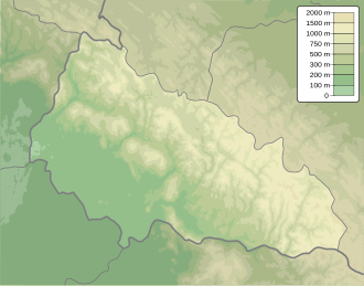
| Map (Zakarpattia) | |||
|
|
|||
| Coordinates | 48 ° 18 '7 " N , 24 ° 26' 45" E | ||
The Yablonitsky Pass (older also Tatar Pass ; Ukrainian перевал Яблуницький [Jablunyzkyj Perevalist], Hungarian Tatár-Hago ) is an important mountain pass in the Ukraine during the Carpathian main ridge between the Zakarpattia Oblast and the Ivano-Frankivsk Oblast .
The 931 m high pass separates the headwaters of the Prut in the north from the headwaters of the Tisza in the south. The national trunk road N 09 runs over it from Jassinja in the southwest via Jablunyzja to Yaremche in the northeast.
The Sighetu Marmației – Ivano-Frankivsk railway crosses the main Carpathian ridge six kilometers southeast.
Web links
Commons : Yablunyzkyj-Pass - collection of pictures, videos and audio files

