Teúl de González Ortega
| Teúl de González Ortega | ||
|---|---|---|
|
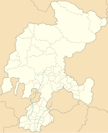
Coordinates: 21 ° 28 ′ N , 103 ° 28 ′ W Teúl de González Ortega on the map of Zacatecas
|
||
| Basic data | ||
| Country | Mexico | |
| State | Zacatecas | |
| Municipio | Teúl de González Ortega | |
| City foundation | 1536 | |
| Residents | 3374 (2010) | |
| Detailed data | ||
| surface | 1.96 km 2 | |
| Population density | 1,721 inhabitants / km 2 | |
| height | 1940 m | |
| Website | ||
| Teúl - Church of San Juan Bautista | ||
| Teúl - Portales Trinidad de Cervantes | ||
Teúl de González Ortega is a small town with only about 4,000 inhabitants and the capital of a municipality (municipio) with about 5,500 inhabitants in the extreme south of the Mexican state of Zacatecas near the border with the state of Jalisco . The city is the administrative seat of the municipality of the same name . Because of its historic city center, it is one of the Pueblos Mágicos .
location
Jerez de García Salinas is located in the central highlands of Mexico at an altitude of approx. 1940 m . Mexico City is approx. 675 km (driving distance) in a southeast direction; Zacatecas , the capital of the state, is located approximately 215 km to the northeast. The climate is temperate; Rain (approx. 810 mm / year) falls almost exclusively in the summer half-year.
Population development
| year | 2000 | 2005 | 2010 |
| Residents | 3,145 | 3,174 | 3,374 |
Only a small part of the community's mostly Indian-born residents speak the regional Nahuatl dialect; Colloquial language is mostly Spanish.
Population and economy
Corn, beans, vegetables, agaves and opuntia are grown in the fields in the area; There are many small craft workshops and shops in the city, and smaller industrial companies have also set up shop in the outskirts.
history
Since the 7th century the area was probably inhabited by the Caxcán people. In the centuries before the Spanish conquest (conquista) , the region was under the influence of the Chichimecs and their subgroups such as the Zacatecs ; However, these did not leave any stone buildings. In 1536, on behalf of Nuño Beltrán de Guzmán , the region was explored and conquered by Pedro Almíndez Chirino , a conquistador in the retinue of Hernán Cortés . Allegedly the place was founded during this time; the nickname González Ortega she received in the 19th century after a colleague of Benito Juarez .
Attractions
- The most important sacred building in the city is the Church of San Juan Bautista with its little decorative single tower facade . The baroque bell tower (campanar) rests like a foreign body on the substructure. The nave is vaulted; the yoke in front of the apse is spanned by a dome , as is customary in Mexico .
- Behind the row of arcades of the Portales Trinidad de Cervantes , built in the 19th century , are shops and cafes.
- Surroundings
- Approx. The pre-Hispanic ruins of El Teúl are 1 km south of the village .
Web links
- Teúl, sights - photos and information (Spanish)


