Mexico City
| Mexico City | |
|---|---|
|
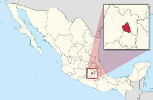
Location of Mexico City in Mexico
|
|
| Basic data | |
| Country | Mexico |
| city | Mexico City |
| City foundation | August 13, 1521 |
| resident | 9,209,944 (2020) |
| - in the metropolitan area | 21,340,000 |
| City insignia | |
| Detailed data | |
| surface | 1,495 km² (city) 7,866 km² (metropolitan area) |
| Population density | 6,160 (city) 2,713 (metropolitan area) Ew./km 2 |
| height | 2310 m |
| City structure | 16 boroughs (alcaldías) |
| Postal code | 01000 to 16999 |
| prefix | (+52) 55 |
| Time zone | UTC −6 |
| City Presidency | Claudia Sheinbaum Pardo |
| Website | |
| Cityscapes | |
Mexico City ( Spanish Ciudad de México [ sjuˈða (ð) ðe ˈmexiko ], short: CDMX; until 2016 México DF ) is the capital of Mexico . It does not belong to any member state , but forms its own regional authority, in which 9.2 million people (2020) live. The metropolitan area Zona Metropolitana del Valle de México (ZMVM) , to which Mexico City, the eastern part of the state of México and a municipality from the state of Hidalgo belong, is one of the largest in the world with over 21 million inhabitants .
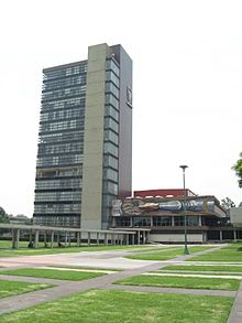
The city is the political, economic, social and cultural center as well as the largest transport hub in the country. It is the seat of the Archdiocese of Mexico and numerous universities and technical schools. The UNESCO has its historic center with the remains of the Aztec -hauptstadt Tenochtitlan and water gardens in the district of Xochimilco in 1987 and the central university campus of the National Autonomous University of Mexico in 2007 to World Heritage declared.
The name of the city
The Mexicans usually call their capital el DF ("el De-Efe", abbreviation of Distrito Federal , " federal district "). So when people talk about Mexico , they usually mean the state. La Ciudad de México is mentioned less often and mostly in an official context . The country of Mexico, in turn, got its name from the current capital. Inhabitants of the city are referred to as capitalinos ("capital city"), defeños (derived from DF ) or chilangos , the word mexicano again mainly refers to the republic. The name México originally goes back to the Aztecs , who called themselves "Mexica". The English-language name Mexico City is sometimes used in German-speaking countries for "Mexico City" .
On January 29, 2016, the Spanish name of the city was officially changed to Ciudad de México (= Mexico City), abbreviated to "CDMX".
geography
Geographical location
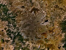
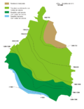
Mexico City is located at the southern end of the 60 kilometer long and 100 kilometer wide Mexico Valley at an average altitude of 2,310 meters above sea level and is surrounded on three sides by mountains - including the famous twin volcanoes Popocatépetl and Iztaccíhuatl and the Sierra Nevada . The combination of this location and a metropolis with its emissions, especially from motorized traffic, often creates smog .
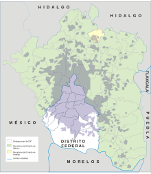
This basin has been the center of the country for centuries, long before there could be any talk of a Mexican nation. The city has an area of 1,499.03 square kilometers. It borders the state of México to the north, east and west and the state of Morelos to the south .
For the metropolitan area of Mexico City, there are three different definitions:
- "Megalópolis del Centro de México" (MCM)
- In addition to Mexico City, this includes a further 249 municipalities in the vicinity of the capital, including the Zonas Metropolitanas of Cuernavaca-Cuautla, Pachuca, Puebla-Tlaxcala and Toluca. The municipalities in the MCM are distributed among the states as follows: México (99), Tlaxcala (52), Puebla (36), Hidalgo (31) and Morelos (31). The area covers an area of 9,763 square kilometers.
- "Zona Metropolitana de la Ciudad de México" (ZMCM)
- It includes the 16 city districts (Delegaciones) of the capital, 40 municipalities (Municipios) of the state of México and one municipality of the state of Hidalgo . It has a floor area of 4,986 square kilometers.
- " Zona Metropolitana del Valle de México " (ZMVM)
- In addition to Mexico City, this region includes 58 municipalities in the state of México and one municipality in the state of Hidalgo. It has an area of 7,815 square kilometers.
Hydrology
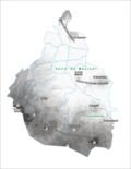
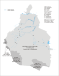
The pre-Columbian ecosystem as found by the Aztecs when they advanced into central Mexico can be reconstructed quite precisely on the basis of excavations : They point to a landscape that was characterized by numerous lakes with swamps in between. Numerous streams and rivers flowed from the surrounding mountains, which were mainly covered with pine and oak forests, the largest of which flowed into the northern Zumpango Lake. While the smaller northern and southern lakes contained fresh water, the water of the deeper Texcoco Lake was very salty because of the nitric subsoil, the lack of runoff and the high level of evaporation.
When the Aztecs arrived in the Valley of Mexico, they found a highly developed hydroponics : corn, beans, tomatoes, squash and other foods were grown on irrigated land and floating gardens called chinampas ; Dikes, river diversions and drinking water pipes were also common in the Valle de México. In the 15th century, the Aztecs began to build their own dikes that connected the island to the mainland. They also served as aqueducts . A 16-kilometer-long dike, interrupted only by a few locks, was built east of Tenochtitlán through Lake Texcoco to protect the city from flooding.
In the first years of their rule, the Spaniards misunderstood the importance of the facilities and let them fall into disrepair. However, when the floods became more and more devastating from 1540, it was decided to reconstruct it. The deforestation of the slopes in connection with the cattle grazing in the woods had already severely eroded the steep slopes . The earth could no longer absorb the precipitation and was washed into Lake Texcoco (which at the time of the conquest was 14 meters deeper than it is today).
The old systems were no longer able to cope with the masses of water that had to be managed. For example, around 50,000 people died during the great floods between 1629 and 1633. In 1789 a canal through the mountain range was finally completed, with which the valley was drained to the outside. The erosion caused the springs that previously supplied the city with drinking water to dry up. The drinking water supply came from deep wells (1886 already over 1000). But since the sewage (untreated) was brought out of the valley, the groundwater level continued to sink .
The many lakes that once filled the valley fell dry. The water was withdrawn from the fine-grained, bentonite clays in the city's subsoil, so that they shrank. As a result, some areas of the city center sank by up to 8.5 meters between 1891 and 1970, and by up to 9.10 meters by 1998. In the period from October 2014 to May 2015, sink rates of typically up to 12.70 to 22. 86 cm / year measured in large areas of the city. In addition to the effects on the structure of the building, this also affects the sewer system : some of the systems have been torn apart, the slopes have reversed. Wastewater sometimes penetrates the drinking water pipes, which are also leaky, and makes them infectious . A new sewage tunnel, the Túnel Emisor Oriente , is under construction.
The head of Mexico's water supply , Ramón Aguirre Díaz, expects in 2017 that the water sources below the city will dry up in 40–50 years. The large Cutzamala system supplies several districts and municipalities in the state of Mexico with around 485 million cubic meters of drinking water per year. 20% of the urban population are only supplied unreliably and with sick water from the tap; Deliveries by tanker are expensive. 41.4% of the drinking water seeps away from leaking pipes. Global warming and a possible decrease in precipitation have a negative impact on security of supply. A sustainable conversion of the water supply (and disposal (?)) Would cost 200 billion pesos (approx. 9.5 billion euros), which is why the current government tended to privatize the water supply in 2017.
|
|
|
| topography | Hydrology | climate |
geology
Mexico City is located in an earthquake-prone region that is regularly hit by low to medium-intensity tremors. On September 19, 1985, a devastating earthquake measuring 8.0 on the moment magnitude scale with an epicenter in the state of Michoacán 350 kilometers away officially killed 10,000 people and around 250,000 became homeless. According to the rescue teams, up to 45,000 people died. A total of 2,800 buildings were damaged, 880 of them collapsed. The large number of victims was due, among other things, to the poor construction of many buildings, and the mostly soft subsoil of the capital amplified the shock waves . On September 19, 2017, a 7.1 magnitude quake wreaked havoc in the city.
In the center of an originally drainless basin lies the state capital, which today is connected to the Pánuco river system by a drainage canal . The valley is located in the southern part of the Mexican highlands known as Mesa Central . It is also very different orographically from the north. The character of the mountains predominates in the landscape. Forest-covered volcanic cones, huge craters of extinct volcanoes, sudden rockfalls that erosion has torn into the mountainside, alternate with fertile plateaus and valleys filled with volcanic debris.
There is the center of agriculture, the most important crops of which are beans, maize, wheat, vegetables and fruit due to their location in the Tierra Templada . The entire Mexican highlands are rich in lead, copper, tin, cinnabar, sulfur, gold and silver. The Aztecs used the precious metals to create magnificent jewelry and other objects of art. Bituminous coal, which in the continuation of Lignite from Texas occurs and Coahuila, covers the entire coal requirements of Mexico.
City structure
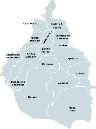
Mexico City is divided into 16 city districts (delegaciones) , which in turn are further subdivided into city districts ( colonias ) and, at the lowest regional level, into barrios . The following table lists the districts, their population and population density according to the 2010 census .
Source: Instituto Nacional de Estadística Geografía e Informática. |
climate
The city is located in the tropics , more precisely in the cold tropics because of its high altitude. During the day in winter it is quite warm with 20 to 25 ° C, but at night it is significantly cooler, sometimes even frosty. In summer between April and June it gets very warm around noon with 25 to 30 ° C. October to May is the dry season and June to September is the rainy season, with heavy showers mostly in the afternoon and evening, but sometimes well into the morning. Then it's very humid.
The average annual temperature is 15.9 ° C and the average annual rainfall is 816.2 millimeters. The warmest month is May with an average of 18.9 ° C, the coldest months are December and January with an average of 12.5 ° C and 12.2 ° C.
Most of the precipitation falls in July with an average of 175.1 millimeters, the least in February with an average of 4.3 millimeters.
| Mexico City | ||||||||||||||||||||||||||||||||||||||||||||||||
|---|---|---|---|---|---|---|---|---|---|---|---|---|---|---|---|---|---|---|---|---|---|---|---|---|---|---|---|---|---|---|---|---|---|---|---|---|---|---|---|---|---|---|---|---|---|---|---|---|
| Climate diagram | ||||||||||||||||||||||||||||||||||||||||||||||||
| ||||||||||||||||||||||||||||||||||||||||||||||||
|
Average monthly temperatures and rainfall for Mexico City
Source:
|
|||||||||||||||||||||||||||||||||||||||||||||||||||||||||||||||||||||||||||||||||||||||||||||||||||||||||||||||||||||||||||||||||||||||||||||||||||||||||||||||||||||
environmental issues
The largest Mexican metropolis has to struggle with numerous environmental problems . These include high levels of air pollution, problems with the drinking water supply , inadequate waste disposal structures, deficits in local public transport and excessive traffic.
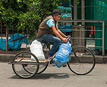
Around 1.3 million people in Mexico City live (as of 2020) without direct access to drinking water. The water for Mexico City comes from other parts of the country or from underground reservoirs that have often dried up - the city has to drill deeper and deeper to reach groundwater. The pipes are cracked so that a lot seeps away; Sewage and industrial waste pollute the water. Nevertheless, residents who have access to drinking water consume a lot. The average per capita consumption there in 2018 was 314 liters per day.
According to the World Health Organization (WHO), the air quality of Mexico City has long been considered one of the worst in the world. For the parameters sulfur dioxide , fine dust , carbon monoxide and ozone , the recommended limit values of the WHO are clearly exceeded. The main reason for this is the more than four million passenger cars, 120,000 taxis, 28,000 buses and tens of thousands of trucks that circulate in the metropolitan region every day . Due to rapid urbanization, increased traffic and industrial concentration in the metropolitan area , excessive emissions and smog pose a serious threat to public health. The International Council on Clean Transportation (ICCT) estimated for 2007 that every year in Greater Mexico City around 4,000 people die from air pollution.
The city is located in the Valley of Mexico , an outflow-free plateau at an altitude of about 2000 meters, which is enclosed by mountains from the west, south and east. During inversion weather conditions , respiratory diseases in particular increase among the population of the capital. Warm air masses a few hundred meters above sea level and the lack of wind above the ground then prevent air circulation.
The government has been stepping up the fight against pollution for years. Driving bans for private vehicles with excessively high emissions were issued after only vehicles with even or odd numbers were allowed to drive on a daily basis. The use of low-lead and low-sulfur fuels was encouraged, and industry and private households were obliged to install catalytic converters . Many old industrial plants also had to close and the existing plants had to implement stricter environmental protection measures.
story
Aztec rule
According to Aztec records, the founding of the city under the name Tenochtitlan goes back to the year 1345, when a crowd of nomads from the north settled on an island in Lake Texcoco . The Aztecs (actually Méxica ) settled there after long years of wandering, during which they had fed on what had been freely or involuntarily obtained in permanent settlements.
According to tradition, they had received an order from their god Huitzilopochtli to found a town on the spot where they found an eagle eating a snake while sitting on a cactus. They found him - on an island in the middle of the lake. Eagle, snake and cactus form the central motif of today's Mexican flag.
However, the actual history of the settlement was probably different. For Méxica , who were driven from place to place , the small islands in the middle of the shallow lake were primarily a good strategic retreat. The spot was well chosen, for the lake provided them with fish, and the soil of the chinampas , the floating gardens that they had established, was exceedingly fertile.
The little land available would not have been enough to feed the big city, so large rafts were built and loaded with earth. Flowers and vegetables were grown on these usable areas in the lake. Dams were built between the islands and the mainland to regulate the water level of the lake and were built in such a way that the islands connected by bridges and canals could be flooded in an emergency. Drawbridges protected against attacks (and prevented escape).
The city on the island soon extended over more than 13 square kilometers. The Aztecs began to expand their sphere of influence. First they subjugated the high valley with armed force, intrigue and with the help of changing allies. A hundred years before the Conquista , the Aztecs ruled over a vast empire in which there was a lively exchange of goods and to which even some of the most remote areas of the country had to pay tribute.
The Conquista
In 1519, Hernán Cortés landed on the east coast with a small Spanish army of just a few hundred men and set out on his long march to Tenochtitlán. Several circumstances benefited him: possession of firearms, support from tribes at war with or oppressed by the Aztecs, and the reluctance of their ruler Moctezuma II to offer open resistance.
The Aztec ruler, who had suffered heavy defeats in the battle against the Purépecha in the west, was a brooding, deeply religious man who believed he recognized the white-headed, bearded god Quetzalcoatl in Cortés , who had returned to fulfill an ancient prophecy . So he had the Spaniards come to the city on November 8, 1519; scary, but with great welcoming ceremonies. Cortés and his companions were overwhelmed by the sight of the Aztec capital. The town on the lake with its 300,000 inhabitants and its magnificent buildings could easily compete with any major European city of that time. Dams regulated the waterways between the beautiful stone houses laid out according to a strict pattern.
After a general Moctezumas had brought several Spaniards into his power and sent their cut heads around everywhere, Cortés took Moctezuma prisoner on November 17, 1519 in his own palace and had him detained in the Spanish camp. But if the Spanish reports are to be believed, he was ultimately stoned to death by his own people when he tried to prevent a riot over the uninvited guests. As a result, the Spaniards were driven out of the city with great losses. Cortés and some of his men escaped and found refuge with their closest allies among the local people in Tlaxcala . There they built new ships and were able to regroup their troops. With the support of their Indian partners, they kept Tenochtitlán under siege for three months until they finally broke the desperate, suicidal resistance of the Aztecs on August 13, 1521 and were able to take the city.
The memory of this defeat hurts the Mexican historical consciousness to this day. They don't care much for Cortés either, but the indigenous people who supported him at the time, especially Moctezuma and Malinche , Cortés' interpreter, are considered non-persons. There is not a single Moctezuma monument to be found in the whole country, whereas the memory of his successor Cuauhtémoc , the leader of the resistance, is held in high esteem. How bitter the struggle for Tenochtitlán must have been can be seen from the fact that hardly anything is left of the flourishing Aztec metropolis: “Everything I saw then,” wrote Bernal Díaz del Castillo , “was trodden down and destroyed; no stone was left unturned. "
Spanish and Post Colonial Period
The victorious Spaniards systematically destroyed every visible memory of the ancient culture and built their churches where the great temples stood. A palace for Cortés was built on the foundations of the ruler's palace, and stones from the Aztec city were used for the new building. As the city continued to grow, they drained most of Lake Texcoco. From there the Spaniards undertook expeditions and subjugated the Native Americans as far north as what is now the United States and south as far as Central America .
Mexico City became the capital of the Viceroyalty of New Spain in 1535 , which included all Spanish provinces in America north of Costa Rica , the Caribbean islands and also the Philippines . Spanish colonial rule lasted around three centuries. In 1551, the country's first university ( UNAM ) opened in the capital .
In 1692 there was an uprising by the Indians in Mexico City , in which many buildings were destroyed or damaged, including the official residence of the Spanish viceroys, which was built on the palace of the Aztecs in 1523. The unrest was triggered by food shortages due to poor harvests resulting from prolonged rainfall and flooding in the region.
In 1737 the “Virgin of Guadalupe” was declared the patron saint of Mexico City by the Catholic Church . In the 18th century, numerous churches and buildings were built in the Baroque style , from which the Mexican Churriguera style later developed.
In 1810, under the leadership of Miguel Hidalgo and José María Morelos, the War of Independence came to an end , which was victoriously ended in 1821 with the capture of the city by rebels under the leadership of Agustín de Iturbide . On July 21, 1822 he was appointed emperor. On September 14, 1847, after the Battle of Chapultepec in the Mexican-American War , Mexico City was captured by the US forces under General Winfield Scott and occupied for five months.
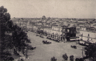
From 1863 to 1867, after the French intervention in Mexico , the city was ruled by Emperor Maximilian and the French army. It was conquered after hard fighting for days under the leadership of the Swiss Captain Stöckli, who served in the Foreign Legion . Benito Juárez , elected president in 1858, drove the French out of Mexico City and across the country in 1866. After the victory over the French in 1867 he personally supervised the civil execution of Emperor Maximilian I in Querétaro and took over the affairs of state in Mexico City.
Around 1875 the city comprised little more than the area around the Zócalo, which is the central square in front of the cathedral, and the Alameda. The Chapultepec Castle, Coyoacán, San Ángel and the Basílica de Guadelupe - now located far inside the city - were then surrounded by fields and the last remaining lakes. But the city was already showing the first features of its current form: the Paseo de las Reformas already connected Chapultepec with the city center, and the increasing population surged beyond the colonial city center . From the end of 1870 to 1911, the dictator Porfirio Díaz had a monument erected for himself using an unprecedented building program. Tram lines were built and the last remnants of Lago de Texcoco on the outskirts were drained. These measures resulted in a further increase in population and when the revolution broke out in 1910, La Ciudad de México had a population of more than 700,000.
The modern city
The city gradually expanded beyond the area of the drained lake. For a modern city, the situation was in many ways unfavorable. Pathogens spread in the inadequately drained swamps. Many buildings sagged over the decades due to the lower water table. In the center one comes across old, z. Churches and houses that have sunk several meters in some cases (see above under hydrology ). There are also frequent earthquakes, most recently on April 18, 2014 and September 19, 2017.
During the revolution, nearly two million Mexicans lost their lives and a much larger number lost their property and livelihoods. Thousands of desperate people fled to the rapidly growing capital in search of work and better living conditions. Between 1920 and 1940 the city's population doubled to 1.8 million, huge gaps in the infrastructure and social problems worsened.
At the Plaza de las Tres Culturas on October 2, 1968, the state showed its cruelest side. Troops and tanks cracked down on nearly 250,000 demonstrating students. It was the culmination of months of student protests against the poor social conditions, miserable teaching conditions and democratic deficits of the de facto dictatorial government of the unity PRI (Partido Revolucionario Institucional) . As the Summer Olympics were due to open in Mexico City ten days later , the riot was suppressed with brutal violence. According to official statements, the death toll was 30, and according to the students it was over 500. The event went down in history as the " Tlatelolco massacre ".
In 1968 the city had a population of six million. The construction of houses could not keep up with the annual population growth of seven percent. In addition, since many people could not afford houses, huge slums with self-made miserable huts emerged. Most of them had neither water nor adequate sanitary facilities.
The public transport network was also unable to keep pace with the city's growth, although construction of a subway began in the late 1960s . In 2000 the 175th underground station was inaugurated. Further underground stations are planned. The growth continues: According to estimates, thousands of newcomers come to the metropolis every day, the borders of which have meanwhile blown those of the official urban area and extend far into the state of México. As one of the most densely populated metropolitan regions in the world, it is plagued by numerous social and structural problems.
Population development
With 8.9 million inhabitants (2015), Mexico City is the second largest city in Latin America after São Paulo and with 21.6 million people (2019) in the agglomeration one of the ten largest metropolitan regions in the world . In 2015 the population density in the city was 5,967 inhabitants per square kilometer, in the metropolitan area 2,683.
Mexico City has been the seat of the Spanish viceroys since the city was founded in 1521 and thus received its position as a primate city: It is still today the capital and hub for the most important political and economic events in the country. But it was only through better care for people (for example in the health sector) and the settlement of numerous industrial companies since the 1930s that people from the surrounding area began to flow into the city. In 1950 the city still had 3.1 million inhabitants. In 1970 there were already 6.9 million people and the growth rate of the metropolitan area was around one million people per year.
Population development of the city
The following overview shows the number of inhabitants according to the respective territorial status. Up to 1889 these are mostly estimates, from 1895 to 2010 they are census results . The population figures refer to the actual city without the suburban belt.
|
|
|
Population development in the metropolitan area
The Mexico City metropolitan area has seen a huge expansion in population over the past few decades. However, there has also been a slowdown here in recent years. A population of 25.4 million is expected in 2035.
| year | population |
|---|---|
| 1950 | 3,365,000 |
| 1960 | 5,479,000 |
| 1970 | 8,831,000 |
| 1980 | 13,028,000 |
| 1990 | 15,642,000 |
| 2000 | 18,457,000 |
| 2010 | 20,137,000 |
| 2018 | 21,581,000 |
Development of the living situation
In 1824, Mexico City was divided into the actual city and the district around it, called "Zona Metropolitana de la Ciudad de México" (ZMCM). At the time, this district was 1,479 square kilometers in size, but the city has long since grown beyond its borders. Mexico City itself comprises the densely populated areas in the city center with growth of 1.8 percent per year. The ZMCM includes the peripheral areas, mainly in the state of México, to which many people from the city center migrate. The annual growth in these districts is less than four percent per year.
In Mexico City, the distribution of the population in affluent and socially disadvantaged districts is very noticeable: the upper class settled in the west and south of the city early on. The south, first the Colonia Roma and later Coyoacán and San Ángel, were popular with the Mexican nobility. Today the south is a popular residential area. The west became the preferred residential area for the wealthy through Emperor Maximilian , who built a castle in the 400 hectare park of Chapultepec in 1864. Many hotels, banks and insurance companies have settled in the area around Chapultepec Park. The north counts as a large industrial area: numerous industrial companies and several working-class quarters can be found here. After the Second World War, the upper-class residential area Ciudad Satélite was built to the northwest. Politically, it belongs to the city of Naucalpán , a direct neighboring municipality to Mexico City with 844,000 inhabitants (2015 census). Mainly people from the middle class live in the east.
The eastern suburbs are the residential area of the socially disadvantaged population up to the pepenadores , who search the garbage for usable leftovers. The lower class lives on the bottom of the dry Lake Texcoco , from which a lot of dust is often carried into the poor residential areas by the unfavorable wind. In terms of urban planning, these are informal settlements , with many of the older settlements currently in a process of gradual consolidation despite the lack of important infrastructure (e.g. tap water). The people living there are at risk from various infectious diseases that are spread due to inadequate hygienic conditions. In this area lies the city of Nezahualcóyotl , home to 1.1 million people (2010 census). The politically independent municipality is one of the poorest large cities in Mexico.
politics
City government
The Prime Minister of Mexico City has been Claudia Sheinbaum Pardo from the Movimiento Regeneración Nacional (MORENA) since December 5, 2018 . She was elected on July 1, 2018 as part of the Juntos Haremos Historia coalition and is the first woman to hold this office.
Her predecessor since December 5, 2012 was Miguel Ángel Mancera from Movimiento Progresista (PRD, PT, Convergencia). He won the election on July 1, 2012 with 46.37 percent of the votes. The Prime Minister of Mexico City had been Marcelo Ebrard of the Coalición Por el Bien de Todos ( PRD , PT , Convergencia ) since December 5, 2006 . He won the elections on July 2, 2006 with 46.37 percent of the votes cast, ahead of Demetrio Sodi ( PAN ) with 27.26 percent and Beatriz Paredes Rangel from Unidos por la Ciudad ( PRI , PVEM ) with 21.59 percent . Ebrard took over from his predecessor Alejandro Encinas (PRD), who had ruled since July 2005.
The mayor has been freely elected by the population since the constitution was changed in 1996. There has been a head of government since January 1, 1929. Previously, Mexico City has been ruled by a governor since the creation of the federal district on November 18, 1824, and by a prefect between 1837 and 1848, when the city was administratively part of the state of México.
In 1903, the federal district included Mexico City and 22 other municipalities, these were initially divided into twelve, currently 16 administrative districts "Delegaciones" in 1928. The districts are the actual administrative bodies in Mexico City. They are represented and led by elected “Jefes Delegacionales”. Its establishment goes back to an administrative reform in 1982, the aim of which was to achieve more efficient administration through decentralization. The administrative districts integrate the historic community centers of the Federal District.
The supreme power of government in the federal district was in the hands of the "Departamento del Distrito Federal" (DDF), an office controlled by the Mexican federal government, until the 1990s. However, since 1997 there has been a directly elected "Jefe del Gobierno del Distrito Federal" (head of government of the federal district, colloquially also known as the Mayor of Mexico City, since 2016 "Jefe del Gobierno de la Ciudad de México") and an "Asamblea Legislativa del Distrito Federal ”(Parliament of the Federal District, since 2016“ Asamblea Legislativa de la Ciudad de México ”). The capital is thus equated with the Mexican states. Should another city become the capital of the United Mexican States, Mexico City would be converted into a state called Valle de México .
The first freely elected head of government in Mexico City was Cuauhtémoc Cárdenas from the PRD. He took over the post on December 5, 1997 from his predecessor Óscar Espinosa Villarreal of the Institutional Revolutionary Party (PRI). Cárdena's successor was Rosario Robles Berlanga (PRD) on September 29, 1999. The Democratic Revolution Party has ruled the country's capital since 1997. During his government, Cárdenas promoted democratization and achieved success in the fight against corruption .
Since December 5, 2000 Andrés Manuel López Obrador was head of government of the federal district. He resigned from this post on July 29, 2005 to run for President of Mexico in 2006. He narrowly won the mayoral elections in Mexico City. However, he gained a high reputation among the citizens with extensive social measures that were intended to alleviate the greatest misery in many areas and made him the most popular politician in Mexico.
Politicians were less successful in combating general crime: property crimes such as assaults on pedestrians, users of public transport and drivers, theft of cars, break-ins into homes / buildings and cases of fraud, as well as violent crime such as robbery, robbery, manslaughter, drug-related crime, kidnapping , Extortion, threats and rape are part of everyday life in Mexico City.
Town twinning
Mexico City has partnerships with the following cities:
-
 Berlin , Germany (since September 1, 1993)
 -
 Cuzco , Peru (since July 7, 1987)
 -
 Dolores Hidalgo , Mexico (since September 1, 2008)
 -
 Havana , Cuba (since September 25, 1997)
 -
 Los Angeles , USA (since December 11, 1969)
 -
 Madrid , Spain (since November 17, 1983)
 -
 Nagoya , Japan (since February 15, 1978)
 -
 San Salvador , El Salvador (since September 14, 1979)
 -
 São Paulo , Brazil (2011)
 -
 Seoul , South Korea (since August 30, 1993)
Culture and sights
theatre
Mexico City has one of the richest theater scenes in the world. The Mexican theater takes on an educational and socio-political function, which is represented by a broad spectrum of contemporary playwrights .
One of the most famous theaters in the city is the “ Palacio de Bellas Artes ” (Palace of Fine Arts), built between 1904 and 1934 on the east side of the “ Alameda Central ” park . The classic dome building made of Carrara marble and decorated with bronze decorations and Art Deco interior is the most important cultural center in the heart of the city (theater, dance, concert, opera, art exhibitions). In the palace you can see murals by Diego Rivera , José Clemente Orozco , David Alfaro Siqueiros , Rufino Tamayo and Jorge González Camarenazu.
The national folklore ballet (Ballett Nacional Folklórico) founded by Nellie Campobello is an important part of the city's cultural life. The ballet has already achieved worldwide fame. It is made up of dancers from all over the country, and its superb choreography is interspersed with Mexican dances, music and singing. The program includes some of the most famous traditional dances.
The “ Auditorio Nacional ” (National Auditorium) is located on the Paseo de la Reforma at Chapultepec Park . Opened in 1952, it was first used as an exhibition space, and later there were also ballet performances, classical music performances and pop concerts. Numerous national and international artists perform here every month.
Museums
Mexico City has numerous museums, including the Museo Nacional de Antropología (National Anthropological Museum), Museo Nacional de Arte (National Art Museum), Museo Rufino Tamayo and Museo de Arte Moderno (Museum of Modern Art), and Museo Frida Kahlo .
Museo de Arte Moderno
The Museo de Arte Moderno (MAM) was completed in 1964 according to plans by the architects Rafael Mijares Alcérreca and Pedro Ramírez Vázquez . In addition to changing exhibitions, it houses a collection of modern Mexican painting with works by David Alfaro Siqueiros , José Clemente Orozco , José María Velasco Gómez , Diego Rivera and Juan O'Gorman . This museum also houses the special surrealist collection by Remedios Varo .
Museo Nacional de Antropología
The National Anthropological Museum is located in Chapultepec Park and houses the most important collection of the pre-Columbian heritage of Mexico and is one of the most important archaeological collections in the world. The building, which opened in 1964, was designed by the architects Pedro Ramírez Vázquez and Jorge Campuzano . The exhibition halls are laid out around an inner courtyard, half of which is covered by a huge, rectangular “umbrella” made of light metal. A single concrete column in the middle of an artificial waterfall forms the support of the roof. The halls are surrounded by gardens, which are included in the museum activities as open-air exhibition space.
Museo Nacional de Arte
The Museo Nacional de Arte was founded in 1982 with holdings from various museums to provide an overview of Mexican art from the 16th century to the 1950s in a single location. It is located in a small plaza, where the city's most famous statue is placed: El Caballito , the representation of Charles IV of Spain, the work of Manuel Tolsá . Originally (the figure was created in 1803) the massive bronze statue adorned the Zócalo, after which it moved several times.
Museo Rufino Tamayo
The Museo de Arte Contemporáneo Internacional Rufino Tamayo opened in 1981 with more than 300 works donated by the painter Rufino Tamayo (1899–1991) from Oaxaca . It contained own works and works by other famous artists of the 20th century. Works by Francis Bacon , Salvador Dalí , Giovanni Giacometti , René Magritte , Joan Miró and Pablo Picasso can be seen, for example . The museum hosts changing exhibitions of international and Mexican art, lectures, theater and dance performances and concerts. It contains a documentation center specializing in Rufino Tamayo. For the design of the building, Teodoro González de León and Abraham Zabludovsky received the National Architecture Prize in 1981.
Museo Frida Kahlo
The house of Frida Kahlo is in the suburbs Coyoacán. The colorful building, called Casa Azul ("Blue House") because of its blue exterior walls, has been prepared as a museum. Built in the typical colonial style, the museum houses a special selection of Frida Kahlo's pictures, her furniture, clothes and books. She lived there with her husband Diego Rivera from 1929 to 1954. A house nearby was occupied by Leon Trotsky (1879–1940) during his exile , where he was also murdered in his study. It is set up as a museum and is visited by many people together with Frida Kahlo's house.
A little further away from the Museo Frida Kahlo, in San Angel, is the " Casa Museo Estudio de Diego Rivera y Frida Kahlo ", where both artists also lived. There are two houses, one in pink and one in blue, a house for each person with their own personality, designed and built in 1927 by the painter Juan O'Gorman . For Mexico it was the beginning of modern architecture.
Other museums
On a hill in the old town stands the " Convento de San Francisco ", completed in 1540 , a former Franciscan monastery, which today houses the historical regional museum ("Museo Regional de Querétaro"). Hernán Cortés baptized the first Aztec rulers in the adjoining church in San Francisco . The building was built in a typical Churrigueresque style.
In the Avenida Madero, on the western edge of the Zócalo, is the baroque “ Palacio de Iturbide ”, where art exhibitions take place. There is also " Antiguo Colegio de San Ildefonso ", a colonial building that is still in good condition, where, in addition to temporary exhibitions, the wall paintings by Diego Rivera, David Alfaro Siqueiros and José Clemente Orozco are shown. South of the Zócalo is the " Museo de la Ciudad de México " with exhibits on the city's history and the high valley.
To the west of the “ Alameda Central ” park, which was created in 1592 , by the Hotel Cortés, the “Pinacoteca Virreynal” (viceroyal painting collection) with pictures by the most important artists of the Spanish colonial era is housed in a former monastery church .
There are other museums in the vicinity of the “Alameda Central” park: the Museo Franz Mayer , with a collection of various furniture, silverware and Mexican paintings; the " Museo de Artes e Industrias Populares " (National Museum of Folk Art and Crafts) and the " Museo Mural Diego Rivera " with an exhibition of the painter's numerous works, including one of his most famous works of art: "Dream on a Sunday afternoon in Alameda Park" .
Two other art museums in the San Ángel area are the " Museo de Arte Carrillo Gil ", where mainly Mexican contemporary art can be seen, including temporary exhibitions of modern art and the " Museo Soumaya ", which opened in 1994 in the " Plaza Loreto ". The Museo Soumaya is known among other things because of the exhibition of 100 sculptures of Rodin and is the only museum in Mexico City, where permanently the works of European artists, including some Impressionists, but also works by Pablo Picasso , Joan Miró and Salvador Dalí to see are.
The former Hacienda La Noria from the 16th century, located in Xochimilco, has been open to the public as the Museo Dolores Olmedo since 1994 . Works by Diego Rivera, Frida Kahlo and Angelina Beloff , among others, are exhibited here. Especially on the day of the dead , the museum is an attraction in this district.
The Museo de la Secretaría de Hacienda y Crédito Público is now located in the former bishop's residence .
music
Numerous concerts of various musical styles take place in the capital every day. The venues are in the south, in the districts of Coyoacán and San Ángel, but the Zona Rosa and Condesa also have a lot to offer musically.
Those who want to mingle with the city's upper class can do so in Del Valle and Polanco. Sometimes the most interesting concerts also take place in remote places. Rock and Latin as well as the latest hits from the USA are often represented, Europop is becoming increasingly popular, Cuban sounds and even live jazz can be heard.
Well-known local bands include Café Tacuba , lesser-known La Vieja Estacion (blues), Señoritas de Aviñon (jazz, blues) or Work in Progress (WiP) (rock, blues, pop).
A special event will take place in Plaza Garibaldi . Hundreds of music- making mariachi groups gather there every evening . A band usually consists of four violinists, three trumpeters who stay a little apart, three to four guitarists and a singer.
A real Caballero only hires the musicians and sings themselves. The mariachis probably got their name from the time of the French invasion in the 19th century, when it became common to hire a music group for weddings - mariage . In the plaza you can also hear Norteño groups offering a mix of Tex-Mex-Country, or the softer marimba sounds from southern Mexico.
There are also music groups such as B. Mexican Institute of Sound , which mixes the classical and traditional Latin American musical styles with modern musical styles such as electro .
Buildings
Mexico City
The streets of the capital are laid out like a chessboard. The pattern is interrupted by a few broad boulevards with modern commercial buildings and high-rise apartment buildings, as well as several parks and large squares that are popular meeting places for city dwellers.
Zócalo

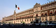
The historic center of Mexico City is the Constitution Square or Zócalo . It is located where the palace of the Aztec ruler Moctezuma II (1465–1520) once stood. The square is framed by the monumental cathedral of Mexico City , the “Palacio Municipal” (City Palace) from 1720 and the “ Palacio Nacional ” (National Palace ) from 1792, the seat of the President. In the “Palacio Nacional” you can see murals by Diego Rivera .
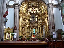
The baroque cathedral was built from 1573 to 1667 and is one of the oldest and largest sacred buildings in America. The facade has three portals. Inside is the richly carved Altar de los Reyes ('Altar of Kings'). Like many other buildings in the city, the cathedral is slowly sinking into the swampy ground.
The central part of the facade of the Sagrario (parish church), built in the Churrigueresque style, is accompanied by lateral wall surfaces made of reddish Tezontle stone.
North of the Zócalo is the archaeological site "Templo Mayor", where the remains of the former temple area of Tenochtitlán were found. The colonial building in the west has housed the Monte de Piedad (pawnshop) since the 19th century . Close to the Zócalo is Calle Moneda, lined with colonial buildings and palaces from Tezontle, with the Churrigueresque church of La Santísima and the baroque Archbishop's Palace.
In the direction of the Palacio de Bellas Artes there is a small park, the Alameda Central . Here is a monument to the Mexican President Benito Juárez (1806–1872).
Paseo de la Reforma
One of the city's main arteries, the Paseo de la Reforma , was built under Emperor Maximilian. It began on the outskirts of the old town, on the northwest corner of the Alameda Park, and led to the summer residence of the Mexican emperor, Chapultepec Castle . It was laid out as a wide boulevard based on the European model. Some of the villa-like buildings from the 19th century have been preserved. In the historical central part, however, more and more skyscrapers dominate, including the tallest building in Latin America, the Torre Mayor and typical commercial buildings. The road has been extended in both northeast and west directions and is one of the longest roads in the world.
In a north-easterly direction, the transversal boulevard "Paseo de la Reforma" extends to the Square of the Three Cultures, the main square of the pre-Columbian city of Tlatelolco , which was uncovered in 1963 . Evidence from three epochs is united there: In addition to exposed Aztec buildings and the baroque church of Santiago de Tlatelolco from the Spanish colonial era, there are also modern buildings here. At the monument to the last Aztec ruler Cuauhtemoc, it crosses the north-south connection of the capital, the Avenida de los Insurgentes .
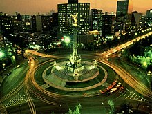
To the south extends the Chapultepec Park with various museums, a zoo, the Chapultepec Castle, which used to be the official seat of the President and also served as Emperor Maximilian's residence, and the “ Zona Rosa ” district, where numerous restaurants, bars and shopping centers are located . At this height is the Independence Monument, a 45 meter high column with the angel of victory on top ( El Ángel de la Independencia ) .
Mexico was the only country that did not politically recognize the attack on Austria in 1938 and objected to it as a member of the League of Nations . As a reminder of this, there is a small monument erected by the Austrian government under Bruno Kreisky on the “Paseo de la Reforma” today . In Vienna, the Mexikoplatz , which was renamed from Erzherzog-Karl-Platz in 1956, is a reminder .
Other structures
Also worth seeing is the monumental Palacio Postal (main post office) built from limestone . The neo-Gothic decorated building on Calle Tacuba is opposite the “Palacio de Bellas Artes” and was built between 1902 and 1907 according to plans by the architect Adamo Boari . The stairwell is built in Art Nouveau style and is decorated with glass and iron. There is a small postal museum on the first floor. Nearby is the "Casa de los Azulejos" (House of Tiles) on Avenida Madero. Built in the baroque style, the outside is decorated with thousands of tiles from Puebla . The house houses the well-known restaurant and shop "Sanborns".
In the 1940s, the Nidjei Israel Synagogue was built.
The " Torre Latinoamericana " is also located on Avenida Madero and opposite the Palacio de Bellas Artes . The former tallest building in Latin America (182 meters) was built between 1948 and 1956. The 45-story skyscraper was built according to plans by the architect Augusto H. Álvarez .
In several places in the city there are murals by Diego Rivera , monumental frescoes are exhibited in the National Palace under the theme "Mexico through the centuries". Also well-known are the murals by José Clemente Orozco , including the painting "Omnisciencia", which can be seen in the Casa de los Azulejos.
Numerous suburbs and the most varied of neighborhoods have emerged from the expansion of the city: from the elegant Pedregal residential area with its modern architecture to the densely populated Netzahualcóyotl, a simple residential area located in the dry valley of Lake Texcoco . The Casa Barragán , the house and studio of the architect Luis Barragán, has been a World Heritage Site since 2004 . It was built in 1947/1948 in the suburb of Mexico City, Tacubaya , and is an excellent example of a post- WWII structure. The concrete building consists of a ground floor and two upper floors that look like a small private garden.
In the northern suburb of Villa de Guadalupe , on Mount Tepeyac, stands the Basilica of Our Lady of Guadalupe (Basilica de Nuestra Señora Guadalupe). It is the most important shrine in Mexico and one of the most important Marian shrines in the world and, with 20 million annual pilgrims, the largest place of pilgrimage in the world. In 1531 the Virgin Mary is said to have appeared to the baptized Aztec Juan Diego on Mount Tepeyac . A church was then built on the site of the apparition. As the subsoil sank, the basilica had to be closed to visitors and pilgrims. The new basilica, designed by the Mexican architect Pedro Ramírez Vázquez, which was consecrated in 1974 and opened in 1975, is very impressive in terms of its size and open architecture. It has 10,000 seats and can accommodate up to 40,000 visitors. This makes it one of the largest churches in the world. This is also important because at that time it was still forbidden in Mexico to hold masses in the open air.
Teotihuacan
Teotihuacán , the ruined city with the mighty pyramids, about 50 kilometers northeast of Mexico City, was the dominant culture of the "classical" period and the actual predecessor of the Aztec empire. About 300,000 people lived there, whose influence extended across the country and far south to the Maya area on the Yucatán peninsula and as far as Guatemala .
In its heyday, Teotihuacán was probably the largest pre-Columbian settlement in America with around 75 temples and 600 workshops. Around 200 BC BC until the beginning of the Christian era, the city received its most important features: the mighty pyramid of the sun and the pyramid of the moon were built and the Calzada de los Muertos (Street of the Dead) was laid out. The expansion of the city covers 23 square kilometers, of which the ceremonial center alone takes up four square kilometers. The pyramids are so gigantic that they were thought to be mountains before they were exposed.
The massive "Pirámide del Sol" (Pyramid of the Sun) is the towering landmark of Teotihuacán. As far as the ancient buildings of Mexico are concerned, their height of 70 meters was only exceeded by Cholula . Two and a half million tons of stones were moved to build it, without wheeled carts or beasts of burden and without the use of metal tools - both of which were unknown to the ancient cultures of Mexico. Its base is close to that of the Great Pyramid , but because of its terraced construction and the flatter sides, it is nowhere near as high.
The “Pirámide de la Luna” (moon pyramid) rises at the end of the Street of the Dead. It is smaller and was built a little later, but still during the period of Teotihuacán I, making it one of the oldest in the country. The construction is similar: four sloping floors that are accessed via a huge ramp. The ruins of Teotihuacán have been on the UNESCO World Heritage List since 1987.
Parks
Xochimilco Park
The so-called "floating gardens" of Xochimilco (in Nahuatl "place where flowers grow") have been part of the UNESCO World Heritage Site since 1987 . In 1990 the water gardens were declared an urban ecology park (Parque Ecológico de Xochimilco). No other district is so reminiscent of the old city (albeit in an idealized form) as Xochimilco with its floating shops, markets and colors.
Flowers-decorated boats with day trippers drive through the canals. Women sell tiny canoes made of flowers, fruit and hot food, and now and then larger boats with marimba musicians and entire mariachi groups come by to tie up alongside and serenade for a small fee. In recent years, significant efforts have been made to clean the canals and keep the water level falling. The canals will therefore remain a popular destination for thousands of capital city residents every weekend in the future.
The market - “mercado de xochimilco” - is probably one of the most colorful, densest and loudest in the world. Every day there is a traffic standstill due to buses - "peseros" - for which Xochimilco is the terminus of countless routes.
The Doll Island has been open to tourism since the mid-1990s . Thousands of partly mutilated dolls have been hung up in the trees of the island.
Chapultepec Park
The Chapultepec Park or Bosque de Chapultepec covers a green area of four square kilometers and is the “ green lung ” of the capital. It consists of three sections. In the largest and furthest to the east are the most interesting facilities, including the "Museo Nacional de Antropologia", the "Museo de Arte Moderno", the "Museo Rufino Tamayo" and the zoo. On the south side of the Reforma, opposite the “Museo de Antropologia”, lies Lake Chapultepec.
The Chapultepec Castle ("Castillo de Chapultepec") is located on the hill of Chapultepec . In front of it stands the “Monumento a los Niños Héroes”, a memorial for the cadets who tried to defend the castle against the US Army in the 1847 Mexican-American War . Legend has it that the last six survivors, wrapped in the national flag, threw themselves to death from the cliffs so as not to fall into the hands of enemy troops.
The Castillo itself was built in 1785 as the summer residence of the Spanish viceroy. Until then it was a hermitage that was built after the disappearance of the Aztec ruler. It was used as a military academy until independence; the castle was given its current appearance at the request of Emperor Maximilian, who had it rebuilt based on the model of his Italian villa. Now it houses the “Museo Nacional de Historía” (history museum) on two floors.
On the western shore of the lake is the main entrance to the city's zoo, the Zoológico de Chapultepec , which takes up a large part of the interior of the park and is divided into different climatic zones, including desert, tropics and temperate mixed forest zone . Most of the cages are relatively spacious and animal-friendly. Most interesting are the zoo sections, which house the animals native to Mexico, and the area reserved for the xoloitzcuintle , the hairless and only descendants of the four pre-Columbian dog species. Other animal species from all over the world are also represented: tigers, bears, lions, elephants and pandas . Parque Zoológico was the first zoo in the world to give birth to giant pandas.
Over the years, new park sections were added on the western edge of the original "Bosque de Chapultepec". These were sometimes referred to as "Nuevo Bosques de Chapultepec", but usually mostly as Segunda Sección, which means second section and Tercera Sección, which means third section. In the Segunda Sección are the "Museo Tecnológico", the "Papalote Museo del Niño", the "Museo de Historía Natural de la Ciudad de México", and " La Feria Chapultepec Mágico " (largest amusement park in the city) and another amusement park called "Planeta Azul".
The “Tren Escénio”, a park railway , leaves from the Museum of Natural History and takes a short circuit through the park, past some pear apple trees and the ceremonial site “Fuente Xochipilli”. In the Tercera Sección is the Panteón Civil de Dolores with the graves of Diego Rivera , José Clemente Orozco and other personalities. Also in this section is “El Rollo” (a water park with slides and a wave pool) and “Atlantis” (a kind of zoo-circus with marine mammals and sea birds, some of which perform dressage acts).
Natural monuments
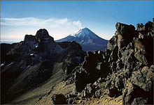
To the southeast of Mexico City are the two snow-capped volcanoes Popocatépetl (5,452 meters) and Iztaccíhuatl (5,285 meters). Since the volcanic activity began on December 21, 1994, the region has been on constant yellow alert, and rules of conduct have been posted in the surrounding areas in the event of an evacuation. On December 19, 2000, the Popocatépetl erupted, the largest since 1802. Glowing boulders were hurled out of the crater, clouds of dust settled on the capital and several times the Mexico City airport, which is more than 60 kilometers away, had to be closed for a few hours .
Lava flows did not advance very far, and so only the farmers suffered from the situation, whose farms had to be evacuated for several weeks while the cattle were left to their own devices. The area around the Popocatépetl remains closed to the public within a radius of two kilometers, but the "Parque Nacional de Volcanes", which surrounds the two volcanoes, has reopened. The 14 monasteries on the slopes of Popocatépetl, built by the Spanish conquistadors in the 16th century, were declared a UNESCO World Heritage Site in 1994.
The names of the two volcanoes go back to an Aztec love story: Popocatépetl ("smoking mountain") was a warrior, Iztaccíhuatl ("white lady") was his lover, the daughter of the emperor. When she believed Popocatépetl killed in battle, she died of grief. But her lover came back unharmed; he laid her corpse on a mountain and stayed there to keep watch with a burning torch for all eternity.
Sports
Soccer (fútbol) is the most popular Mexican sport. The most important games are played in the Aztec Stadium ("Estadio Azteca") with 87,000 seats, the home stadium of the most successful Mexican team, America ("Las Aguilas"). The university club UNAM (“Los Pumas”) can also count on a large number of spectators when it plays in the 72,000-seat Olympic Stadium (“Estadio Olimpico”) opposite the university. Cruz Azul (sponsored by a cement factory for many years, hence called "Los Cementeros") plays in the " Estadio Azul " with 39,000 seats.
Two championships are played annually because, in contrast to the Bundesliga, there are no round-trip rounds, but two tournaments (Apertura and Clausura) with play-offs (Liguilla). The Apertura corresponds to the first half of the season and the Clausura to the second half of the Bundesliga. The Apertura is played between August and December and the Clausura between January and the end of May / beginning of June, so that, as a rule (and before the play-offs), two games are played in Mexico City every weekend. One of the big games is the clash between America from Mexico City and Chivas from Guadalajara , the country's second largest city.
Lucha libre , the Mexican form of wrestling, is still one of the most popular spectator sports. On several evenings a week, wrestling matches take place in over a dozen arenas in front of a fanatical audience in the capital alone. The largest competition venues are the “Arena Coliseo” and the “Arena México”.
The bullfight is an integral part of Mexican life, and no other event just manages to lift barriers within Mexican society as a corrida de toros . During the bullfighting season (late October to early April), corridas take place every Sunday in the huge Plaza México , with 48,000 seats the largest bullring in the world.
In 1981 the three-cushion world championship for national teams took place here, the winner was Japan with the players Nobuaki Kobayashi and Jun'ichi Komori .
gastronomy
Typical of the cuisine in the capital region are “Antojitos Mexicanos”, small bites that are mainly made from masa - the dough for tortillas , a bread substitute made from corn, similar to pancakes. These include, for example, tacos , small tortillas with fillings in all possible variations, but also “tortas” (filled wheat rolls) and “tostadas” (deep-fried, flat tortillas with toppings). In addition, the guest is served various sauces such as salsa verde, salsa mexicana and salsa ranchera or guacamole . The antojitos are sold in many streets of the capital at small stalls, where there are mostly tacos in numerous variations. Special taco fillings are “Carne al Pastor” , pork that is prepared on a rotisserie like gyros or doner kebab , and “Carnitas”, roasted pork boiled in milk, and “Chicharrón”, fried pork rind. “ Tamales ” are also popular . These are a mixture of masa, which is usually filled with beef or chicken and sometimes also covered with various spicy sauces, in order to finally cook them wrapped in corn or banana leaves.
Instead of an early breakfast, which is typically only drunk with coffee, Mexicans usually eat their “Almuerzo”, the richer second breakfast, either egg dishes or chilaquiles , dried and deep-fried, mostly triangular pieces of tortilla (“totopos”) in a mild red or green chilli sauce , prepared with onions, cream and cheese. A typical lunch is the “Comida corrida”, consisting of soup, rice, a main course and usually a small dessert. It is an inexpensive lunch that is used by both blue-collar and white-collar workers. Dinner is then simple, usually just a taco or a “pan dulce” (sweet pastry) with a glass of milk or coffee.
Food from all regions of the country is available in the city. The famous “Chiles en Nogada” from the Puebla area are tasty, large peppers stuffed with beef and pork and dried fruit, served in a sauce made from cream and skinned walnuts and sprinkled with pomegranate seeds. “ Mole ” comes from Puebla and Oaxaca , a rich sauce that is usually served with chicken. Also popular from Jalisco is the “ Pozole ”, a stew-like dish with chicken or pork and large nixtamalized corn kernels . In addition to the numerous local restaurants, Mexico City is also home to pubs with Chinese , US , Argentine , French and Italian cuisine. Inexpensive restaurants, cafes, taquerias and stalls selling drinks can be found on almost every street corner. Mexican confectionery is a specialty and has been offered in the Dulcería de Celaya for over 140 years .
trade
The capital has everything the country has to offer, including markets for handicrafts and traditional items, as well as handicraft shops (“artesanía”). The “Zunftgassen” are a peculiarity of the city: entire blocks of houses that are reserved for a specific trade. This arrangement is an example of Aztec heritage - their markets were sorted by goods, and the colonial rulers followed suit.
The "Bazar Sábado" is a handicraft market in an old hacienda in San Ángel. Special handicrafts can be bought here. Immediately there, at Plaza San Jacinto and Plaza del Carmen, there is also an open-air painting exhibition. The market and exhibition are held for most of the Saturday. On Sunday the painters and artists move to Parque Sullivan, just north of the Zona Rosa. The “Coyoacán markets” are also interesting. Of the two markets, there is one market - with mainly food on offer - three blocks a day above Plaza Hidalgo; the other market sells handicrafts. It is set up right around the Zócalo on Sundays and is a meeting place for local youth. Among other things, typical Mexican clothing and silver jewelry are offered.
“La Merced”, Izazaga San Pablo, is the city's largest market. It consists of various modern buildings that, despite their size, cannot cope with the onslaught of traders who want to set up a stand. Most of the space is taken up by groceries, but everything else a Mexican market has to offer can also be found there. “Mercado de Sonora”, three blocks from La Merced, is known for herbal, magical medicines and miracle medicines and the curanderos ( shamans ) who come there and offer their services. Culinary specialties from all over the world are sold on the “Mercado San Juan”.
One of the largest markets in Mexico City is the "Tepito" market, which is located in the north of the city center. The range of goods is extraordinarily large and ranges from textiles and electrical appliances to plagiarism and black copies of all kinds. However, the crime rate in the Tepito district, with its mostly poor population, is very high and every few days there are large-scale police operations, often only with crews indented in Tepito. In summer 2002, for example, a visitor died in shootings between rival traders and in spring 2003 35 people were killed in gang fights. In May 2003, when the police tried to dig up a laboratory for product piracy , bloody street battles broke out between the special units of the Mexican police and mostly young traders in the market in Tepito.
To the northeast of Plaza Garibaldi is the “La Lagunilla” market. It mainly offers antiques, clothing and confectionery ("chucherias"). Another market that is frequented by both locals and tourists can be found near the Zona Rosa. This “Mercado de la Ciudadela” not only sells handicrafts from all over Mexico, but also “Artesanias”. These are partly from Oaxaca (e.g. clay jugs) and partly from other regions of Mexico. The so-called "Chopo" is also located in the city center. Punks , hippies , goths and members of other youth subcultures meet here every Saturday to buy books, accessories, music, art and clothing. Small punk concerts take place regularly on the Chopo, and entry is free.
At the end of the 20th century, the typical shopping centers from the USA (“malls”) with department stores and boutiques (Avenida Presidente Masaryk, Polanco) as well as a range of goods from all over the world emerged. Examples are Plaza Satélite in the north, Perisur in the south and Centro Comercial Santa Fé in the west of the city.
Economy and Infrastructure
business
According to a study from 2014, the wider Mexico City region generates a gross domestic product of 404 billion US dollars ( PPP ). In the ranking of the most powerful metropolitan regions worldwide, it took 19th place.
More than half of the country's industrial production is generated in Mexico City itself or in the vicinity. Medicines, chemicals, textiles and electronics, steel and transport equipment are manufactured here, as well as a wide range of food and consumer goods for light industry .
Mexico City is the center of an emerging industrial belt that stretches from Guadalajara in the west to Veracruz on the coast of the Gulf of Mexico in the east. The city's stock exchange is one of the largest in Latin America . It was founded in 1886 as "Bolsa Mercantil de México", and in 2001 it was given its current name, Bolsa Mexicana de Valores .
About 8.4 percent of Mexico's population lived in the capital in 2005 and generated 21.1 percent of the national gross domestic product (GDP). The city's economic growth was 2.0 percent (Mexico = 3.0 percent). The GDP per capita was 18,381 US dollars (USD Mexico = 7.348). Of the 7,754 large companies registered in Mexico , 1,393 (18.0 percent) were based in the capital.
The economy has been heavily deregulated and privatized in recent years . The dominance of private companies is growing steadily and the privatization of railways, airports and banks is coming to an end. The liberalization of the energy sector continues. Reforms are still pending in the telecommunications and petrochemicals sectors. The budget situation is almost balanced and the debt constant.
The official unemployment rate in 2008 averaged 5.8 percent for the year, well above the national average of 3.8 percent. The development in the capital has been as follows in recent years: 2001 (3.8 percent); 2002 (3.9 percent); 2003 (4.6 percent); 2004 (5.9 percent); 2005 (5.6 percent); 2006 (5.5 percent), 2007 (6.0 percent) and 2008 (5.8 percent). There is a large imbalance in the real wage distribution. Around a third of the population lives below the poverty line .
The rapid growth of Mexico City has created numerous difficulties, including ominous air pollution due to the large number of cars and industrial plants as well as an increasingly inadequate water supply. For years, the city has been faced with the major problem of satisfying the exorbitant water demand of 300 liters per day per person. The excessive extraction of groundwater below the city caused the ground to sink by up to ten meters in some cases. This led to damage to buildings and to water and drainage pipes, but also to an increased risk of flooding. Furthermore, the city is losing around 40 percent of its water through the completely ailing network of pipes. Today Mexico City is additionally supplied with water from distant springs outside the high valley. Modern multi-storey buildings are currently being built on huge steel and concrete pillars to keep them from sinking.
traffic
Long-distance transport
Highways
The capital is connected to all major cities in the country by highways (Autopista). The routes lead to Santiago de Querétaro (211 kilometers) in the northwest, Toluca (65 kilometers) in the west, and Cuernavaca (85 kilometers), Cuautla (120 kilometers) and Oaxtepec (80 kilometers) in the south. Other routes connect Mexico City with Puebla (127 kilometers) in the east, as well as Texcoco (15 kilometers), Tulancingo (100 kilometers) and Pachuca de Soto (91 kilometers) in the northeast.
Most of the motorways are chargeable (de cuota) and are built and operated by private investors together with the state. Since the toll is very high, new projects, including the north bypass of Mexico City, should generally be operated with lower tolls in the future.
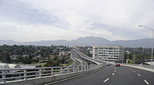
The capital's motorway network has been expanded considerably since the middle of the 20th century. The western part of the Anillo Periférico, a ring road , was already in operation in the 1950s and has now been completely completed. A second floor was built over part of the western section of the Periférico. The agglomeration has now outgrown the Periférico, which used to be outside the city, and has taken over the partially eight-lane motorway. In the urban area, still existing watercourses were laid in underground tubes, and the river beds were converted into expressways (Circuito Interior, Viaducto). Large streets in the urban area have been declared one-way streets and are known as axes (Ejes) , which are differentiated according to direction and a number. They have between 6 and 8 lanes.
Rail transport
As a result of the privatization of the Mexican railway company Ferrocarriles Nacionales de México , all passenger trains to and from Mexico City have ceased their service. The only indication that they ever operated is a steam locomotive in front of the former train station in the Buenavista. The Terminal Valle de México (TVM) marshalling yard in the north of the city serves rail freight traffic .
Air traffic
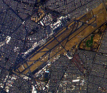
Mexico City International Airport is the busiest in Latin America and one of the world's most important in terms of flight movements and cargo turnover. In terms of passenger throughput, it was ranked 44th worldwide in 2006. Although it has no official name, it is colloquially named after Benito Juárez , the statesman and president of Mexico from 1861 to 1872.
The airport has now reached the limits of its capacity. It is located five kilometers east of the Zócalo, well within the city limits and is by far the largest airport in the country. The construction of another airport in the catchment area of the city was planned to relieve him. In July 2002, after violent protests by residents of affected settlements, this plan was dropped. The plan was resumed at the end of 2014, and construction of Mexico's new airport began in Lago de Texcoco . However, the construction work was surprisingly stopped in 2018 and not pursued any further. The airport in Puebla near Huejotzingo is planned as an alternative airport , but it hardly has its own air traffic.
Intercity bus transport
Mexico City has four large intercity bus stations, one for each direction. Countless competing bus companies drive to the bus stations. The largest bus station is the Terminal del Norte, in the north of the city, which serves the border with the United States and everything roughly north, including Guadalajara and Morelia . From the “Terminal de Autobuses de Pasajeros de Oriente”, or TAPO for short, in the east, you drive to Puebla , the Gulf coast in the state of Veracruz , but also to Oaxaca , Chiapas and the Yucatán peninsula ; you can even get to Guatemala from there.
The bus station "Central de Autobuses del Sur" is in the south. From there the intercity buses leave for the Pacific coast - especially to Cuernavaca , Taxco de Alarcón , Acapulco and Ixtapa Zihuatanejo . The western bus station, the “Terminal Central Poniente”, is the smallest of them all and connects Mexico City primarily with Toluca . Other slower buses run via Toluca to Morelia, Guadalajara, and other destinations in Jalisco and Michoacán . Also to Pátzcuaro , Uruapán , Valle de Bravo and Querétaro . All bus stations have an underground station in the immediate vicinity.
For longer journeys to the outskirts of the city or further away, the buses stop on the outskirts and are checked by armed organs (army, police, private companies). Officials run through the bus and film every passenger, asking everyone to look at the camera. The big bus stations are equipped with security checkpoints like airfields, but the controls are a little less strict. People who are obviously tourists are also waved through when the detectors beep.
Local transport
Rail transport
The first horse-drawn tram in Mexico City ran on December 12, 1857 and the first electric tram on January 15, 1900. The previously extensive network was reduced to an 18-kilometer section. The Tren Ligero tram ("light train") runs between Tasqueña subway station (the southernmost terminus of line 2) across the earth south to Xochimilco. The train is operated by a different company than the metro and may not be used with a subway ticket.
Traffic in the city is often blocked, especially during rush hour - partly due to the narrow streets. In order to relieve traffic, the first section of the subway was put into operation on September 5, 1969 .
The construction only initially improved the traffic problems. Today the metro runs on eleven lines and a total network of 201.7 kilometers and was once developed into one of the largest and most powerful underground systems in the world . However, the subway system cannot even begin to meet today's standards. The density of local traffic has not grown proportionally with the population in the last 20 years, which has resulted in a completely overwhelmed metro network.
Nevertheless, if certain precautionary measures are taken, the subway is the most efficient means of transport for tourists too. With one ticket, using several lines, the entire city can be crossed in about an hour, considering the heavy car traffic and the enormous expansion of the metropolis is very fast.
The system of assigning meaningful colored symbol images to each of the 175 subway stations, which was originally intended to take account of the high rate of illiteracy in Mexico City, is unique . Presentations of archaeological excavations can be seen in some of the stations.
Since the metro system does not cross the boundaries of the political unity of Mexico City, there was no fast and efficient means of mass transport to the adjacent metropolitan region for a long time. On June 1, 2008, the first part of a rapid transit network "Ferrocarril Suburbano de la Zona Metropolitana del Valle de México" was opened, which connects the abandoned central station Buenavista with Cuauhtitlan and has a length of 27 kilometers. The railway runs on the route of the first double-track, electrified railway line to Santiago de Querétaro , which has been under construction since 1978 , but which was never really operated effectively. After the abandonment of passenger transport in Mexico in connection with the privatization of the railways in 1996, there were numerous projects that wanted to use this route, but none of them were implemented.
On May 3, 2021, there was a serious underground accident in which at least 23 people were killed and around 70 people were injured. When a subway bridge collapsed, several wagons fell on a busy street.
Road traffic
Numerous large buses , including modern electric buses , operate in the urban area . The state-subsidized Metrobus runs on “ Avenida Insurgentes ” and trolleybuses also run in both directions on Lázaro Cárdenas, between Terminal del Norte and Central del Sur . The trolleybus operation in the city was opened on April 6, 1952, after there had already been experimental operations in 1948 and 1951. A large urban bus station is located between Chapultepec Metro Station and the entrance to the park. From there buses go to all parts of the city.
There are also numerous peseros (colectivos), buses with 30 seats or VW buses for around eight to ten passengers in the city. They are often light green with a white roof and the destinations are on the windshield. The peseros also have line numbers, but not every vehicle travels the entire route, but perhaps turns back halfway, so the labels are the best landmarks. Peseros are faster and slightly more expensive than the city buses, but much cheaper than the numerous taxis, and let passengers get on and off at any point on their fixed route.
Since many street names have been assigned several times, the passenger should give the driver the address with the city district (Delegacion), district (Colonia) and street name and point out the nearest square, street, monument or similar before taking a taxi.
The heart of the inner-city transport reforms is the development of a fast bus network . A bus network is quicker and cheaper to set up than a subway. 70 kilometers are already in operation, it should be 200 kilometers; the red articulated buses serve the main routes on their own lanes. The city pushed ahead with the expansion of the express bus network despite a lot of resistance from private bus owners. For example, it has succeeded in getting Volvo and Mercedes to deliver the Mexicans their most modern buses with emission values of the Euro 4 standard - companies in emerging countries usually only take over old vehicles from the first world.
In the city center or the historical center as well as at other particularly busy points in the city, road traffic is usually regulated by police officers, the Policía de Tránsito . The approximately 2,500 traffic police officers are deployed in particular in the morning at work and in the evening after work and shopping. With their work, which is not entirely harmless, ten to twelve of them are attacked by motorists every day, they try to curb the extremely pronounced individual traffic despite the " hoy no circula " driving ban on private vehicles that has been in place for 25 years .
In December 2015, a new road traffic regulation came into force, with which the maximum speed in the city is reduced from 70 km / h to 50 km / h, provides for 30 km / h zones and allows driving licenses to be returned. However, the driver's license requirement does not apply retrospectively and it can be assumed that the majority of residents of the capital would not pass the driving test.
media
In Mexico City, television and radio are the most widely used media due to the high level of illiteracy . Newspapers and magazines are mostly read by the middle and upper classes. Around 80 percent of the numerous radio and television stations belong to the Televisa group , the largest private provider of television programs in Spanish. The largest private competitor is Televisión Azteca . 45 percent of the residents get their information via television, 45 percent via the radio and only ten percent via the print media .
32 daily newspapers are currently published in the capital. The largest and most influential is El Universal, founded during the Mexican Revolution (1910–1929) . Like the Excelsior, it is close to the former ruling party PRI (Partido Revolucionario Institucional). The second largest daily newspaper in the capital is Reforma, founded in 1993 . It is more inclined to the incumbent right-wing liberal ruling party PAN (Partido Acción Nacional). Other important daily newspapers are the left-wing La Jornada, founded in 1984 and closely related to the opposition party PRD (Partido de la Revolución Democrática), and the right-wing Catholic El Heraldo, which opposes it . The dominant business newspapers are El Financiero and El Economista, founded in 1988 . The most important political magazine is Proceso, published since 1976 .
There is also German-language media in the metropolis, including the monthly magazine mitt. (derived from "Mitteilungsblatt") and the internet portal treff3.net . The mitt, which has been published since 1932 . is one of the oldest publications in the city.
education
The capital region is home to numerous universities, colleges and technical schools, research institutes and libraries. Studies in Mexico City and throughout the country are determined by the huge " Universidad Nacional Autónoma de México " (UNAM) founded in 1551 with 286,484 students. It is by far both the oldest and largest university on the American continent. The library on the university campus is adorned with mosaic depictions from the history and culture of the country - the largest natural stone mosaic in the world - and is a prime example of modern architecture in a country that is again becoming aware of its history. The University's main campus is on since 2007 UNESCO list of World Heritage .
Private universities in Mexico City are the Universidad Tecnológica de México, the Universidad del Valle de México, the Universidad Iberoamericana (UIA), the Universidad La Salle AC, the Universidad Intercontinental, the Universidad del Claustro de Sor Juana , the Universidad Anáhuac México and the Universidad Panamericana.
Other important educational institutions in the region are the Universidad Autónoma Metropolitana (UAM), the Instituto Politécnico Nacional (IPN), the Universidad Pedagógica Nacional (UPN), the Instituto Tecnológico y de Estudios Superiores de Monterrey (ITESM), Instituto Technológico Autónomo de México ( ITAM), the Escuela Bancaria y Comercial, the Centro Universitario Grupo Sol SC, the Escuela Nacional de Artes Plásticas, the Instituto de Estudios Superiores del Colegio Holandés, the Instituto Nacional de Antropología e Historia , the Centro Cultural Universitario Justo Sierra and the Grupo Cultural ICEL
In Mexico City there are several German elementary schools and high schools that lead to the German and Mexican Abitur. The largest German school abroad in the world is the Colegio Alemán Alexander von Humboldt . It was founded in 1894 by German immigrants. It is named after the German naturalist Alexander von Humboldt .
Personalities
sons and daughters of the town
Bishops and archbishops of the city
literature
- Juan Villoro: Horizontal Vertigo: A City Called Mexico. Ballantine, New York 2021, ISBN 978-1-5247-4888-3 (from the Spanish by Alfred MacAdam).
- Ana Álvarez (Ed.), Citámbulos (Mexico), DAZ (Berlin): Citámbulos - Mexico City: Journey to the Mexican megacity. Jovis Verlag, Berlin 2008, ISBN 978-3-939633-76-1 .
- Christof Parnreiter: Historical Geographies, Spatial History. Mexico City and the Mexican city network from industrialization to globalization. Franz Steiner Verlag, Stuttgart 2007, ISBN 978-3-515-09066-7 .
- York Lohse: Mexico City in the 18th century. The image of a colonial metropolis from a contemporary perspective. Peter Lang, Frankfurt 2005, ISBN 3-631-53603-8 .
- Hans G. Hofmeister: Mexico-City - A metropolis of the south in the global restructuring process. Kassel University Press, Kassel 2002, ISBN 3-89958-016-8 .
- Eckhart Ribbeck: Informal Modernism - Spontaneous Building in Mexico City "Informal Modernism - Spontaneous Building in Mexico City". AWF, Bensheim 2002, ISBN 3-933093-25-2 .
- Martin Heintel , Heinz Nissel, Christof Parnreiter, Günter Spreitzhofer, Karl Husa, Helmut Wohlschlägl (eds.): Megacities of the Third World in the Globalization Process. Mexico City, Jakarta, Bombay - Comparative case studies in selected cultures. Institute for Geography, Vienna 2000, ISBN 3-900830-40-1 .
- Oscar Lewis: The Children of Sanchez. Self-portrait of a Mexican family. Lamuv, Göttingen 1992, ISBN 3-921521-62-9 .
- Uwe Schmengler: Environmental Problems in Mexico City. Schmengler, Berlin 1992, ISBN 3-9801643-0-6 . (Copy of the original thesis: pp. 1–37 ( Memento from September 30, 2007 in the Internet Archive ), pp. 38–67 ( Memento from September 30, 2007 in the Internet Archive ), pp. 68–95 ( Memento from September 27 , 2007 in the Internet Archive ) . September 2007 in the Internet Archive ), pp. 96–120 ( Memento from September 30, 2007 in the Internet Archive ), Literature ( Memento from September 27, 2007 in the Internet Archive ).)
- Dieter Klaus, Wilhelm Lauer, Ernesto Jauregui: Pollution pollution and urban climate in Mexico City. F. Steiner, Stuttgart 1988, ISBN 3-515-05410-3 .
- Anne Becker, Olga Burkert, Anne Doose, Alexander Jachnow, Marianna Poppitz (Eds.): A matter of negotiation in Mexico City. Contested spaces, city appropriations, imaginarios urbanos. b-books, Berlin 2008, ISBN 978-3-933557-89-6 .
Web links
- City website (Spanish)
- City Tourist Office (Spanish and English)
- Goethe Institute Mexico City
- City Guide (English)
- Mexico City public transport route planner
- Aerial photos of the capital ( memento from June 16, 2007 in the web archive archive.today )
- Worlds of Art: Mexico
- Pictures of Mexico City (Spanish and English)
- Mexico City Becoming and transforming a megacity
Individual evidence
- ↑ INEGI : Censo de Población y Vivienda 2020
- ^ A b World Urbanization Prospects - Population Division - United Nations. Retrieved October 3, 2020 .
- ^ A b Central University City Campus of the Universidad Nacional Autónoma de México (UNAM). Entry of the central campus of UNAM on the UNESCO World Heritage List. UNESCO , accessed December 13, 2011 .
- ^ Mexico City officially changes its name to - Mexico City. on: theguardian.com , January 29, 2016.
- ↑ Dangerous overexploitation of groundwater: Mexico City sinks into the ground orf.at, March 12, 2017, accessed on March 13, 2017. - With reference to the following 3 articles of the NYT, The Guardian, El Sol de Tulancingo.
- ↑ Michael Kimmelman, Josh Haner: Changing climate, changing cities: Mexico City, Parched and Sinking, Faces a Water Crisis nytimes.com, February 17, 2017, accessed March 13, 2017. (English)
- ↑ Mexico City's water crisis - from source to sewer theguardian.com, November 12, 2015, accessed March 13, 2017. (English)
- ↑ Garantizado el abasto de agua en la CdMx: Ramón Aguirre elsoldetulancingo.com, February 18, 2017, accessed on March 13, 2017. - Sistema de Aguas de la Ciudad de México (Sacmex) - (Spanish)
- ^ Mexico City earthquake of 1985. Encyclopædia Britannica , September 16, 2010, accessed September 20, 2017 .
- ^ Catálogo de Localidades. microrregiones.gob.mx, accessed October 30, 2016 .
- ^ WMO World Weather Information Service: Mexico. World Meteorological Organization , accessed December 13, 2011 .
- ↑ ; wetterkontor.de
- ↑ Sonja Peteranderl, DER SPIEGEL: They are now catching the rain in Mexico City: How a start-up is fighting the water crisis - DER SPIEGEL - Politics. Retrieved August 29, 2020 .
- ↑ Filthy Mexico City: 4,000 smog deaths a year. n-tv , March 7, 2008, accessed December 13, 2011 .
- ↑ population. In: Instituto Nacional de Estadística y Geografía (INEGI). Retrieved October 3, 2020 .
- ^ Instituto Electoral del Distrito Federal. Retrieved December 13, 2011 .
- ^ City partnership Mexico City ( Memento from December 3, 2013 in the web archive archive.today )
- ↑ Asociation de Agencias de Turismo del Cusco: Ciudades hermanas
- ↑ Just get down on your knees, be amazed and pray. kath.net, November 24, 2006, accessed December 14, 2011 .
- ^ Alan Berube, Jesus Leal Trujillo, Tao Ran, and Joseph Parilla: Global Metro Monitor . In: Brookings . January 22, 2015 ( brookings.edu [accessed July 19, 2018]).
- ↑ Groupo BMV: Our History ( Memento from January 16, 2015 in the web archive archive.today )
- ↑ Top Airports 2007 ( Memento from September 7, 2012 in the web archive archive.today )
- ^ The Tramways of Mexico. tramz.com: Electric Transport in Latin America, August 8, 2010, accessed December 14, 2011 .
- ^ Ciudad de Mexico Metro. Robert Schwandl (UrbanRail.Net), 2009, accessed December 14, 2011 .
- ↑ At least 23 dead when the underground bridge collapsed. May 4, 2021, accessed May 4, 2021 .
- ↑ Natalie Kitroeff, Maria Abi-Habib, James gloss, Oscar Lopez, Weiyi Cai, Evan Grothjan, Miles Peyton and Alejandro Cegarra: Why the Mexico City Metro Collapsed. NYT June 13, 2021 (accessed June 14, 2021)
- ^ David A. Wyatt: All-Time List of North American Trolleybus Systems. July 17, 2011, accessed December 14, 2011 .
- ↑ La Policía de Tránsito ( Memento from September 18, 2012 in the web archive archive.today )
- ↑ Sólo pueden 500 policias infraccionar a conductores de la Ciudad de México. CNN , June 15, 2010, accessed December 14, 2011 .
- ↑ SSP-DF capacita a policías de tránsito. El Universal , February 10, 2010, accessed December 14, 2011 .
- ↑ Programas de Contingencia Ambiental: Hoy No Circula (Permanente) ( Memento from February 21, 2013 in the web archive archive.today )
- ↑ The end of the 700 peso rag: Mexico City introduces driver's license test , Spiegel Online , December 17, 2015.
- ^ Agenda Estadística 2006. National Autonomous University of Mexico (UNAM), November 14, 2006, accessed December 14, 2011 .
