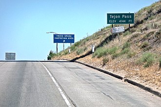
Tejon Pass
| Tejon Pass | |||
|---|---|---|---|
|
Sign at the top of the pass |
|||
| Compass direction | North | south | |
| Pass height | 1275 m | ||
| county | Kern County , California ( USA ) | Los Angeles County , California ( USA ) | |
| Watershed | San Joaquin River | Santa Clara River | |
| Valley locations | Bakersfield | Santa Clarita | |
| expansion |
|
||
| Mountains | Tehachapi Mountains | ||
| Map (California) | |||
|
|
|||
| Coordinates | 34 ° 52 '26 " N , 118 ° 53' 39" W | ||
The Tejon Pass [ teɪˈhoʊn ], which rises a maximum of 1,275 meters above sea level , is a mountain pass at the southwest end of the Tehachapi Mountains in southern California . The pass connects Los Angeles with the northern part of California and is located about 80 kilometers northwest of this city.
Fort Tejon , which was built in 1854 and was supposed to protect settlers from Indian attacks, used to be located on the pass . Today a highway, Interstate 5 , follows this old pass route. The pass is also the namesake for a severe earthquake that occurred on January 9, 1857 along the San Andreas Fault. It is known as the Fort Tejon earthquake in 1857 . However, the epicenter of the quake was not at Tejon Pass, but near the present-day town of Parkfield . In the then sparsely populated California, however, the only reliable reports came from Fort Tejon.


