The Bulwark
| The Bulwark | ||
|---|---|---|
|
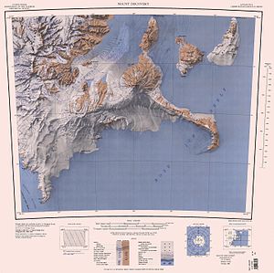
The Bulwark in the northwest section of the map sheet |
||
| location | Victoria Land , East Antarctica | |
| Mountains | Royal Society Range , Transantarctic Mountains | |
| Coordinates | 78 ° 17 ′ 0 ″ S , 163 ° 33 ′ 0 ″ E | |
|
|
||
The Bulwark ( English for The Bulwark ) is a steep-walled granite block on the Scott coast of the East Antarctic Victoria Land . It rises up on the west side of the Koettlitz Glacier , the ice masses of which flow around it and flow into Walcott Bay .
It was first mapped by participants in the Terra Nova Expedition (1910-1913) under the direction of the British polar explorer Robert Falcon Scott . Scientists in a campaign run by Victoria University's Antarctic Expeditions from 1960 to 1961 named it after its appearance.
Web links
- The Bulwark in the Geographic Names Information System of the United States Geological Survey (English)
- The Bulwark on geographic.org (English)

