Tirso
| Tirso | ||
|
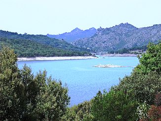
The Tirso flows through the Lago Gusana reservoir |
||
| Data | ||
| location | Sardinia , Italy | |
| River system | Tirso | |
| source | north of Bitti , in the province of Nuoro | |
| Source height | 985 m | |
| muzzle | on the west side of the island near Oristano in the Mediterranean Sea Coordinates: 39 ° 53 ′ 6 ″ N , 8 ° 32 ′ 26 ″ E 39 ° 53 ′ 6 ″ N , 8 ° 32 ′ 26 ″ E |
|
| Mouth height | 0 m | |
| Height difference | 985 m | |
| Bottom slope | 6.5 ‰ | |
| length | 152 km | |
| Catchment area | 3375 km² | |
| Reservoirs flowed through | Lago Omodeo | |
| Navigable | 4 km before the mouth | |
The Tirso is the longest river in Sardinia .
It rises as Riu de su Campo north of Bitti , in the province of Nuoro on the east side of the island, flows through the reservoir Lago Omodeo and flows out on the west side of the island at Oristano . On the middle course it is spanned by the Ponte Ezzu, an old Roman bridge, at the village of Illorai . It is 150 km long and only navigable for the last few kilometers. The fertile plain north of Oristano through which it flows is called the Tirso plain.
