Todra (river)
|
Todra Oued Todra |
||
| Data | ||
| location | Tinghir Province , Drâa-Tafilalet Region , Morocco | |
| River system | Oued Rheris | |
| Drain over | Oued Rheris → Tafilalet | |
| Head of the valley | At the transitions to the east to the Azahar N'Sidi Bou Yacoub and to the north to the valley system of the Dades ( High Atlas ) 31 ° 50 ′ 12 ″ N , 5 ° 33 ′ 17 ″ W |
|
| Source height | 2920 m | |
| muzzle | in the Oued Rheris coordinates: 31 ° 33 ′ 9 " N , 4 ° 38 ′ 4" W 31 ° 33 ′ 9 " N , 4 ° 38 ′ 4" W |
|
| Mouth height | 875 m | |
| Height difference | 2045 m | |
| Bottom slope | 12 ‰ | |
| length | 164 km | |
|
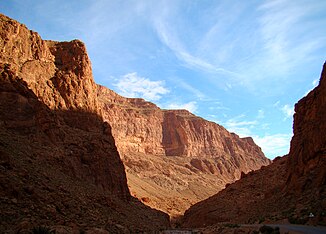
upper part of the Todra Gorge |
||
The Oued Todra (also spelled Oued Todgha ) is the main river in the Tinghir Province in the Drâa-Tafilalet region and one of the most important rivers in southern Morocco . In the summer months, d. H. from May to October it normally no longer has any water.
course
The head of the valley, which opens the longest valley path for rainwater from the Todra, is located on the southeast side of a striking mountain ridge in the High Atlas , which separates the Todra valley system from the adjacent Dades valley system to the northwest . The head of the valley lies at an altitude of 2920 m between the Irhil n 'Tissent ( 3088 m ) in the north and the Jebel Tiguioelt ( 2793 m ) on the mountain ridge that runs parallel to the south. Above the end of the valley lies the transition to the Azahar N'Sidi Bou Yacoub to the east , which joins the Oued Rheris , and to the north the transition to the Dades valley system.
After about 9 kilometers of the valley path, the Todra breaks through the mountain ridge west of the Jebel Tiguioelt on the way south in a deeply cut canyon. Then it reaches a wide valley basin in which it joins several other source streams about five kilometers northeast of the Berber village of Tamtattouchte . This village passes the Todra at valley kilometer 28.
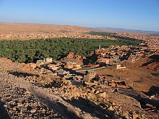
Soon afterwards the valley narrows again to break through the last mountain range of the Atlas Mountains and meanders through the impressive rocky landscape of the Todra Gorge , the narrowest section of which the Todra reaches around 49 km. Then the landscape opens up to a river oasis and the provincial capital Tinghir is reached at km 61 . The oasis landscape ends at kilometer 82 at the height of Ait Assa Ou Brahim .
Now the valley turns to the east, accompanying the foot of the Djebel Sarhro mountain range , and irrigates the oasis of Tinejdad (kilometer 120). Halfway to Erfoud , it flows about 10 km east of the village of Ksar Ba Touroug and after 164 km of the valley path into the Oued Rheris , which - parallel to the Oued Ziz - usually seeps into the oasis landscape of the Tafilalet at the latest . After extremely heavy or long-lasting rains, which are extremely rare, the Oued Rheris and Oued Ziz merge south of the Tafilalet to form the Oued Daoura , which goes under in the southern Moroccan or Algerian stone desert.
Attractions
The Todra Gorge is one of the scenic highlights in southern Morocco. But the green oases along the river are also extremely impressive - especially in spring.
Individual evidence
- ↑ OpenTopoMap
- ↑ Length determined from OpenStreetMap
- ↑ Irhil n 'Tissent at Geonames
- ↑ Jebel Tiguioelt at Geonames


