Dades
|
Dades ⴰⵙⵙⵉⴼ ⵏ ⴷⴰⴷⵙⵙ Oued Dadès Assif Dadès |
||
|
Dades Gorge |
||
| Data | ||
| location | Ouarzazate Province , Drâa-Tafilalet Region , Morocco | |
| River system | Wadi Draa | |
| Drain over | Wadi Draa → Atlantic | |
| Head of the valley | South slope of Azilal Zaït Ououchchene on the main ridge of the High Atlas 32 ° 0 ′ 38 ″ N , 5 ° 38 ′ 2 ″ W |
|
| Source height | approx. 3010 m | |
| muzzle | in the El Mansour Eddahbi reservoir Coordinates: 30 ° 58 ′ 13 ″ N , 6 ° 42 ′ 49 ″ W 30 ° 58 ′ 13 ″ N , 6 ° 42 ′ 49 ″ W |
|
| Mouth height | approx. 1100 m | |
| Height difference | approx. 1910 m | |
| Bottom slope | approx. 12 ‰ | |
| length | As the crow flies 154.5 km | |
|
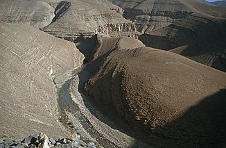
End of the Dadès gorge at Aït Arbi |
||
The Dades , also Oued Dadès or Assif Dadès ( tamazight ⴰⵙⵙⵉⴼ ⵏ ⴷⴰⴷⵙⵙ) is one of the most important rivers in southern Morocco .
course
The Dadès rises in the High Atlas ; the end of the valley furthest from the mouth can be found on the southern slope of the 3219 m high Azilal Zaït Ououchchene at an altitude of around 3010 m. This is also the northern end of the catchment area of the Wadi Draa . From here, the Dadès meanders southwards through high valleys with no vegetation and forms the first settled river oases 13 km south-southwest of the origin. Then the valley narrows to the Dades Gorge to break through the last mountain ranges of the High Atlas. At Boumalne Dadès he enters the plateau between the high and the anti-Atlas . Here it turns to the southwest and continues down to the confluence with the El Mansour Eddahbi reservoir east of Ouarzazate , which has replaced the merging of the river with the Assif n'Tidili or Oued Ouarzazate to form Wadi Draa since 1972 . This continues the river valley through the western part of the Jbel Sarhro and then irrigates a large number of palm oases from Agdz to Zagora .
Attractions
The Dadès Gorge is one of the greatest landscape impressions in southern Morocco. In the southern foothills of the gorge there are several interesting villages (e.g. Aït Youl and Aït Arbi ) with traditional residential castles made of rammed earth ( tighremts ) by the Berbers who probably only settled here in the 18th century .
The small town of Boumalne extends along a large oasis of palm trees on the Dadès River; in its further course oasis cities like El-Kelâa M'Gouna and Skoura line its banks.
Individual evidence
- ↑ Head of the valley compare with the map at Geonames
- ↑ Height information at OpenCycleMap
- ↑ Measure distance with google maps

