Boumalne Dadès
| Boumalne Dadès | ||||
|---|---|---|---|---|
|
||||
| Basic data | ||||
| State : |
|
|||
| Region : | Drâa-Tafilalet | |||
| Province : | Tinghir | |||
| Coordinates | 31 ° 22 ′ N , 6 ° 0 ′ W | |||
| Residents : | 12,328 (2014) | |||
| Height : | 1580 m | |||
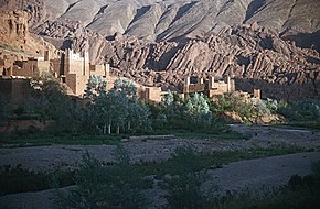
Boumalne Dadès or Boumalne du Dadès ( Arabic بومالن دادس, Central Atlas Tamazight ⴱⵓⵎⴰⵍ ⵏ ⴷⴰⴷⵙ Bumal n Dads ) is an oasis city in southern Morocco with around 12,500 inhabitants.
location
Boumalne is located on the southern edge of the High Atlas on the Dadès River on the so-called road of the Kasbahs about 117 km (driving distance) northeast of Ouarzazate or 53 km southwest of Tinghir at an altitude of almost 1600 m above sea level. d. The Jbel Sarhro mountain range extends south of Boumalne .
population
The city is mainly inhabited by Berbers who - in addition to their regional Berber dialect - also speak Moroccan Arabic and some French .
economy
In earlier times Boumalne hardly differed from the oasis villages in the area - people lived mainly as self-sufficiency from the income from agriculture and cattle breeding (sheep, goats, chickens) on the riverbank. Since the construction of the great west-east connection (today N10) during the French colonial period , the place has developed into a regional center of trade, handicrafts and services.
history
In the absence of written records, nothing is known about the earlier history of the place. At the beginning of the 20th century, the place was under the control of the Berber tribe of Aït Atta , who fought with the French colonial power for years, which only ended in 1933. After that, the former oasis settlement recorded significant population and economic growth.
Attractions
- There are only remnants of the former clay architecture. Today's concrete post construction with infills made of hollow blocks is plastered towards the street and tinted red.
- A kasbah built by the Berber prince Thami El Glaoui around 1925 towers above the town.
Surroundings
- About 10 km to the north at the exit of the Dades Gorge are the imposing, but unfortunately also in dire decay, residential castles of the two villages Aït Arbi and Aït Youl . The scenic situation is definitely worth a detour (possibly also with a rented bike).
- From Boumalne or from the village of Tagdilt located 20 km to the southeast, hiking and trekking tours can be undertaken in the Jbel Sarhro area.
literature
- Arnold Betten: Morocco. Antiquity, Berber Traditions and Islam - History, Art and Culture in the Maghreb. DuMont, Ostfildern 2012, ISBN 978-3-7701-3935-4 , pp. 300f
- David Hart: The Ait Atta of Southern Morocco. Daily Life and Recent History. Westview Press, Cambridge 1984, ISBN 0-906559-15-4 .
Web links
Individual evidence
- ↑ Moroccan population statistics ( Memento of the original from March 3, 2016 in the Internet Archive ) Info: The archive link was inserted automatically and has not yet been checked. Please check the original and archive link according to the instructions and then remove this notice.


