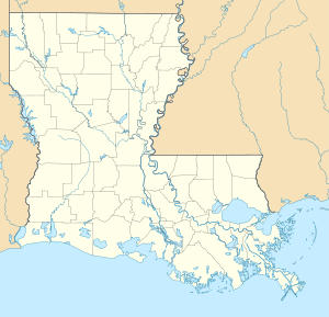
Toledo Bend Reservoir
| Toledo Bend | |||||||||
|---|---|---|---|---|---|---|---|---|---|
| The Toledo Bend Reservoir stretches across the border of Louisiana and Texas | |||||||||
|
|||||||||
|
|
|||||||||
| Coordinates | 31 ° 10 '25 " N , 93 ° 33' 58" W | ||||||||
| Data on the structure | |||||||||
| Lock type: | Earthfill dam | ||||||||
| Construction time: | 1964-1967 | ||||||||
| Height of the barrier structure : | 29 m | ||||||||
| Building volume: | 5.83 million m³ | ||||||||
| Crown length: | 3 431 m | ||||||||
| Crown width: | 7.5 m | ||||||||
| Power plant output: | 92 MW | ||||||||
| Operator: | Texas and Louisiana River Authorities | ||||||||
| Data on the reservoir | |||||||||
| Altitude (at congestion destination ) | 51.85 m | ||||||||
| Water surface | 749 km² | ||||||||
| Reservoir length | 104 km | ||||||||
| Reservoir width | 16 km | ||||||||
| Storage space | 6291 million m³ | ||||||||
| Catchment area | 18,376 km² | ||||||||
The Toledo Bend Reservoir is a reservoir on the Sabine River in Texas and Louisiana . The lake has an area of 749 km², making it the largest man-made body of water in the southern United States and the fifth largest in the entire United States (after Lake Powell , Lake Sakakawea , Lake Oahe and Fort Peck Lake ). The hydropower plant has an output of 92 megawatts . The dam stands in the northwest corner of Newton Counties in Texas and Louisiana. The purposes of the facility are water supply, hydropower generation and recreation.
Construction of the dam
In 1949 the Sabine River Authority of Texas was founded for the project and in 1950 the Sabine River Authority, State of Louisiana .
In 1959 the two states made $ 30 million available. The land was acquired in 1963 and construction began in 1964. The Massman-Johnson Construction Company was the general contractor . By the end (1969), Texas had paid an estimated $ 70 million. The dam was built by the two states without any help from the federal government. The water damming began in October 1966 and the power plant began operating in 1969.
The Toledo Bend reservoir has a shoreline of approx. 2000 km and offers many opportunities for recreation through water sports , fishing and other activities.
swell
- ↑ North Toledo Bend WMA
- ↑ Toledo Bend Project ( Memento of the original from September 28, 2006 in the Internet Archive ) Info: The archive link was automatically inserted and not yet checked. Please check the original and archive link according to the instructions and then remove this notice.
- ↑ Handbook of Texas, Toledo Bend Reservoir
- ↑ Toledo Bend Reservoir in East Texas
See also
- List of the largest dams on earth
- List of the largest reservoirs on earth
- List of the largest hydroelectric plants in the world
- List of dams in the United States
Web links
- ToledoBendLakeCountry.com Website of the Toledo Bend (Sabine Parish) Tourist Commission
- ToledoBend.Com Information about the Toledo Bend Lake
- Toledo-Bend.Com Information about Toledo Bend Lake and the surrounding areas of Texas and Louisiana
- Toledo Bend Dam, history
- Sabine River Authority of Texas: Toledo Bend Project

