Sabine River
| Sabine River | ||
|
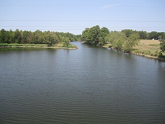
Sabine River south of Big Sandy |
||
| Data | ||
| Water code | US : 555872 | |
| location | Texas , Louisiana (USA) | |
| River system | Sabine Pass | |
| Drain over | Sabine Lake → Sabine Pass → Gulf of Mexico | |
| source | Outflow from Lake Tawakoni in Hunt County 32 ° 48 ′ 29 ″ N , 95 ° 55 ′ 14 ″ W |
|
| Source height | 122 m | |
| muzzle | in the Sabine Lake coordinates: 29 ° 59 ′ 8 " N , 93 ° 47 ′ 26" W 29 ° 59 ′ 8 " N , 93 ° 47 ′ 26" W |
|
| Mouth height | 0 m | |
| Height difference | 122 m | |
| Bottom slope | 0.13 ‰ | |
| length | 925 km | |
| Catchment area | 25,268 km² | |
| Reservoirs flowed through | Lake Tawakoni , Toledo Bend Reservoir | |
| Medium-sized cities | Port Arthur | |
| Communities | Big Sandy | |
|
Course of the Sabine River (light blue) and Neches River (dark blue) |
||
The Sabine River is a river in Texas and Louisiana that has its origin in Hunt County and flows into Sabine Lake after 925 kilometers , an estuary that is in turn connected to the Gulf of Mexico via the Sabine Pass .
In the upper reaches it has been dammed to Lake Tawakoni since 1958 , and in the middle part to the Toledo Bend Reservoir . Both serve Dallas as water reservoirs. From the Toledo Bend Reservoir down, it forms the eastern border between Texas and Louisiana.
In terms of the amount of water it carries, it is the largest river in Texas as it drains the wettest part, an area totaling approximately 25,268 km². Of that area, 76 percent is in Texas and the remainder in Louisiana. Shortly before the Gulf of Mexico, the Neches River and Sabine River form the Sabine Lake .
history
The catchment area of the Sabine was settled early on. Archaeological excavations testify to Indian settlement in all eras, starting with the 12,000 year old Clovis culture . The Caddos immigrated in 780 AD , the early period of which is dated to around 1260. The river gave the name to the Sabine Free State , which existed from 1806 to 1821 .
In 1819, the border between the United States and the then Spanish viceroyalty of New Spain was set in the Adams-Onís Treaty on the lower reaches of the Sabine River. The demarcation lasted even after Mexico's independence in 1822 until 1836, when the Republic of Texas declared itself independent and became part of the United States in 1845.
“Sabine” is derived from the Spanish word for “cypress”, as it flows through the bald cypress swamps in eastern Texas. The river itself was named Río de Sabinas by Domingo Ramón in 1716 .


