Lake Oahe
| Lake Oahe | |||||||||||
|---|---|---|---|---|---|---|---|---|---|---|---|
| Lake Oahe in winter | |||||||||||
|
|||||||||||
|
|
|||||||||||
| Coordinates | 44 ° 27 '5 " N , 100 ° 24' 10" W | ||||||||||
| Data on the structure | |||||||||||
| Construction time: | 1948-1963 | ||||||||||
| Height of the barrier structure : | 75 m | ||||||||||
| Building volume: | 70.339 million m³ | ||||||||||
| Crown length: | 2835 m | ||||||||||
| Data on the reservoir | |||||||||||
| Water surface | 1453 km² | ||||||||||
| Storage space | 28,776 million m³ | ||||||||||
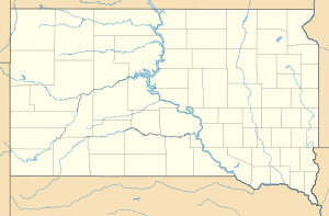
The Lake Oahe, of the Oahe Dam is dammed, is one of the largest dams on the Missouri River in the north of Pierre , South Dakota , USA . The lake, which stretches 372 km along the course of the Missouri to Bismarck in North Dakota , is the third largest reservoir in the USA measured by the water surface, after the storage space (for which there are 27,400 or 28,776 or 29,093 million m³) third or fourth largest.
The dam is part of the large-scale Missouri Dam Project Pick Sloan that the US Congress put into effect with the Flood Control Act 1944. Construction of the Oahe Dam began in 1948. It is named after the Oahe Indian Mission , which was established in 1874 by the Sioux . The 75 m high dam was inaugurated on August 17, 1962 by John F. Kennedy . The power plant began producing electricity in 1962 and supplies electricity to the states of Nebraska , Minnesota , Montana, and North and South Dakota. In addition to generating electricity, the lake is also used for flood regulation (flood protection), irrigation and water supply. The reservoir has a storage capacity of around 29 km³ on an area of 1453 km² and thus an average water depth of 19.8 m. The Grand River , the Moreau River and the Cheyenne River , a flow from the west into the lake.
Effects on Indian territories
The dam flooded large parts of the fertile soil of Indian reservations Cheyenne River Reservation and Standing Rock Reservation . Lake Oahe caused the greatest loss of Indian land to public works in US history. The culture and economy of the Indian peoples affected were shaken. Many high-yield forests and cultivated areas as well as Indian settlements were flooded. Standing Rock and Cheyenne River Reserves lost 68 percent of their pastureland. Around 37 percent of Indian families had to move to higher-lying, less productive areas. Old places of worship were flooded. The dam resulted in an impoverishment of the population that continues to this day. Before the flood, they were primarily self-sufficient and independent. After that most of them became welfare recipients. Sufficient compensation was not paid.
Petroleum pipeline
The 1900 km long Dakota Access Pipeline from the fracking production sites in northern North Dakota to the state of Illinois runs under Lake Oahe . From April 2016, Indians and environmentalists demonstrated for months in the “Oceti Sakowin” protest camp against the building of the building. They see holy sites and water quality threatened by the planned pipeline crossing below the lake.
literature
- Harriett Skye: Mini Nataka Pi: The Oahe Dam and the Standing Rock People, 1900-1960. University of California, Berkeley 2007.
See also
Web links
- Oahe Dam & Lake on the Army Corps of Engineers website
Individual evidence
- ↑ MSNBC : No Man's Land: The Last Tribes of the Plains. In: Geography of Poverty. A journey through forgotten America , June 8, 2015.
- ^ Paul A. Olson: The Struggle for the land. Indigenous Insight and Industrial Empire in the Semiarid World . University of Nebraska Press / Center for Great Plains Studies, Lincoln u. a. 1990, ISBN 0-8032-3555-0 , pp. 195 ( books.google.de ).
- ↑ Michael L. Lawson: Dammed Indians. The Pick-Sloan Plan and the Missouri River Sioux, 1944-1980 . University of Oklahoma Press, Norman 1994, ISBN 0-8061-2672-8 , pp. 50 ( books.google.de ).
- ^ Robert Kelley Schneiders: Flooding The Missouri Valley The Politics Of Dam Site Selection And Design. In: Great Plains Quqarterly. 17, 1997. pp. 237-491.
- ^ Harriett Skye: Mini Nataka Pi: The Oahe Dam and the Standing Rock People, 1900-1960. University of California, Berkeley 2007.
- ↑ Peter Capossela: Impacts of Army Corps of Engineers Pick Sloan Program on Indian Tribes. In: Journal of Environmental Law and Litigation. Volume 30, No. 1, May 2015 ( scholarsbank.uoregon.edu PDF).
- ↑ Controversial US pipeline will not be continued for the time being orf.at, December 5, 2016, accessed December 5, 2016.


