Pick-Sloan Missouri Basin Program


The Pick-Sloan Missouri Basin Program , also known as the Missouri River Basin Project , was a large-scale dam project by the United States government along the Missouri River in the Great Plains from the 1940s .
history
After the drought disasters of the 1930s in the " Dust Bowl ", various water management agencies as well as Colonel Lewis A. Pick for the US Army Corps of Engineers and Glen Sloan for the Bureau of Reclamation developed competing plans for an irrigation system and flood control Missouri.
The Army Corps ' pick plan contained three main elements: flood dams over a length of 1,500 kilometers along the entire Missouri from Sioux City to the mouth of the Mississippi , five large dams and lakes on the Missouri and 18 dams on tributaries of the Missouri.
The Bureau's Sloan plan was more extensive. It contained 90 dam projects to regulate the Missouri (and its tributaries) and to generate electricity. Around 19,400 square kilometers (4.8 million acres ) should be irrigated by the construction work.
The plans affected - for reasons of cost - a disproportionately large amount of Indian territory. No Indian representatives were involved in the preparations and planning. The seven Indian reservations affected only found out about the plans after the construction projects had been approved.
After the tsunami in 1943 in Omaha in the State of Nebraska , where next to the town of military importance Airport was flooded, and under the pressure of a proposal to establish a new supervisory authority established Army Corps and Bureau on 17 October 1944 together picks and Sloan plans to House Flood Control Committee . Out of 113 original dam projects from both drafts, 107 were combined into the Pick Sloan Plan and approved by the committee.
The US Congress passed a Flood Control Act on December 22, 1944 , which made the dam plans legally effective. Franklin D. Roosevelt approved $ 200 million for the project now officially called the Missouri River Basin Development Program . It comprised 107 reservoirs that would generate 1.6 gigawatts of electricity and irrigate approximately 19,400 square kilometers (4.8 million acres ) of land along the Missouri in Montana , North Dakota and South Dakota , and 1,500 kilometers of river levees. The aim of the program was also to tame the river to control floods, make the river navigable and promote the fishing industry. The House Flood Control Committee hired the Army Corps of Engineers to build five dams under the Pick Sloan Plan. Another construction project was led by the Bureau of Reclamation .
With the Reclamation Project Authorization Act 1972, another dam construction phase of the Pick Sloan program was approved.
Dams and lakes
Between 1946 and 1966, six new dams were built along the Missouri as part of the Pick Sloan project, some of which are among the largest in the world:
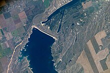
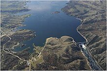
- From 1947, the Canyon Ferry Dam (dam: Canyon Ferry Lake ) in Montana, in operation since 1954, construction management: Office for Land Reclamation ( Bureau of Reclamation )
- from 1946 the Garrison Dam (reservoir Lake Sakakawea ) in North Dakota, in operation since 1955, construction management: US Army Corps of Engineers (USACE)
- from 1948 the Oahe dam ( Lake Oahe ) near Pierre in South Dakota, in operation since 1962, construction management: USACE
- from 1959 the Big Bend Dam ( Lake Sharpe reservoir ) near Lower Brule in South Dakota, in operation since 1964, construction management: USACE
- from 1946 the Fort Randall dam (Lake Francis Case) in South Dakota, in operation since 1953, construction management: USACE
- from 1952 the Gavins Point Dam ( Lewis and Clark Lake ) near Yankton , in operation since 1955, construction management: USACE
In a second phase of the Pick Sloan program from 1976 to 1994, the Bureau of Reclamation built six dams at North Loup and Middle Loup in Nebraska in the Missouri River basin, following approval by the Reclamation Project Authorization Act of October 20, 1972 :
- Davis Creek Dam with the Davis Creek Reservoir
- Virginia Smith Dam with the reservoir Calamus Lake (formerly: Calamus Dam and Reservoir ) on the Calamus River
- Kent Diversion Dam
- Sherman Dam with the Sherman Reservoir
- Milburn Diversion Dam
- Arcadia Diversion Dam
Missouri dams built outside the Pick Sloan project are (downstream sequence): Toston Dam (1940), Hauser Dam (1907), Holter Dam (1908), Black Eagle Dam (1927), Rainbow Dam (1912 ), Cochrane Dam (1958), Ryan Dam (1915), Morony Dam (1930), and the Fort Peck Dam (1940), all in the state of Montana.
Effects on Indian Reservations
For the seven adjoining Indian reservations, the five dams built by the Army Corps in North and South Dakota during the first Pick Sloan construction phase were a disaster: some 550 square miles of land with fertile soil, forests and ancestral settlements were expropriated and flooded without adequate compensation. Many Indian settlements had to be relocated. The effects of the construction project can still be felt today. The Indians had to move their cemeteries, lost cultural sites as well as their economic basis. Instead of their previous subsistence economy , they were now forced to pursue a money economy and were often dependent on social benefits from the federal government. The village structures were disrupted by the forced relocations. In contrast to the affected white settlers, their losses were only compensated with insufficient compensation. No other construction project in America has caused as much damage to Indian land as the Pick Sloan Project.
The following were affected by flooding in their tribal areas:
- the Fort Berthold Reservation in North Dakota through Lake Sakakawea ( Garrison Dam ),
- in South Dakota the Standing Rock Reservation and the Cheyenne River Reservation through Oahe Lake ( Oahe Dam ),
- the Lower Brule Reservation and the Crow Creek Reservation through Lake Sharpe ( Big Bend Dam ),
- the Yankton Reservation through Lake Francis Case ( Fort Randall Dam ) and
- in Nebraska the Santee Sioux Reservation through Lewis and Clark Lake ( Gavins Point Dam ).
It was not until the late 1990s that Congress decided to pay further compensation to affected tribes.
The recent protests near the Standing Rock Reservation against the Dakota Access Pipeline are seen in historical context with the Pick Sloan Project.
literature
- Peter Capossela: Impacts of Army Corps of Engineers Pick Sloan Program on Indian Tribes. ( Full text online ) In: Journal of Environmental Law and Litigation , Volume 30, No. 1, May 2015
- Michael L. Lawson: Dammed Indians: The Pick-Sloan Plan and the Missouri River Sioux, 1944-1980 . University of Oklahoma Press, 1994. ISBN 9780806126722
- Michael L. Lawson: Dammed Indians Revisited: The Continuing History of the Pick-Sloan Plan and the Missouri River Sioux. South Dakota State Historical Society Press, 2009
- Robert Kelley Schneiders: Dams across the wide Missouri: Water transportation, the Corps of Engineers, and environmental change along the Missouri Valley, 1803-1993 . In: Retrospective Theses and Dissertations. Number 12242 , 1997
Web links
- MSNBC : No Man's Land. The Last Tribes of the Plains (English)
- Bureau of Reclamation : An Overview of the Pick-Sloan Missouri River Basin Program (pdf)
- Robert Kelley Schneiders: Flooding The Missouri Valley The Politics Of Dam Site Selection And Design (pdf / english)
- Laws
- www.govtrack.us Lower Brule and Crow Creek Tribal Compensation Act
- Congressional Record - Senate, May 27, 1999, 11372 . In: Congressional Record, V. 145, Pt. 8, May 24, 1999 to June 8, 1999
- Senate Report 110-505: Providing for compensation to the Lower Brule and Crow Creek Sioux Tribes Of South Dakota for damage to tribal land caused by Pick-Sloan projects along the missouri river
References and comments
- ^ A b c d Peter Capossela: Impacts of Army Corps of Engineers Pick Sloan Program on Indian Tribes. ( Full text online ) In: Journal of Environmental Law and Litigation , Volume 30, No. 1, May 2015
- ^ A b National Park Service : Pick-Sloan Plan - Part One - The Background
- ^ A b c Robert Kelley Schneiders: Dams across the wide Missouri: Water transportation, the Corps of Engineers, and environmental change along the Missouri Valley, 1803-1993 . In: Retrospective Theses and Dissertations. Number 12242 , 1997
- ^ Bureau of Reclamation : Canyon Ferry Project. Pick-Sloan Missouri Basin Program , 1994
- ↑ a b c d e U.S. Army Corps of Engineers : Summary of Engineering Data - Missouri River Main Stem System
- ^ Bureau of Reclamation : Resource Management Plan: Calamus Reservoir, Nebraska Great Plains Region . In: US Bureau of Land Management Papers. Paper 39, 2010 (on the website of the Bureau of Reclamation: Resource Management Plan: Calamus Reservoir, Nebraska , June 2010)
- ^ Paul A. Olson: The Struggle for the Land: Indigenous Insight and Industrial Empire in the Semiarid World . University of Nebraska / Center for Great Plains Studies, 1990. ISBN 9780803235557 ( online )
- ↑ Michael L. Lawson: Dammed Indians: The Pick-Sloan Plan and the Missouri River Sioux, 1944-1980 . University of Oklahoma Press, 1994. ISBN 9780806126722
- ^ A b Robert Kelley Schneiders: Flooding The Missouri Valley The Politics Of Dam Site Selection And Design. In: Great Plains Quarterly 17, 1997. Pages 237-491
- ↑ Harriett Skye: Mini Nataka Pi: The Oahe Dam and the Standing Rock People, 1900--1960. Berkeley, 2007. ISBN 9780549528319
- ^ Compensation at last for tribes that lost lands to dams. In: Chicago Tribune , December 15, 2002
- ↑ USA Today : 7 history lessons that help explain the Dakota Access Pipeline protests , November 16, 2016

